Category:1850s maps of the Balkans
Jump to navigation
Jump to search
English: This category is intended to collect maps from the 1850s that show multiple Balkan countries in one map frame.
Subcategories
This category has the following 8 subcategories, out of 8 total.
A
- 1850s maps of Albania (3 F)
B
- 1850s maps of Bulgaria (7 F)
C
- 1850s maps of Croatia (4 F)
G
M
- 1850s maps of Montenegro (2 F)
R
S
Media in category "1850s maps of the Balkans"
The following 12 files are in this category, out of 12 total.
-
 Alison's history of Europe atlas 1850 (92104024).jpg 7,000 × 5,743; 4.99 MB
-
 Atlas turc - F. de Brocktorff, del - btv1b84432795 (01 of 11).jpg 5,075 × 7,417; 5.58 MB
-
 1850s map - Generalkarte der Europäischen Türkei und des Vladikats Montenegro.jpg 18,703 × 16,358; 55.07 MB
-
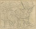 (1853) MAP OF LOWER DANUBIA.jpg 3,131 × 2,568; 3.47 MB
-
 1853 - Map of the Ottoman Empire, the Black Sea and the frontiers of Russia and Persia.jpg 15,482 × 10,565; 15.87 MB
-
 1853 map of the Balkans showing the Seat of the Russo-Turkish War (1828–29).jpg 3,345 × 2,486; 1.61 MB
-
 1854 map of the Eastern Balkan peninsula during the Crimean War.jpg 5,959 × 8,500; 14.99 MB
-
 Ca. 1854 Portuguese map of the Balkans.jpg 2,534 × 3,500; 1.44 MB
-

-
 Ethnographische Karte der Österreichischen Monarchie - zusammengesetzt.png 9,459 × 7,094; 97.28 MB
-

-
 1859 Czech map of Turkey in Europe - the Balkan Peninsula.djvu 6,631 × 5,232; 5.32 MB
.jpg)
.jpg)

_MAP_OF_LOWER_DANUBIA.jpg)

.jpg)


