Category:1850s maps of Europe
Jump to navigation
Jump to search
Temperate regions: North America · South America · Africa · Europe · Asia · Oceania – Polar regions: – Other regions:
Subcategories
This category has the following 57 subcategories, out of 57 total.
.
A
- 1850s maps of Albania (3 F)
- 1850s maps of Austria (3 F)
B
- 1850s maps of the Black Sea (33 F)
- 1850s maps of Belarus (17 F)
- 1850s maps of Belgium (9 F)
- 1850s maps of Bulgaria (7 F)
C
- 1850s maps of Croatia (4 F)
- 1850s maps of Cyprus (2 F)
- 1850s maps of Czechia (4 F)
D
E
- 1850s maps of Eastern Europe (15 F)
- 1850s maps of Estonia (2 F)
F
G
H
- 1850s maps of Hungary (6 F)
I
- 1850s maps of Iceland (10 F)
- 1850s maps of Ireland (15 F)
L
- 1850s maps of Latvia (4 F)
- 1850s maps of Lithuania (6 F)
M
- 1850s maps of Moldova (4 F)
N
P
- 1850s maps of Portugal (28 F)
R
S
- 1850s maps of Slovenia (22 F)
T
U
V
Media in category "1850s maps of Europe"
The following 12 files are in this category, out of 12 total.
-

-

-

-

-
 Az abszolutizmus kora; királyok Isten kegyelméböl (1890) (14784673125).jpg 2,080 × 3,360; 1.31 MB
-
 Carte générale d'Europe dressée - par Charle... - btv1b53093081s.jpg 9,400 × 6,712; 10.72 MB
-
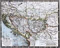 Desjardins Balkans 1853.jpg 2,068 × 1,648; 1.17 MB
-
 Emigrant's Map and Guide for Routes to North America WDL41.png 1,364 × 1,024; 2.62 MB
-
 Europe (Ancien Continent) - Fonds Ancely - B315556101 A LEVASSEUR 096.jpg 2,991 × 2,103; 1.91 MB
-
 Galizien, Ungarn, Slavonien und Croatien, Siebenbürgen und Dalmatien, Molda, Wallachey.jpg 5,546 × 4,504; 8.36 MB
-
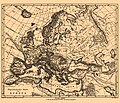 Iconographic Encyclopedia of Science, Literature and Art 165.jpg 2,610 × 2,244; 1.25 MB
-
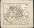
 Ungarn und ein Theil von Siebenbürgen.jpg 5,187 × 4,487; 9.15 MB
%27_(11042392875).jpg)

%27_(11045538123).jpg)
%27_(11051875765).jpg)
_(14784673125).jpg)


_-_Fonds_Ancely_-_B315556101_A_LEVASSEUR_096.jpg)


