Category:1860s maps of China
Jump to navigation
Jump to search
Countries of Asia: Afghanistan · Armenia‡ · Azerbaijan‡ · People's Republic of China · Cyprus‡ · Egypt‡ · Georgia‡ · India · Indonesia‡ · Iran · Iraq · Japan · Lebanon · Oman · Pakistan · Philippines · Russia‡ · Syria · Turkey‡ · Turkmenistan · Uzbekistan · Yemen
Limited recognition: Abkhazia‡ · Taiwan · State of Palestine
‡: partly located in Asia
Limited recognition: Abkhazia‡ · Taiwan · State of Palestine
‡: partly located in Asia
Subcategories
This category has the following 6 subcategories, out of 6 total.
- 1861 maps of China (2 F)
- 1862 maps of China (3 F)
- 1863 maps of China (7 F)
- 1865 maps of China (1 F)
Media in category "1860s maps of China"
The following 17 files are in this category, out of 17 total.
-
 191 of 'The Englishman in China' (11037034244).jpg 1,006 × 613; 134 KB
-
 Sketch to illustrate the movements of the Allied Forces in China.png 8,066 × 7,094; 35.76 MB
-

-

-
 1862 map of the Inner and Outer Cities of Beijing.jpg 5,943 × 8,500; 8.8 MB
-
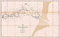
 Xizang quan tu. LOC 2006626293.jpg 10,809 × 5,576; 7.68 MB
-
 Xizang quan tu. LOC 2006626293.tif 10,809 × 5,576; 172.44 MB
-
-
 Le Tour du monde-10-p291.png 3,785 × 5,660; 1.59 MB
-
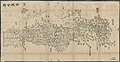
 Zhejiang Sheng yuan fang xiang quan tu. LOC gm71005032.jpg 10,404 × 7,762; 7.41 MB
-
 Zhejiang Sheng yuan fang xiang quan tu. LOC gm71005032.tif 10,404 × 7,762; 231.04 MB
-
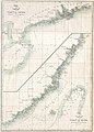
 Admiralty Chart No 2653 Pei-Ho or Peking River - Sheet 1, Published 1859, Corrections to 1868.jpg 24,323 × 15,612; 53.24 MB
-

-
 China Proper Map William Mackenzie c1866.png 2,449 × 3,080; 15.13 MB
-
 Le Tour du monde-09-p083.jpg 1,920 × 1,929; 1.49 MB
-
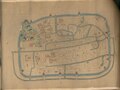
 Plan of the City of Peking - ILN 1860.jpg 1,520 × 1,210; 1.35 MB
-
 Plan of Victoria, Hong Kong 1866.jpg 11,000 × 5,200; 10.23 MB
.jpg)


