Category:1890s maps of China
Jump to navigation
Jump to search
Countries of Asia: Afghanistan · Armenia‡ · Azerbaijan‡ · People's Republic of China · Cyprus‡ · Egypt‡ · Georgia‡ · India · Indonesia‡ · Iran · Japan · Jordan · Lebanon · Myanmar · Pakistan · Philippines · Russia‡ · Syria · Turkey‡ · Yemen
Limited recognition: Abkhazia‡ · Taiwan · State of Palestine
‡: partly located in Asia
Limited recognition: Abkhazia‡ · Taiwan · State of Palestine
‡: partly located in Asia
Subcategories
This category has the following 12 subcategories, out of 12 total.
- 1890 maps of China (14 F)
- 1893 maps of China (1 F)
- 1895 maps of China (2 F)
- 1896 maps of China (7 F)
- 1897 maps of China (5 F)
- 1898 maps of China (21 F)
- 1899 maps of China (11 F)
I
P
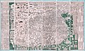
- Pekin kinbō zu (50 F)
T
- Tianxia Zongyutu (40 F)
Z
- Zhong E jiao jie quan tu (8 F)
Media in category "1890s maps of China"
The following 21 files are in this category, out of 21 total.
-
 'Claudius Bombarnac' by Léon Benett 37.jpg 1,506 × 1,065; 688 KB
-

-
 1892 map of China and Korea by the Imperial Japanese Army.jpg 24,554 × 15,890; 89.96 MB
-
 1892 map of China by Mingjie Liu.jpg 14,499 × 8,790; 28.99 MB
-
-
 Huang chao zhi sheng di yu quan tu - Cai shang zhi - btv1b53109917j.jpg 8,794 × 11,167; 20.38 MB
-
 Huang chao zhi sheng di yu quan tu - Cai shang zhi - btv1b53109919f (1 of 2).jpg 9,132 × 12,377; 20.97 MB
-
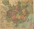
 Meyers leiner Hand-atlas 1893 (73137143).jpg 9,488 × 6,399; 11.45 MB
-
 A map of China prepared for the China Inland Mission 1894.jpg 7,842 × 6,747; 22.58 MB
-

-
 Henan Sheng quan tu LOC gm71002471.jpg 10,832 × 9,456; 13.52 MB
-
 Henan Sheng quan tu LOC gm71002471.tif 10,842 × 9,456; 293.34 MB
-

-

-

-

-

-
 Gaillard.Carte de Chine.Ports ouverts.1898.jpeg 800 × 635; 88 KB
-
 KarteChihli.jpg 935 × 1,484; 401 KB
-
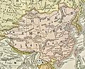 Qing china.jpg 888 × 725; 779 KB
-
 Tchekiang Carte.jpg 1,024 × 1,486; 511 KB

.jpg)


.jpg)
.jpg)

%27_(11227823116).jpg)

,_etc%27_(11153769004).jpg)
_C.lle_Paris_;_(avec_visa_du_Docteur_Ernest_Hamy,_pour_le_Bulletin_de_g%C3%A9ographie)_-_btv1b532122172.jpg)
.jpg)
.jpg)


