Category:1860s maps of Spain
Jump to navigation
Jump to search
Countries of Europe: Albania · Armenia‡ · Austria · Azerbaijan‡ · Belarus · Belgium · Bosnia and Herzegovina · Bulgaria · Croatia · Cyprus‡ · Czech Republic · Denmark · Estonia · Finland · France‡ · Georgia‡ · Germany · Greece · Hungary · Republic of Ireland · Italy · Latvia · Lithuania · Moldova · Montenegro · Netherlands‡ · Norway · Poland · Portugal‡ · Romania · Russia‡ · Serbia · Slovenia · Spain‡ · Sweden · Switzerland · Turkey‡ · Ukraine · United Kingdom
Limited recognition: Abkhazia‡
‡: partly located in Europe
Limited recognition: Abkhazia‡
‡: partly located in Europe
Autonomous communities of Spain: Autonomous cities:
Subcategories
This category has the following 11 subcategories, out of 11 total.
- 1862 maps of Spain (6 F)
- 1863 maps of Spain (7 F)
- 1864 maps of Spain (13 F)
- 1865 maps of Spain (3 F)
- 1866 maps of Spain (1 F)
- 1867 maps of Spain (1 F)
- 1868 maps of Spain (4 F)
- 1869 maps of Spain (4 F)
Media in category "1860s maps of Spain"
The following 9 files are in this category, out of 9 total.
-
 1862 Johnson Map of Spain and Portugal - Geographicus - SpainPortugal-j-62.jpg 3,000 × 2,404; 2.43 MB
-
 1864 Johnson Map of Spain and Portugal - Geographicus - SpainPortugal-johnson-1864.jpg 3,000 × 2,470; 2.97 MB
-
 1865 Johnson Map of France, Spain and Portugal - Geographicus - FranceSpain-johnson-1865.jpg 3,751 × 5,000; 6.98 MB
-
 1865 Spruner Map of Spain and Portugal - Geographicus - Hispania-spruner-1865.jpg 3,500 × 2,827; 2.52 MB
-
 017A C-27-203-1.jpg 339 × 480; 22 KB
-

-
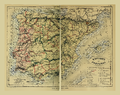 Bouillet - Atlas universel, Carte 69.png 3,425 × 2,698; 11.51 MB
-
 Johnson, A.J. Europe. 1864.I.jpg 1,914 × 1,365; 795 KB
-
 Triangulacion geodesica de España. Estado en 30 de setbre 1865 - btv1b8443315k.jpg 5,698 × 4,238; 3.91 MB


%27_(11074496526).jpg)


