Category:1890s maps of North Dakota
Jump to navigation
Jump to search
States of the United States: Alabama · Alaska · Arizona · Arkansas · California · Colorado · Connecticut · Delaware · Florida · Georgia · Hawaii · Idaho · Illinois · Indiana · Iowa · Kansas · Kentucky · Louisiana · Maine · Maryland · Massachusetts · Michigan · Minnesota · Mississippi · Missouri · Montana · Nebraska · Nevada · New Hampshire · New Jersey · New Mexico · New York · North Carolina · North Dakota · Ohio · Oklahoma · Oregon · Pennsylvania · Rhode Island · South Carolina · South Dakota · Tennessee · Texas · Utah · Vermont · Virginia · Washington · West Virginia · Wisconsin · Wyoming – Washington, D.C.
Puerto Rico
Puerto Rico
Subcategories
This category has the following 4 subcategories, out of 4 total.
- 1893 maps of North Dakota (7 F)
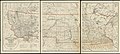
Media in category "1890s maps of North Dakota"
The following 8 files are in this category, out of 8 total.
-

-
-
 Map of North and South Dakota.jpg 2,928 × 3,566; 2.75 MB
-
 107 of 'Rhymes of the States. With drawings, etc' (11239124563).jpg 1,873 × 2,617; 1.15 MB
-

-
 Map of Richland County, N.D., 1897.jpg 4,906 × 6,728; 44.26 MB
-
 Early Indian treaty territories, North Dakota. Map 1 (1851-1891).png 1,440 × 845; 2.85 MB
-
 Fort Buford Military Reservation, North Dakota and Montana.jpg 534 × 736; 215 KB


.jpg)
_(14753528616).jpg)

.png)
