Category:1890s maps of Rhode Island
Jump to navigation
Jump to search
States of the United States: Alabama · Alaska · Arizona · Arkansas · California · Colorado · Connecticut · Delaware · Florida · Georgia · Hawaii · Idaho · Illinois · Indiana · Iowa · Kansas · Kentucky · Louisiana · Maine · Maryland · Massachusetts · Michigan · Minnesota · Mississippi · Missouri · Montana · Nebraska · Nevada · New Hampshire · New Jersey · New Mexico · New York · North Carolina · North Dakota · Ohio · Oklahoma · Oregon · Pennsylvania · Rhode Island · South Carolina · South Dakota · Tennessee · Texas · Utah · Vermont · Virginia · Washington · West Virginia · Wisconsin · Wyoming – Washington, D.C.
Puerto Rico
Puerto Rico
Subcategories
This category has the following 7 subcategories, out of 7 total.
- 1894 maps of Rhode Island (1 F)
- 1899 maps of Rhode Island (3 F)
Media in category "1890s maps of Rhode Island"
The following 8 files are in this category, out of 8 total.
-
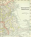
 US-MAPS(1891) p500 - MAP OF RHODE ISLAND.jpg 1,504 × 2,160; 948 KB
-
-

-
 Map of Rhode Island.jpg 1,959 × 2,904; 1.79 MB
-
 Town of Warwick Plate 1 1895 Coles Neighborhood.png 409 × 482; 560 KB
-
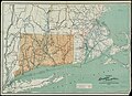 1895 Connecticut railroad map.jpg 10,157 × 7,340; 9.12 MB
-

-
_p500_-_MAP_OF_RHODE_ISLAND.jpg)
.jpg)


_(14589999317).jpg)
_(19357252442).jpg)