Category:1895 maps of South Carolina
Jump to navigation
Jump to search
States of the United States: California · Connecticut · Florida · Georgia · Illinois · Iowa · Kentucky · Louisiana · Maine · Maryland · Massachusetts · Michigan · Minnesota · Mississippi · Missouri · Nevada · New Jersey · New York · Ohio · Oklahoma · Oregon · Pennsylvania · Rhode Island · South Carolina · Tennessee · Texas · Utah · Vermont · Virginia · Washington · West Virginia · Wisconsin · Wyoming – Washington, D.C.
| ← 1890 1892 1893 1894 1895 1896 1897 1898 1899 → |
Subcategories
This category has the following 2 subcategories, out of 2 total.
Media in category "1895 maps of South Carolina"
The following 15 files are in this category, out of 15 total.
-
 Official topographical map of Abbeville Co., South Carolina LOC 2012586235.jpg 13,528 × 13,856; 20.18 MB
-
-

-

-

-

-

-

-

-

-
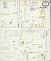
 Sanborn Fire Insurance Map from Manning, Clarendon County, South Carolina. LOC sanborn08161 001.tif 6,450 × 7,650; 141.17 MB
-

-
 Sanborn Fire Insurance Map from McColl, Marlboro County, South Carolina. LOC sanborn08159 001.tif 6,450 × 7,650; 141.17 MB
-

-


