Category:18th-century maps of Italy
Jump to navigation
Jump to search
Countries of Europe: Albania · Armenia‡ · Austria · Azerbaijan‡ · Belarus · Belgium · Bosnia and Herzegovina · Bulgaria · Croatia · Cyprus‡ · Czech Republic · Denmark · Estonia · Finland · France‡ · Georgia‡ · Germany · Greece · Hungary · Iceland · Republic of Ireland · Italy · Latvia · Lithuania · Luxembourg · Malta · Moldova · Montenegro · Netherlands‡ · Norway · Poland · Portugal‡ · Romania · Russia‡ · Serbia · Slovakia · Slovenia · Spain‡ · Sweden · Switzerland · Turkey‡ · Ukraine · United Kingdom
Specific status: Isle of Man – Limited recognition: Abkhazia‡
‡: partly located in Europe
Specific status: Isle of Man – Limited recognition: Abkhazia‡
‡: partly located in Europe
Subcategories
This category has the following 28 subcategories, out of 28 total.
#
.
- 18th-century maps of Abruzzo (3 F)
- 18th-century maps of Sardinia (18 F)
- 18th-century maps of Veneto (8 F)
1
C
- 18th-century maps of Corsica (71 F)
R
Media in category "18th-century maps of Italy"
The following 17 files are in this category, out of 17 total.
-

-

-

-
 1770 Janvier Map of Italy - Geographicus - Italy-janvier-1770.jpg 4,000 × 2,801; 3.34 MB
-
 1770 Rizzi Zannoni Two Part Map of Italy - Geographicus - Italy-zannoni-1770.jpg 4,000 × 5,537; 5.96 MB
-
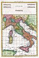 1780 Raynal and Bonne Map of Italy - Geographicus - Italie-bonne-1780.jpg 1,682 × 2,500; 1.21 MB
-
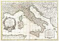
 1794 D'Anville Map of Italy - Geographicus - Italy-anville-1794.jpg 5,000 × 6,286; 8.5 MB
-
 1799 Clement Cruttwell Map of Italy - Geographicus - Italy-cruttwell-1799.jpg 3,500 × 2,999; 2.69 MB
-

-

-
 Carte des Voyages de Télémaque (Cropped).tif 3,030 × 1,685; 24.84 MB
-
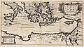 Carte des Voyages de Télémaque.jpg 3,030 × 1,688; 3.79 MB
-

-

-
 Kaart van Italië, objectnr A 16231.jpg 7,340 × 6,092; 34.58 MB
-
-
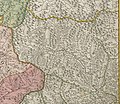
 Topografia e idrografia del Reno 1732.jpg 7,886 × 5,184; 1.93 MB


.jpg)
