Category:18th-century maps of Luxembourg
Jump to navigation
Jump to search
Countries of Europe: Albania · Armenia‡ · Austria · Azerbaijan‡ · Belarus · Belgium · Bosnia and Herzegovina · Bulgaria · Croatia · Cyprus‡ · Czech Republic · Denmark · Estonia · Finland · France‡ · Georgia‡ · Germany · Greece · Hungary · Iceland · Republic of Ireland · Italy · Latvia · Lithuania · Luxembourg · Malta · Moldova · Montenegro · Netherlands‡ · North Macedonia · Norway · Poland · Portugal‡ · Romania · Russia‡ · Serbia · Slovakia · Slovenia · Spain‡ · Sweden · Switzerland · Turkey‡ · Ukraine · United Kingdom
Specific status: Gibraltar · Isle of Man – Limited recognition: Abkhazia‡
‡: partly located in Europe
Specific status: Gibraltar · Isle of Man – Limited recognition: Abkhazia‡
‡: partly located in Europe
Media in category "18th-century maps of Luxembourg"
The following 19 files are in this category, out of 19 total.
-

-

-
 Kornelimuenster bis Pruem 1720.png 3,887 × 3,508; 2.73 MB
-
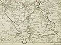
 Amel bis Trier ca 1700-50.jpg 757 × 1,532; 1.93 MB
-

-

-

-

-

-

-
-
 Carte de la frontière du Barrois sur le pays de Luxembourg 1775.jpg 1,227 × 936; 433 KB
-

-
 LASB K Hellwig 0014.jpg 9,181 × 8,926; 24.81 MB
-
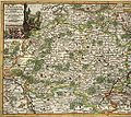
 Reilly 169.jpg 1,182 × 960; 482 KB
-
 Duchy of Luxemburg in 1789.jpg 1,341 × 1,177; 664 KB
-
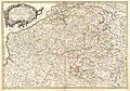
 Pieter van der Aa Luxembourg 1712.jpg 498 × 444; 93 KB
-
 Prevote de Luxembourg reprod 1705.jpg 2,745 × 2,453; 1.46 MB
-
 Prevote de Thionville reprod 1705.jpg 2,892 × 2,140; 1.48 MB
.jpg)


