Category:18th-century maps of Turkmenistan
Jump to navigation
Jump to search
Media in category "18th-century maps of Turkmenistan"
The following 3 files are in this category, out of 3 total.
-
 1730 Van Verden Map of the Caspian Sea - Geographicus - CaspienSea-vanverden-1721.jpg 2,310 × 3,500; 2.23 MB
-
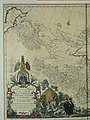 CEM-44-La-Chine-la-Tartarie-Chinoise-et-le-Thibet-1734-West-2569.jpg 1,920 × 2,560; 2.08 MB
-
 Chechen Island on a map of 1730.png 495 × 658; 797 KB


