Category:1900s maps of Russia
Jump to navigation
Jump to search
Countries of Asia: Afghanistan · Armenia‡ · Azerbaijan‡ · People's Republic of China · Cyprus‡ · Egypt‡ · Georgia‡ · India · Indonesia‡ · Iran · Iraq · Japan · Jordan · Lebanon · Pakistan · Philippines · Russia‡ · Syria · Thailand · Turkey‡ · Uzbekistan
Limited recognition: Abkhazia‡ · Taiwan · State of Palestine
‡: partly located in Asia
Limited recognition: Abkhazia‡ · Taiwan · State of Palestine
‡: partly located in Asia
Countries of Europe: Albania · Armenia‡ · Azerbaijan‡ · Belarus · Belgium · Bosnia and Herzegovina · Bulgaria · Croatia · Cyprus‡ · Czech Republic · Denmark · Finland · France‡ · Georgia‡ · Germany · Greece · Hungary · Iceland · Republic of Ireland · Italy · Lithuania · Netherlands‡ · Norway · Poland · Portugal‡ · Romania · Russia‡ · Serbia · Slovakia · Spain‡ · Sweden · Switzerland · Turkey‡ · Ukraine · United Kingdom
Limited recognition: Abkhazia‡
‡: partly located in Europe
Limited recognition: Abkhazia‡
‡: partly located in Europe
Subcategories
This category has the following 9 subcategories, out of 9 total.
- 1900 maps of Russia (7 F)
- 1903 maps of Russia (23 F)
- 1905 maps of Russia (14 F)
- 1906 maps of Russia (7 F)
- 1908 maps of Russia (1 F)
- 1909 maps of Russia (2 F)
-
- 1900s maps of Chechnya (2 F)
- 1900s maps of Dagestan (1 F)
Media in category "1900s maps of Russia"
The following 29 files are in this category, out of 29 total.
-
 Russland BV042519804.jpg 5,601 × 6,481; 3.15 MB
-
 Schematičeskaja karta isčezajuščich ozer Obonež'ja.jpg 1,429 × 1,188; 290 KB
-
 Plan Tsarskoe Selo 1901.jpg 516 × 700; 154 KB
-
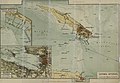 Россия. Кронштадт. План. 1901егг kronstadt-1901 e1.jpg 3,873 × 2,682; 2.77 MB
-
 1902 moscow-metropolyten.jpg 1,861 × 2,189; 1.95 MB
-
 Russian map of Pensa.jpg 1,995 × 841; 221 KB
-
 Russland BV043573099.jpg 2,126 × 2,800; 855 KB
-
 Zentralrussland BV043573100.jpg 3,536 × 3,884; 1.46 MB
-
 1902 map of Russia.jpg 1,982 × 1,654; 665 KB
-
 Russian map of Pensa (2).jpg 1,994 × 787; 182 KB
-
 Harmsworth atlas CS Russia.jpg 1,618 × 2,208; 1.75 MB
-
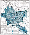
 Ставропольская губерния 1909 г Александровский уезд.jpg 3,307 × 2,340; 5.53 MB
-
 Brockhaus and Efron Encyclopedic Dictionary b31 410-0.jpg 3,399 × 2,433; 2.4 MB
-
 Brockhaus and Efron Encyclopedic Dictionary b46 890-2.jpg 1,864 × 2,183; 1.48 MB
-
 Brockhaus and Efron Encyclopedic Dictionary b54 212-0.jpg 2,697 × 1,717; 1.44 MB
-
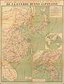 Ca. 1904 map - Carte de l'Extreme-Orient et du Theatre De La Guerre Russo-Japonaise.jpg 14,756 × 19,337; 38.4 MB
-
 Plan SPB tram 1904.jpg 7,572 × 9,626; 16.32 MB
-
 Russland BV042519797.jpg 2,140 × 1,790; 718 KB
-
 Russland BV042519802.jpg 2,750 × 960; 653 KB
-
 Russland BV042519808.jpg 2,600 × 1,225; 714 KB
-
 Russland BV042519811.jpg 3,340 × 2,900; 1.14 MB
-
 Russland BV042519813.jpg 960 × 2,610; 625 KB
-
 Russland BV042519814.jpg 1,840 × 1,970; 736 KB
-
 Russland BV042519815.jpg 1,920 × 2,870; 870 KB
-
 Russland BV043573101.jpg 1,035 × 1,820; 551 KB
-

-
 Zentralrussland BV043573096.jpg 1,840 × 4,034; 1,016 KB
-
 КАРТА ДАЛЬНЯГО ВОСТОСКА. (МАНЬЧЖУРІЯ, КОРЕЯ и ЯПОНІЯ.) - btv1b53065250m.jpg 7,968 × 10,576; 9.51 MB
-
 Карта Томского горного округа.png 2,480 × 2,842; 9.58 MB


_(14772618772).jpg)

_-_btv1b53065250m.jpg)

.jpg)