Category:1912 maps of India
Jump to navigation
Jump to search
English: 1912 maps made in India or from India or showing history of India
Media in category "1912 maps of India"
The following 7 files are in this category, out of 7 total.
-

-
 City of Calcutta (10403000).jpg 26,784 × 30,832; 306.51 MB
-
 City of Calcutta by Survey of India 1912.png 11,430 × 13,157; 66.89 MB
-
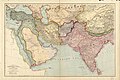 Map by Edward Stanford.jpg 3,999 × 2,664; 3.17 MB
-
 Periplus 181 Gulf of Cambay.png 1,436 × 1,676; 2.75 MB
-
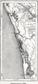 Periplus 207 Cochin.png 1,000 × 2,173; 2.95 MB
-
 Политическая карта Азии начало XX века.jpg 3,194 × 2,128; 1.54 MB
.jpg)


