Category:1920s maps of Palestine
Jump to navigation
Jump to search
Subcategories
This category has only the following subcategory.
S
Media in category "1920s maps of Palestine"
The following 39 files are in this category, out of 39 total.
-
 07-07-Rafah-1925.jpg 6,596 × 7,873; 8.09 MB
-
 12-14-Yibna-1929.jpg 6,576 × 7,851; 7.03 MB
-
 12-16-Jaffa-1929.jpg 6,688 × 7,903; 7.67 MB
-
 13-15-BeitDajan-1929.jpg 6,700 × 8,011; 8.97 MB
-
 13-16-PetahTiqva-1928 full.jpg 6,455 × 7,899; 8.85 MB
-
 13-16-PetahTiqva-1928.jpg 2,950 × 2,926; 2.45 MB
-
 13-16-soilPetachTikva-1928.jpg 6,729 × 8,229; 11 MB
-
 13-18-BirkatRamadan-1929.jpg 6,616 × 7,867; 5.73 MB
-
 13-19-UmmKhalid-1929.jpg 6,557 × 7,851; 5.06 MB
-
 14-13-Amwas-1929.jpg 6,760 × 7,027; 6.61 MB
-
 14-14-ElQubab-1929.jpg 6,552 × 6,683; 6.78 MB
-
 14-15-Lydda-1929.jpg 6,704 × 7,975; 8.15 MB
-
 16-24-Shafa Amr-1929.jpg 6,937 × 7,005; 7.3 MB
-
 19-13-DeirHajla-1928.jpg 7,944 × 6,833; 6.08 MB
-
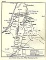
 19-14-Jericho-1928.jpg 8,001 × 6,672; 6.06 MB
-
 19-15-ElMusallabe-1928.jpg 8,306 × 6,714; 6.22 MB
-
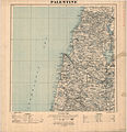
 PalestineandTransjordan1922.jpg 1,686 × 1,607; 1.28 MB
-
 Palestine N.JPG 636 × 692; 74 KB
-
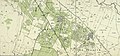
 Palestine north 1924.jpg 2,596 × 2,675; 2.57 MB
-
 Palestine south 1924.jpg 2,604 × 2,738; 2.8 MB
-
 Syria Southern Palestine.png 8,183 × 7,705; 65.56 MB
-
 Das jüdische Siedlungswerk in Palästina (Stand vom Herbst 1925).jpg 1,281 × 1,990; 380 KB
-
 Beit Dajan 1929.jpg 4,685 × 2,168; 3.31 MB
-
 Bukhariya1925.png 2,919 × 3,047; 844 KB
-
 Die Sieben Säulen der Weisheit, Skizze II.jpg 904 × 1,172; 225 KB
-
 Die Sieben Säulen der Weisheit, Skizze IV.jpg 861 × 1,255; 260 KB
-
 Israerail24.jpg 550 × 1,024; 144 KB
-
 Jaffa 1929.jpg 3,935 × 4,905; 5.09 MB
-
 Kufr 'Ana cropped.jpg 3,516 × 1,567; 1.62 MB
-
 Motor and Camel Surveys in the North Arabian Desert.jpg 5,000 × 2,985; 1.64 MB
-
 Palestine Map in Gujarati - Jesus Period.png 472 × 684; 198 KB
-
 Salame cropped.jpg 4,674 × 2,925; 3.57 MB
-
 Sarahanu el 'Amar cropped.jpg 5,935 × 2,932; 5.28 MB
-

-
-
 Umm Khalid 1929.jpg 2,958 × 4,124; 2.78 MB
-
 Yazur 1929.jpg 1,776 × 1,642; 1 MB
-
 Yibna 1929.jpg 4,707 × 4,863; 6.24 MB
-
 מפת ארץ ישראל - המושבות העבריות = Jewish settlements in Palestine - btv1b10104158b.jpg 12,589 × 23,076; 36.04 MB


.jpg)


_(14578770890).jpg)
_(14578835499).jpg)


