Category:1920s maps of Egypt
Jump to navigation
Jump to search
Countries of Asia: Armenia‡ · Azerbaijan‡ · Cambodia · People's Republic of China · Egypt‡ · Georgia‡ · India · Indonesia‡ · Iran · Iraq · Israel · Japan · Jordan · Laos · Lebanon · Mongolia · Philippines · Russia‡ · Syria · Turkey‡ · Vietnam
Limited recognition: Taiwan · State of Palestine
‡: partly located in Asia
Limited recognition: Taiwan · State of Palestine
‡: partly located in Asia
Countries of Africa: Algeria · Angola · Democratic Republic of the Congo · Djibouti · Egypt‡ · Ethiopia · Madagascar · Mauritania · Morocco · Nigeria · South Africa · Sudan · Tunisia
‡: partly located in Africa
‡: partly located in Africa
Subcategories
This category has the following 4 subcategories, out of 4 total.
Media in category "1920s maps of Egypt"
The following 8 files are in this category, out of 8 total.
-
-
 1925 Air Routes of Egypt.jpg 580 × 851; 192 KB
-
 Alexandrie. Plan de la ville Ancienne et moderne - Prof. M. Bartocci del. - btv1b10101085t.jpg 11,181 × 5,433; 6.32 MB
-
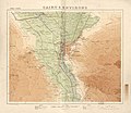 Cairo & environs. LOC 2009580101.jpg 12,377 × 10,758; 14.26 MB
-
 Cairo & environs. LOC 2009580101.tif 12,377 × 10,758; 380.95 MB
-
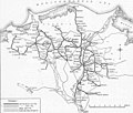 Egyptian Delta Railways - Map of the tracks in the 1920s.jpg 800 × 677; 110 KB
-
 Map Ancient Egypt 1928-1940 - Touring Club Italiano CART-TRC-34.jpg 4,551 × 6,298; 2.78 MB
-
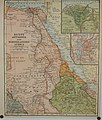
 Mideast1920.jpg 3,992 × 3,012; 2.48 MB
_(14797736313).jpg)


