Category:1956 maps of India
Jump to navigation
Jump to search
English: 1956 maps made in India or from India or showing history of India
Media in category "1956 maps of India"
The following 15 files are in this category, out of 15 total.
-
Admiralty Chart No 1321 Plans on the Kathiawar Coast, Published 1927, New Edition 1956.jpg 16,221 × 11,082; 34.92 MB
-
1956 North Indian Ocean cyclone season summary.jpg 3,000 × 2,047; 692 KB
-
Deccan1956.PNG 1,950 × 2,159; 593 KB
-
Formation of Karnataka State 1956.jpeg 929 × 830; 143 KB
-
HyderIndKart.jpg 930 × 1,060; 94 KB
-
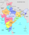
India administrative map 1956 PL.png 1,041 × 1,360; 152 KB
-
Indien 1956-hu.svg 985 × 1,185; 343 KB
-
Indien 1956.svg 985 × 1,185; 307 KB
-
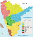
Karnataka 1956 Reorg-fr.svg 672 × 746; 279 KB
-
Map of South Canara district in 1956. Self work..png 544 × 929; 18 KB
-
Mysore 1956.jpg 596 × 488; 102 KB
-
Northeast India - DPLA - a07b3ba822beabece29d6a25d1e09d99.jpg 3,256 × 2,546; 2.23 MB
-
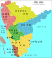
South Indian territories-fr.svg 672 × 746; 267 KB
-
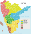
South Indian territories.svg 672 × 746; 306 KB
-
States Reorganisation Act 1956.svg 1,303 × 1,185; 444 KB


