Category:1960s maps of Alabama
Jump to navigation
Jump to search
States of the United States: Alabama · Alaska · Arizona · California · Colorado · Delaware · Florida · Georgia · Hawaii · Illinois · Louisiana · Massachusetts · Michigan · Mississippi · Nebraska · New Hampshire · New Jersey · New York · Ohio · Oklahoma · Pennsylvania · Tennessee · Utah · Virginia · West Virginia – Washington, D.C.
Puerto Rico
Puerto Rico
Media in category "1960s maps of Alabama"
The following 5 files are in this category, out of 5 total.
-
 Map of Alabama showing soil and water conservation district organization. LOC gm69002242.jpg 3,644 × 5,590; 1.85 MB
-
 Conecuh National Forest, Alabama. LOC 75695917.jpg 8,033 × 3,729; 3.91 MB
-
 Conecuh National Forest, Alabama. LOC 75695917.tif 8,033 × 3,729; 85.7 MB
-

-
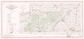
 Talladega National Forest, Talladega and Shoal Creek Ranger Districts, Alabama. LOC gm70001046.tif 9,592 × 10,583; 290.43 MB


