Category:1960s maps of Alaska
Jump to navigation
Jump to search
States of the United States: Alabama · Alaska · Arizona · California · Colorado · Delaware · Florida · Georgia · Hawaii · Illinois · Louisiana · Massachusetts · Michigan · Mississippi · Nebraska · New Hampshire · New Jersey · New York · Ohio · Oklahoma · Pennsylvania · Tennessee · Utah · Virginia · West Virginia – Washington, D.C.
Puerto Rico
Puerto Rico
Media in category "1960s maps of Alaska"
The following 13 files are in this category, out of 13 total.
-

-
 1960AKHouse.svg 744 × 443; 4.6 MB
-
 1964 United States presidential election in Alaska by State House District.svg 800 × 429; 10.47 MB
-

-
 1968 United States presidential election in Alaska by State House District.svg 800 × 429; 10.28 MB
-
 Admiralty Chart Catalogue 1967 Page 092 Index Q.jpg 8,572 × 6,889; 7.59 MB
-
 Admiralty Chart Catalogue 1967 Page 095 Index Q1.jpg 8,566 × 6,847; 10.88 MB
-
 Alaska Presidential Election Results 1960.svg 1,306 × 848; 1.43 MB
-
 Alaska Presidential Election Results 1964.svg 1,306 × 848; 1.43 MB
-
 Alaska Presidential Election Results 1968.svg 800 × 488; 1.67 MB
-
 Anchorage and Vicinity O61149A6 geo.pdf 6,602 × 8,343; 24.66 MB
-
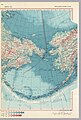 Beringia, 1967.jpg 1,953 × 2,885; 2.19 MB
-
 Canada 1967 - west.jpg 2,892 × 4,084; 2.49 MB


.svg)


