Category:1983 maps of the United States
Jump to navigation
Jump to search
Countries of the Americas: Chile · Guyana · Honduras · Paraguay · United States of America
Other areas: French Guiana
Other areas: French Guiana
States of the United States: California · Florida · Georgia · New Jersey · Ohio · Pennsylvania · South Carolina
Subcategories
This category has the following 8 subcategories, out of 8 total.
C
- 1983 maps of California (1 F)
F
- 1983 maps of Florida (1 F)
G
N
- 1983 maps of New Jersey (2 F)
O
- 1983 maps of Ohio (2 F)
P
- 1983 maps of Pennsylvania (16 F)
S
- 1983 maps of South Carolina (2 F)
Media in category "1983 maps of the United States"
The following 7 files are in this category, out of 7 total.
-
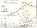 1983 LaPlace LA Tornado Track Map.jpg 607 × 466; 65 KB
-
 1983 U.S. House vote on MLK Jr.png 1,024 × 776; 285 KB
-
 1983 U.S. Senate vote on MLK Jr. Day.png 1,016 × 748; 164 KB
-
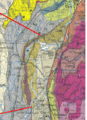
 Erosion problem areas, Louisiana statewide study. LOC 89697226.jpg 6,064 × 5,648; 4.53 MB
-
 Erosion problem areas, Louisiana statewide study. LOC 89697226.tif 6,064 × 5,648; 97.99 MB
-
 Holyoke.jpg 744 × 520; 560 KB
-
 Pocumtuck.gif 421 × 583; 155 KB


