Category:1990 maps of the United States
Jump to navigation
Jump to search
Subcategories
This category has the following 13 subcategories, out of 13 total.
A
- 1990 maps of Alabama (2 F)
D
- 1990 maps of Delaware (3 F)
G
K
- 1990 maps of Kentucky (1 F)
L
- 1990 maps of Louisiana (4 F)
M
- 1990 maps of Maryland (3 F)
P
- 1990 maps of Pennsylvania (13 F)
S
- 1990 maps of South Carolina (4 F)
T
- 1990 maps of Tennessee (2 F)
- 1990 maps of Texas (5 F)
V
- 1990 maps of Virginia (2 F)
Media in category "1990 maps of the United States"
The following 8 files are in this category, out of 8 total.
-
 1990 US Census Map.png 5,285 × 3,762; 1.28 MB
-
 Cape Cod National Seashore, Massachusetts LOC 90685110.tif 5,070 × 7,109; 103.12 MB
-
 Lewis and Clark in the Rocky Mountains LOC 91682738.jpg 5,384 × 7,159; 8.07 MB
-
 Race and Hispanic origin population density of the United States- 1990 LOC 97682420.jpg 6,526 × 5,718; 5.71 MB
-
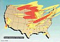 Risks hazards A State by State Guide FEMA196 0017-map.jpg 1,630 × 1,152; 317 KB
-
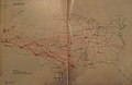 Southwest route map (11 90) (9357014078).jpg 2,553 × 1,658; 1.47 MB
-

-
 World Factbook (1990) United Kingdom.jpg 501 × 523; 78 KB


_(9357014078).jpg)
_United_Kingdom.jpg)