Category:19th-century maps of Cape Verde
Jump to navigation
Jump to search
Countries of Africa: Algeria · Angola · Benin · Botswana · Cameroon · Cape Verde · Chad · Democratic Republic of the Congo · Republic of the Congo · Djibouti · Egypt‡ · Equatorial Guinea · Eritrea · Eswatini · Ethiopia · Gabon · The Gambia · Ghana · Guinea · Guinea-Bissau · Ivory Coast · Kenya · Lesotho · Liberia · Libya · Madagascar · Mali · Mauritania · Morocco · Mozambique · Namibia · Niger · Nigeria · Senegal · Sierra Leone · Somalia · South Africa · South Sudan · Sudan · Tanzania · Togo · Tunisia · Uganda · Zambia · Zimbabwe
Other areas: Canary Islands · Madeira · Western Sahara
‡: partly located in Africa
Other areas: Canary Islands · Madeira · Western Sahara
‡: partly located in Africa
Media in category "19th-century maps of Cape Verde"
The following 46 files are in this category, out of 46 total.
-

-

-
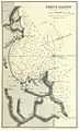 IMRAY(1884) p0173 CAPE VERDES, PORTO GRANDE.jpg 1,603 × 2,664; 2.34 MB
-
 IMRAY(1884) p0166 CAPE VERDE, PORTO PRAYA.jpg 1,591 × 2,652; 2.18 MB
-

-
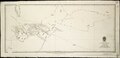
 A new chart of the Cape Verd Islands, from the latest authorities (8252384935).jpg 1,238 × 2,000; 2.27 MB
-
 A Survey of St. Nicholas.jpg 4,233 × 2,949; 3.61 MB
-
-

-

-
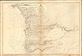
 Admiralty Chart No 366 A Chart of the Cape Verd Islands, Published 1822 2.jpg 10,242 × 8,310; 9.19 MB
-
 Admiralty Chart No 366 A Chart of the Cape Verd Islands, Published 1822.jpg 9,938 × 8,227; 16.21 MB
-
 Admiralty Chart No 369 Plans in the Arquipelago de Cabo Verde, Published 1895.jpg 11,071 × 16,268; 35.97 MB
-
 Admiralty Chart No 377 A Survey of St. Lucea, Branco & Raza, Published 1823.jpg 3,824 × 2,969; 2.85 MB
-
 Admiralty Chart No 380 An Orometric Survey of Bonavista, Published 1820.jpg 3,780 × 2,977; 3.42 MB
-
 Admiralty Chart No 383 A Survey of St. Jago, Published 1823.jpg 3,001 × 3,702; 4.06 MB
-

-
 Admiralty Chart No 599 Cape Verde to River Cacheo, Published 1896.jpg 16,415 × 11,285; 45.86 MB
-
 An Orometric Survey of Mayo.jpg 3,003 × 3,743; 2.55 MB
-
 An Orometric Survey of Sal.jpg 2,832 × 3,745; 2.64 MB
-

-
 Cabo Verde. Villa de S. Filippe, provoaçao principal da ilha do Fogo - btv1b8439919w.jpg 8,622 × 9,130; 6.94 MB
-

-
 Carte des Isles du Cap Verd, levée en 1819 1820 et 1822 (3120222541).jpg 2,000 × 1,329; 1.95 MB
-
 Iles du Cap-Vert... - Bonne filius delineavit - btv1b8439312x.jpg 6,537 × 4,605; 3.42 MB
-
 Islands In The Atlantic.jpg 4,747 × 5,614; 7.32 MB
-
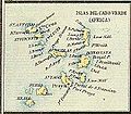 Islas del Cabo Verde.JPG 332 × 291; 65 KB
-

-

-

-

-
-

-

-

-

-

-

-
-
 St. Lucia, Branca and Raza 01.jpg 4,030 × 3,214; 3.48 MB
-
 St. Lucia, Branca and Raza 02.jpg 4,051 × 3,232; 3.21 MB
-
 Sta. Luzia, Branco und Razo.jpg 3,453 × 3,303; 2.3 MB
-
 São Vicente 1863 (cropped).jpg 2,915 × 1,994; 1.96 MB
-
 São Vicente 1863.jpg 5,967 × 5,141; 6.24 MB
-

-

%27_(11254275563).jpg)
.jpg)
_p0173_CAPE_VERDES,_PORTO_GRANDE.jpg)
_p0166_CAPE_VERDE,_PORTO_PRAYA.jpg)

.jpg)


_-_btv1b8439923s.jpg)
.jpg)


.jpg)
.jpg)
.jpg)
.jpg)
.jpg)
.jpg)
.jpg)
.jpg)
.jpg)
.jpg)
.jpg)
_(14595639737).jpg)


.jpg)


