Category:Maps of Cape Verde
Jump to navigation
Jump to search
Countries of Africa: Algeria · Angola · Benin · Botswana · Burkina Faso · Burundi · Cameroon · Cape Verde · Central African Republic · Chad · Comoros · Democratic Republic of the Congo · Republic of the Congo · Djibouti · Egypt‡ · Equatorial Guinea · Eritrea · Eswatini · Ethiopia · Gabon · The Gambia · Ghana · Guinea · Guinea-Bissau · Ivory Coast · Kenya · Lesotho · Liberia · Libya · Madagascar · Malawi · Mali · Mauritania · Mauritius · Morocco · Mozambique · Namibia · Niger · Nigeria · Rwanda · São Tomé and Príncipe · Senegal · Seychelles · Sierra Leone · Somalia · South Africa · South Sudan · Sudan · Tanzania · Togo · Tunisia · Uganda · Zambia · Zimbabwe
Limited recognition: Ambazonia · Azawad · Puntland · Sahrawi Arab Democratic Republic · Somaliland – Other areas: Canary Islands · Ceuta · Madeira · Mayotte · Melilla · Réunion · Saint Helena, Ascension and Tristan da Cunha · Scattered Islands in the Indian Ocean · Western Sahara
‡: partly located in Africa
Wikimedia category | |||||
| Upload media | |||||
| Instance of | |||||
|---|---|---|---|---|---|
| Category combines topics | |||||
 | |||||
Maps of Cape Verde.
Subcategories
This category has the following 17 subcategories, out of 17 total.
Pages in category "Maps of Cape Verde"
The following 2 pages are in this category, out of 2 total.
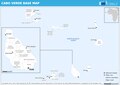
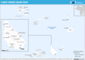
Media in category "Maps of Cape Verde"
The following 11 files are in this category, out of 11 total.
-
 Bees of cape verde range.jpg 756 × 737; 83 KB
-
 Bela-vista-net-Cabo-Verde-map.jpg 445 × 334; 41 KB
-
 Cape Verde - DPLA - 4e8c6db8f0060bb29f8844cb4901f60a.jpg 3,274 × 2,554; 1,002 KB
-
 Cape Verde - DPLA - 78b229611209a56e579c3481b42909ab.jpg 3,280 × 2,556; 1.19 MB
-
 Cape Verde Rise.jpg 1,825 × 2,000; 1.22 MB
-
 ECHO Cabo Verde Editable A4 Landscape.pdf 1,754 × 1,239; 234 KB
-
 ECHO Cabo Verde Editable A4 Landscape.png 1,123 × 794; 188 KB
-
 Faveta-cacheu.jpg 1,024 × 683; 509 KB
-
 FLII CapeVerde.png 1,115 × 835; 47 KB
-
 Greenland Azores Equator blank.jpg 3,600 × 23,400; 19.02 MB
-
 Greenland Azores Equator.jpg 2,400 × 15,600; 10.53 MB


