Category:19th-century maps of Lithuania
Jump to navigation
Jump to search
Countries of Europe: Albania · Armenia‡ · Austria · Azerbaijan‡ · Belarus · Belgium · Bosnia and Herzegovina · Bulgaria · Croatia · Cyprus‡ · Czech Republic · Denmark · Estonia · Finland · France‡ · Georgia‡ · Germany · Greece · Hungary · Iceland · Republic of Ireland · Italy · Latvia · Lithuania · Luxembourg · Malta · Moldova · Montenegro · Netherlands‡ · North Macedonia · Norway · Poland · Portugal‡ · Romania · Russia‡ · Serbia · Slovakia · Slovenia · Spain‡ · Sweden · Switzerland · Turkey‡ · Ukraine · United Kingdom
Specific status: Gibraltar · Isle of Man – Limited recognition: Abkhazia‡
‡: partly located in Europe
Specific status: Gibraltar · Isle of Man – Limited recognition: Abkhazia‡
‡: partly located in Europe
Subcategories
This category has the following 10 subcategories, out of 10 total.
- 1810s maps of Lithuania (12 F)
- 1830s maps of Lithuania (11 F)
- 1840s maps of Lithuania (9 F)
- 1850s maps of Lithuania (6 F)
- 1860s maps of Lithuania (15 F)
- 1870s maps of Lithuania (10 F)
- 1880s maps of Lithuania (15 F)
Media in category "19th-century maps of Lithuania"
The following 2 files are in this category, out of 2 total.
-
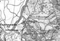 Neravai 1865-1903.png 622 × 423; 327 KB
-


.jpg)