Category:19th-century maps of Sweden
Jump to navigation
Jump to search
Countries of Europe: Albania · Armenia‡ · Austria · Azerbaijan‡ · Belarus · Belgium · Bosnia and Herzegovina · Bulgaria · Croatia · Cyprus‡ · Czech Republic · Denmark · Estonia · Finland · France‡ · Georgia‡ · Germany · Greece · Hungary · Iceland · Republic of Ireland · Italy · Latvia · Lithuania · Luxembourg · Malta · Moldova · Montenegro · Netherlands‡ · North Macedonia · Norway · Poland · Portugal‡ · Romania · Russia‡ · Serbia · Slovakia · Slovenia · Spain‡ · Sweden · Switzerland · Turkey‡ · Ukraine · United Kingdom
Specific status: Isle of Man – Limited recognition: Abkhazia‡
‡: partly located in Europe
Specific status: Isle of Man – Limited recognition: Abkhazia‡
‡: partly located in Europe
Subcategories
This category has the following 13 subcategories, out of 13 total.
- 1820s maps of Sweden (10 F)
- 1840s maps of Sweden (1 F)
- 1860s maps of Sweden (4 F)
- 1870s maps of Sweden (6 F)
- 1890s maps of Sweden (7 F)
1
M
- Maps from Ljunggren Atlas (101 F)
Media in category "19th-century maps of Sweden"
The following 51 files are in this category, out of 51 total.
-
 12-TOR-24-1807-s.JPG 895 × 660; 114 KB
-

-
 Nordenkart, 1800. Høyre side (12235512534).jpg 10,080 × 12,404; 30.2 MB
-
 Sweden, Denmark, Norway and Finland, from the best authorities (3046039688).jpg 2,000 × 1,614; 2.83 MB
-
 Situasjonen i Nord-Europa 1801.jpg 5,500 × 2,953; 19.35 MB
-
 Karta öfver Kemi Lappmark.jpg 3,271 × 5,396; 5.79 MB
-

-
 Map of Sweden Wellcome V0049917.jpg 3,000 × 2,329; 2.76 MB
-
 Karta över Visingsö, 1817 - Skoklosters slott - 98066.tif 3,665 × 5,274; 55.32 MB
-
 Geografisk, militarisk och statistisk Karta öfver hela Sverige och Norrige..jpg 2,225 × 3,300; 2.17 MB
-
 Nordenkart, 1820.jpg 7,820 × 10,584; 17.18 MB
-
 1830rv25.jpg 499 × 249; 46 KB
-
 1830rv25b.jpg 450 × 170; 32 KB
-

-
 Karta öfver landswägarne uti Sverige och Norige LOC 2015591081.jpg 7,745 × 11,054; 14.64 MB
-
 Karta öfver landswägarne uti Sverige och Norige LOC 2015591081.tif 7,745 × 11,054; 244.94 MB
-

-
 Norge og Sverige 1847 copy.jpg 1,404 × 1,911; 2.22 MB
-
 Schweden und Norwegen LOC 2012593350.jpg 6,974 × 7,534; 8.18 MB
-
 Schweden und Norwegen LOC 2012593350.tif 6,974 × 7,534; 150.32 MB
-
 KopingHult.jpg 3,525 × 2,572; 5.54 MB
-
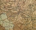
 Hovsta landskommun.jpg 4,517 × 3,168; 7.08 MB
-
 Hässleholm 1865.jpg 1,252 × 1,032; 692 KB
-

-
 1869 Salem.jpg 1,605 × 1,223; 498 KB
-
 108 of 'Den nordiske Syvaarskrig, 1563-1570' (11211413963).jpg 1,430 × 2,333; 1,018 KB
-
 Djursholm sid26.jpg 2,553 × 1,889; 844 KB
-
 128 of 'Leerboek der Aardsrijkskunde. Met Schetskaartjes, etc' (11224508575).jpg 1,241 × 1,849; 418 KB
-
 Map asen unnen.jpg 700 × 1,038; 104 KB
-

-

-
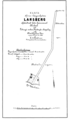 Larsberg 1898.png 896 × 1,549; 48 KB
-

-

-
 Battle of Lund 1676.png 866 × 1,175; 387 KB
-
 Bidrag til et geognosisk kart over Jemtland… - no-nb krt 00907.jpg 7,819 × 6,390; 11.13 MB
-
 Hallunda gård karta 1804.jpg 1,054 × 1,740; 397 KB
-
 Johnson, A.J. Europe. 1864.M.Sweden.jpg 936 × 1,991; 628 KB
-
 Kart over kysten av Norge og Sverige fra Kristiansans til Väröbacka.png 3,642 × 3,413; 35.57 MB
-
 Karta öfver Sverige - Kungliga Biblioteket - 10346168-thumb.png 8,385 × 12,265; 497.22 MB
-
 Karta över del av Ulriksdals slottsområde 1808.jpg 2,066 × 1,172; 359 KB
-
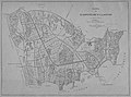
 Karta över Nyköping 1888.tif 8,057 × 9,891; 228.03 MB
-
 Karta över Nyköpings län, 1868.jpg 22,987 × 15,878; 80.24 MB
-
 Landkort over Norge og nogle Naboe-Lande - no-nb krt 01037.jpg 8,468 × 5,294; 11.94 MB
-
 Landskapskarta Indalsälven1.png 16,944 × 3,072; 27.63 MB
-
 Landskapskarta Indalsälven2.png 9,192 × 2,968; 14.18 MB
-
 Le Tour du monde-06-p142.jpg 1,542 × 1,248; 661 KB
-
 Map of Sweden-Norway.jpg 2,934 × 3,523; 2.57 MB
-
 Plankarta över Nyköping 1870.tif 14,489 × 11,141; 461.86 MB
-
 Ystadbanan-kart2.png 2,290 × 953; 1.17 MB
-
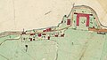
 Åvinge 1892.jpg 1,050 × 1,866; 434 KB

.jpg)
.jpg)
.jpg)


_(14598072408).jpg)


.jpg)


_..._Med_253_Illustrationer_i_Tr%C3%A6snit%27_(11242328696).jpg)

.jpg)

.jpg)

.jpg)
_(14590180577).jpg)

.jpg)
.jpg)


