Category:2011 maps of Africa
Jump to navigation
Jump to search
Temperate regions: North America · South America · Africa · Europe · Asia · Oceania – Polar regions: – Other regions:
| ← 2010 2011 2012 2013 2014 2015 2016 2017 2018 2019 → |
Media in category "2011 maps of Africa"
The following 20 files are in this category, out of 20 total.
-
 Africa - DPLA - bfd25525cc1e9d29045735891905f033.jpg 2,134 × 2,632; 6.26 MB
-
 Africa. LOC 2012592672.jpg 3,451 × 4,450; 2.37 MB
-
 Africa. LOC 2012592672.tif 3,451 × 4,450; 43.94 MB
-
 Death-rate-from-opioid-use-who,Africa,2011.svg 850 × 600; 145 KB
-
 Death-rate-smoking,Africa,2011.svg 850 × 699; 146 KB
-
 Idioma Español en Africa.png 1,794 × 1,677; 356 KB
-
 Idioma español en África y Oriente Próximo.png 3,789 × 5,070; 3.26 MB
-
 Map of South Sudan.jpg 2,147 × 1,687; 755 KB
-
 Republic of South Sudan, July 2011 LOC 2011594621.jpg 2,550 × 3,300; 516 KB
-
 Republic of South Sudan, July 2011 LOC 2011594621.tif 2,550 × 3,300; 24.08 MB
-
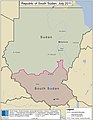 Republic of South Sudan, July 2011.jpg 637 × 825; 58 KB
-
 Sahrawi Arab Democratic Republic in Africa (claimed).svg 1,525 × 1,440; 1.68 MB
-
 South Sudan LOC 2011594751.jpg 8,588 × 6,750; 9.02 MB
-
 South Sudan LOC 2011594751.tif 8,588 × 6,750; 165.85 MB
-
 Southern Sudanese independence referendum, 2011 LOC 2011594622.jpg 2,550 × 3,300; 698 KB
-
 Southern Sudanese independence referendum, 2011 LOC 2011594622.tif 2,550 × 3,300; 24.08 MB
-
 Tournament Nile Basin Countries 2011 Map ar.PNG 677 × 681; 35 KB
-
 UNOCI 2011 map.png 2,340 × 3,012; 1.56 MB
-
 UTC hue4map X region Africa.png 382 × 387; 12 KB
-
 Western sahara walls moroccan map-en.svg 1,676 × 1,302; 195 KB


.svg)


