Category:2011 maps of Croatia
Jump to navigation
Jump to search
Media in category "2011 maps of Croatia"
The following 3 files are in this category, out of 3 total.
-
 Croatia population density map 2011 by county.svg 1,098 × 1,063; 584 KB
-
 Croatia, population density.svg 900 × 900; 18.78 MB
-
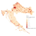
 Population density map of Croatia, 2011.svg 600 × 551; 830 KB


