Category:2013 in the London Borough of Islington
Jump to navigation
Jump to search
Boroughs of London: City of London · City of Westminster · Barking and Dagenham · Barnet · Bexley · Brent · Bromley · Camden · Croydon · Ealing · Enfield · Greenwich · Hackney · Hammersmith and Fulham · Haringey · Harrow · Havering · Hillingdon · Hounslow · Islington · Kensington and Chelsea · Kingston · Lambeth · Lewisham · Merton · Newham · Redbridge · Richmond · Southwark · Sutton · Tower Hamlets · Waltham Forest · Wandsworth
Subcategories
This category has the following 3 subcategories, out of 3 total.
2
- 2013 Emirates Cup (7 F)
A
Media in category "2013 in the London Borough of Islington"
The following 64 files are in this category, out of 64 total.
-
 'C' Stock meet at Farringdon station during snowfall. - panoramio.jpg 3,421 × 2,379; 2.98 MB
-
 The Remus Building, Hardwick Street (geograph 3369721).jpg 1,022 × 768; 369 KB
-
 Shaft and pump house, London Water Ring Main (geograph 5546519).jpg 640 × 480; 109 KB
-
 Amwell St Area, Clerkenwell, London, EC1 (geograph 3399001).jpg 3,017 × 2,229; 1.12 MB
-
 Rosebery Ave, Clerkenwell, London, EC1 (geograph 3399015).jpg 3,762 × 2,369; 1.82 MB
-
 44 Britton Street, Clerkenwell (geograph 3600383).jpg 841 × 1,024; 1.15 MB
-
 44 Britton Street, Clerkenwell- window detail (geograph 3600391).jpg 1,024 × 662; 676 KB
-
 35 - 45, Skinner St (geograph 3855380).jpg 640 × 430; 87 KB
-
 Northampton Rd (geograph 3855359).jpg 640 × 430; 97 KB
-
 A working barge approaches City Road Lock - geograph.org.uk - 3786206.jpg 4,000 × 3,000; 4.3 MB
-
 Amwell Street, Clerkenwell, London, EC1 - geograph.org.uk - 3399071.jpg 3,576 × 2,518; 1.83 MB
-
 Amwell Street, Clerkenwell, London, EC1 - geograph.org.uk - 3399097.jpg 3,746 × 2,917; 2.21 MB
-
 Anna Calvi Assembly Hall October 2013.png 1,067 × 1,547; 1.78 MB
-
 Arsenal Tube Station, Gillespie Road - geograph.org.uk - 3414474.jpg 1,000 × 688; 181 KB
-
 Bike in a Street Market.jpg 2,897 × 2,172; 2.61 MB
-
 Caledonian Road Methodist Church - geograph.org.uk - 3679126.jpg 1,600 × 1,064; 431 KB
-
 Caledonian Road Methodist Church - panoramio.jpg 4,224 × 2,376; 2.6 MB
-
 Canonbury sign.JPG 4,320 × 3,240; 5.33 MB
-
 Coal plate, Great Percy Street, WC1 - geograph.org.uk - 5545898.jpg 640 × 640; 210 KB
-
 Colebrooke Row Vicinity, Islington, London, N1 - geograph.org.uk - 3756816.jpg 3,727 × 2,487; 1.72 MB
-
 College Cross in Islington.jpg 2,520 × 1,701; 3.09 MB
-
 Crafts Council building, Pentonville Road.jpg 640 × 474; 69 KB
-
 Drain Pipe, Islington Central Library, Holloway Road, London (8474927951).jpg 1,536 × 2,048; 1.29 MB
-
 Duncan Terrace, Islington - geograph.org.uk - 3485268.jpg 2,592 × 2,989; 2.3 MB
-
 Embassy of Eritrea, London 1.jpg 1,944 × 2,592; 1.29 MB
-
 Embassy of Eritrea, London 2.jpg 2,592 × 1,944; 1.09 MB
-
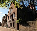
 Finsbury Town Hall London.jpg 1,024 × 768; 648 KB
-
 Florence Street in Islington.jpg 1,260 × 945; 945 KB
-
 Former warehouse, Farringdon Road - geograph.org.uk - 3771780.jpg 612 × 1,034; 889 KB
-

-
 Fountain on Finsbury Square in London, spring 2013.JPG 3,168 × 4,752; 6.57 MB
-
 Great Neon lighting , Hornsey Road , London , November 2013 - panoramio.jpg 3,911 × 1,993; 968 KB
-
 Islington Town Hall - Treppe.jpg 2,520 × 1,890; 2.24 MB
-
 Former Church of St Luke lit at night for a special event.JPG 1,936 × 2,592; 1.4 MB
-
 St Luke Old Street lit at night - photo taken from square directly north of St Luke's.JPG 1,936 × 2,592; 1.71 MB
-
 St Luke Old Street lit at night - photo taken from St Luke's south garden.JPG 1,936 × 2,592; 2.15 MB
-
 St Luke Old Street lit at night - photo taken street to the east of St Luke's.JPG 2,592 × 1,936; 1.59 MB
-
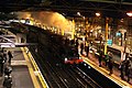 Last steam of the night, 'Met One' whistles through Farringdon. - panoramio.jpg 3,888 × 2,592; 3.96 MB
-
 Left wall, Islington War Memorial - geograph.org.uk - 3371896.jpg 4,288 × 3,216; 4.44 MB
-
 London - Borough of Islington - Angel - clock tower.JPG 2,304 × 3,072; 853 KB
-
 London 28 October 2013 Storm Damage in Highbury - panoramio.jpg 4,320 × 3,240; 4.05 MB
-
 London 28 October 2013 Storm Damage in Highbury Bus Stop - panoramio.jpg 4,320 × 3,240; 3.72 MB
-
London Bus at night 2013-09-14 720p.ogv 24 s, 1,280 × 720; 42.5 MB
-
London Bus at night 2013-09-14 SVCD.ogv 24 s, 1,048 × 576; 10.11 MB
-
 London city eastern part 08.03.2013 17-38-10.JPG 3,167 × 2,287; 2.28 MB
-
 London north of Barbican 12.04.2013 20-36-42.jpg 2,480 × 3,582; 4.52 MB
-
 London north of city 09.03.2013 10-24-37.JPG 3,070 × 2,054; 2.17 MB
-
 London November 1 2013 Road Surfacing Highbury New park - panoramio.jpg 4,320 × 3,240; 5.65 MB
-
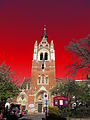
 London November 4 2013 Back of Union chapel Grade II* Listed Building.jpg 3,818 × 3,212; 3.02 MB
-
 Nesting boxes, Clerkenwell - geograph.org.uk - 3744427.jpg 768 × 1,024; 1,002 KB
-
 Orton plaque (9947188756).jpg 2,263 × 1,779; 1.89 MB
-
 Passage with original Tram Lines - panoramio.jpg 2,376 × 3,568; 2.98 MB
-
 Passing Alley, EC1 - geograph.org.uk - 3691410.jpg 1,200 × 1,600; 640 KB
-
 Passing Alley, off St John St, EC1 - geograph.org.uk - 3691397.jpg 1,200 × 1,600; 617 KB
-
 Passing Alley, off St John St, EC1 - geograph.org.uk - 3691402.jpg 1,600 × 1,200; 735 KB
-
 Passing Alley, off St John St, EC1 - geograph.org.uk - 3691406.jpg 1,200 × 1,600; 609 KB
-
 Passing Alley, off St John's Lane, EC1 - geograph.org.uk - 3691395.jpg 1,200 × 1,600; 650 KB
-
 Railway to Dalston, Islington - geograph.org.uk - 3322335.jpg 4,288 × 3,216; 4.7 MB
-
 Telephone Kiosk from 1927 - panoramio.jpg 1,080 × 1,920; 763 KB
-
 Thameslink at Farringdon, City of London, 2013 - panoramio.jpg 3,888 × 2,592; 3.58 MB
-
 The Cally (9522258111).jpg 1,024 × 768; 789 KB
-
 The Castle, Cowcross Street EC1 - geograph.org.uk - 3597804.jpg 640 × 480; 205 KB
-
 The Spaced House, Carleton Road - panoramio.jpg 1,826 × 1,478; 988 KB
-
 Union Chapel Islington London.jpg 3,240 × 4,320; 3.86 MB

.jpg)
.jpg)
.jpg)
.jpg)
.jpg)
.jpg)
.jpg)
.jpg)


.jpg)


.jpg)


.jpg)


