Category:2014 in the London Borough of Islington
Jump to navigation
Jump to search
Boroughs of London: City of London · City of Westminster · Barking and Dagenham · Barnet · Bexley · Brent · Bromley · Camden · Croydon · Ealing · Enfield · Greenwich · Hackney · Hammersmith and Fulham · Haringey · Harrow · Havering · Hillingdon · Hounslow · Islington · Kensington and Chelsea · Kingston · Lambeth · Lewisham · Merton · Newham · Redbridge · Richmond · Southwark · Sutton · Tower Hamlets · Waltham Forest · Wandsworth
Subcategories
This category has the following 3 subcategories, out of 3 total.
A
- Autumn Stampex 2014 (6 F)
E
Media in category "2014 in the London Borough of Islington"
The following 200 files are in this category, out of 245 total.
(previous page) (next page)-
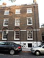
 1 Canonbury Place N1.jpg 2,000 × 1,500; 1.07 MB
-
 1 Highbury Terrace, London N5 1UP.JPG 1,500 × 2,000; 712 KB
-
 124 Highbury New Park, Islington.JPG 1,500 × 2,000; 927 KB
-
 136 Englefield Road N1.jpg 1,500 × 2,000; 1.22 MB
-
 Terraced housing, Skinner Street (geograph 3966904).jpg 1,600 × 1,084; 515 KB
-
 Canonbury railway station MMB 01 378214.jpg 4,476 × 2,913; 3.92 MB
-
 Canonbury railway station MMB 02.jpg 4,626 × 2,901; 6.01 MB
-
 Canonbury railway station MMB 03 172008.jpg 4,729 × 2,970; 4.95 MB
-
 Canonbury railway station MMB 04 378147.jpg 4,542 × 2,391; 4.34 MB
-
 Canonbury railway station MMB 05 378136.jpg 4,466 × 2,901; 4 MB
-
 Canonbury railway station MMB 06 378136.jpg 4,458 × 2,754; 3.51 MB
-
 Highbury and Islington station MMB 29 378224 378202.jpg 4,464 × 2,976; 4.94 MB
-
 Highbury and Islington station MMB 30 378226.jpg 4,729 × 2,808; 4.58 MB
-
 Artillery Arms, Bunhill Row, London 01.JPG 3,456 × 4,608; 6.86 MB
-
 Artillery Arms, Bunhill Row, London 02.JPG 3,456 × 4,608; 7.1 MB
-
 Artillery Arms, Bunhill Row, London 03.JPG 3,456 × 4,608; 8.64 MB
-
 Planters on Lever Street, London 01.jpg 3,872 × 2,592; 5.1 MB
-
 Skinner Street, London 2014.jpg 3,872 × 2,592; 3.36 MB
-
 Kingsway Place, Clerkenwell, London 04.jpg 3,872 × 2,592; 4.03 MB
-
 Corner of Garnault Place and Rosoman Street in Clerkenwell.jpg 2,592 × 3,872; 3.08 MB
-
 Junction of Tysoe and Rosoman in Clerkenwell 07.jpg 3,872 × 2,592; 2.76 MB
-
 Metropolitan Water Board - Borough of Islington - London - August 11th 2014 - 3.jpg 4,953 × 3,456; 6.02 MB
-
 Metropolitan Water Board - Borough of Islington - London - August 11th 2014 - 4.jpg 5,184 × 3,456; 6.05 MB
-
-

-
 Metropolitan Water Board - Borough of Islington - London - August 11th 2014 - 2.jpg 5,184 × 3,456; 6.69 MB
-
 Metropolitan Water Board - Borough of Islington - London - August 11th 2014 - 1.jpg 5,184 × 3,456; 6.95 MB
-
 Crest of the former Metropolitan Water Board (geograph 4263044).jpg 640 × 640; 100 KB
-
 London Metropolitan Archives building (geograph 4251521).jpg 1,600 × 1,060; 480 KB
-

-
 Ornamental fountain, New River Head (geograph 4261447).jpg 640 × 480; 136 KB
-
 The Devils Conduit, New River Head (geograph 4261458).jpg 480 × 640; 109 KB
-

-
 Hardwick Street, EC1 (geograph 4300332).jpg 640 × 480; 95 KB
-

-
 New River Head (geograph 4300322).jpg 640 × 480; 89 KB
-
 The (former) Pump House, New River Head (geograph 4299267).jpg 640 × 479; 77 KB
-
 The remains of a windmill, New River Head (geograph 4299263).jpg 640 × 480; 90 KB
-
 25 Highbury Place N5.jpg 1,500 × 2,000; 1.15 MB
-
 52 Canonbury Park South N1.jpg 1,500 × 2,000; 1,024 KB
-
 Beech Street east end of tunnel 01.jpg 3,648 × 2,736; 3.29 MB
-
 Bezier apartments (14114850034).jpg 3,349 × 3,175; 6.13 MB
-
 Building on corner of Golden Lane and Old Street 01.jpg 3,648 × 2,736; 3.07 MB
-
 Butterfly Stencil Graffiti, corner of Parkhurst and Chambers Roads - panoramio.jpg 4,000 × 3,000; 3.85 MB
-
 Canal Tunnels Entrance Aug 2014.jpg 1,600 × 991; 1.14 MB
-
 Canonbury Station - geograph.org.uk - 3887144.jpg 1,600 × 1,067; 542 KB
-
 Central Cafe at junction of Old Street and Helmet Row view east 01.jpg 3,648 × 2,736; 4.08 MB
-
 Central Street between Mitchell Street and Wenlake Estate view south 01.jpg 2,736 × 3,648; 3.41 MB
-
 Central Street between Pear Tree Street and Patton Street view east 01.jpg 3,648 × 2,736; 4.41 MB
-
 Central Street between Pear Tree Street and Patton Street view north 01.jpg 3,648 × 2,736; 3.53 MB
-
 Central Street between Pear Tree Street and Patton Street view north 02.jpg 3,648 × 2,736; 3.95 MB
-
 Central Street between Pear Tree Street and Patton Street view south 01.jpg 3,648 × 2,736; 3.79 MB
-
 Central Street junction with Bastwick Street view south 01.jpg 3,648 × 2,736; 3.41 MB
-
 Central Street junction with Gee Street view north 01.jpg 3,648 × 2,736; 3.46 MB
-
 Central Street junction with Gee Street view south 01.jpg 3,648 × 2,736; 3.89 MB
-
 Central Street junction with Lever Street view northeast 01.jpg 3,648 × 2,736; 3.1 MB
-
 Central Street junction with Mitchell Street view north 01.jpg 3,648 × 2,736; 3.68 MB
-
 Central Street junction with Mitchell Street view south 01.jpg 3,648 × 2,736; 4.25 MB
-
 Central Street junction with Pear Tree Street view north 01.jpg 3,648 × 2,736; 2.99 MB
-
 Central Street junction with Pear Tree Street view south 01.jpg 3,648 × 2,736; 3.54 MB
-
 Central Street junction with Seward Street view northeast 01.jpg 3,648 × 2,736; 3.84 MB
-
 Central Street junction with Seward Street view south 01.jpg 3,648 × 2,736; 3.16 MB
-
 Central Street view north from junction with Old Street 01.jpg 3,648 × 2,736; 3.57 MB
-
 Central Street view south from junction of Seward Street 01.jpg 3,648 × 2,736; 3.59 MB
-
 Central Street view south from junction with Lever Street 01.jpg 3,648 × 2,736; 3.45 MB
-
 Charterhouse Chimneys (14092630261).jpg 3,456 × 4,578; 10.28 MB
-
 Charterhouse Entrance (13909214950).jpg 3,456 × 5,056; 9.3 MB
-
 Charterhouse weathervane (13909263278).jpg 3,264 × 3,264; 5.27 MB
-
 City Road - geograph-3885615-by-Mike-Quinn.jpg 640 × 480; 95 KB
-
 City Road - geograph-3885623-by-Mike-Quinn.jpg 640 × 480; 83 KB
-
 City Road - geograph-3885636-by-Mike-Quinn.jpg 640 × 480; 74 KB
-
 City Road view north from junction with Finsbury Pavement and Worship Street 01.jpg 3,648 × 2,736; 3.1 MB
-
 City Road view south from entrance to Travelodge 01.jpg 3,648 × 2,736; 3.5 MB
-
 Copenhagen Tunnel south end.jpg 640 × 430; 77 KB
-
 Detail of east window, St James's Church, Islington.JPG 1,944 × 2,592; 1.98 MB
-
 Dla132 (15103702365).jpg 1,080 × 720; 318 KB
-
 East window, St James's Church, Islington.JPG 2,592 × 1,944; 1.88 MB
-
 Effigy of William Lambe with inscription, St James's Church, Islington.JPG 1,944 × 2,592; 1.43 MB
-
 Effigy of William Lambe, St James's Church, Islington.JPG 2,592 × 1,944; 953 KB
-
 Entrance to London College of Fashion on Golden Lane 01.jpg 3,648 × 2,736; 3.13 MB
-
 Entrance to St Josephs Church Car Park - geograph.org.uk - 4227000.jpg 2,304 × 1,728; 843 KB
-
 Finsbury Pavement junction with City Road and Worship Street view south 01.jpg 3,648 × 2,736; 3.28 MB
-
 Finsbury Pavement junction with Finsbury Square (north side) view north 01.jpg 3,648 × 2,736; 3.29 MB
-
 Finsbury Pavement junction with Finsbury Square (north side) view south 01.jpg 3,648 × 2,736; 3.77 MB
-

-

-
 Finsbury Pavement view north beside Finsbury Square 01.jpg 3,648 × 2,736; 3.95 MB
-
 Finsbury Pavement view north between South Place and Finsbury Square (south side) 01.jpg 3,648 × 2,736; 3.15 MB
-
 Golden Lane between Fann Street and Brockley Street view south 01.jpg 3,648 × 2,736; 4.51 MB
-
 Golden Lane junction with Banner Street view north 01.jpg 3,648 × 2,736; 3.07 MB
-
 Golden Lane junction with Banner Street view south 01.jpg 3,648 × 2,736; 3.41 MB
-
 Golden Lane junction with Fann Street view north 01.jpg 3,648 × 2,736; 4.01 MB
-
 Golden Lane junction with Fortune Street view south 01.jpg 3,648 × 2,736; 3.94 MB
-
 Golden Lane junction with Roscoe Street view north 01.jpg 3,648 × 2,736; 2.83 MB
-
 Golden Lane junction with Roscoe Street view south 01.jpg 3,648 × 2,736; 3.04 MB
-
 Golden Lane view north from junction with Garrett Street 01.jpg 3,648 × 2,736; 3.01 MB
-
 Golden Lane view north to junction with Old Street 01.jpg 3,648 × 2,736; 3.28 MB
-
 Golden Lane view south from junction with Old Street 01.jpg 3,648 × 2,736; 3.16 MB
-
 Golden Lane view south from junction with Roscoe Street 01.jpg 3,648 × 2,736; 3.38 MB
-
 Hand Lettered Sticker, Archway - panoramio.jpg 3,000 × 4,000; 2.48 MB
-
 Islington War Memorial - geograph.org.uk - 4083279.jpg 960 × 1,280; 550 KB
-
 St James's Church, Islington.JPG 2,592 × 1,944; 2.5 MB
-
 St Luke's.jpg 2,988 × 5,312; 3.65 MB
-
 John Wesley's House.JPG 4,608 × 3,456; 3.96 MB
-
 Joseph Grimaldi Park, Pentonville.jpg 2,272 × 1,704; 3.05 MB
-
 Leonard Street junction with City Road view east 01.jpg 3,648 × 2,736; 3.56 MB
-
 Leonard Street junction with Tabernacle Street view southwest 01.jpg 3,648 × 2,736; 3.44 MB
-
 Leonard Street view east from outisde number 11 01.jpg 2,736 × 3,648; 3.43 MB
-
 London Farringdon 2014 01.JPG 4,737 × 3,264; 3.4 MB
-
 London's Tube Round mirror.jpg 4,874 × 3,395; 4.89 MB
-
 Lt188 (15103340392).jpg 1,080 × 720; 319 KB
-
 Lt194 a (14917146818).jpg 1,080 × 720; 313 KB
-
 Lt209 (15100697311).jpg 1,080 × 720; 337 KB
-
 Lysian Mission 1 (13927856050).jpg 3,180 × 5,184; 6.88 MB
-
 Lysian Mission 2 (14111404612).jpg 3,917 × 2,972; 8.21 MB
-
 Macclesfield Road, London (21).jpg 2,560 × 1,920; 480 KB
-
 Macclesfield Road, London (25).jpg 1,807 × 1,920; 344 KB
-
 Macclesfield Road, London 00 (24).jpg 2,136 × 1,920; 424 KB
-

-
 Moorgate junction with South Place and Finsbury Pavement view north 01.jpg 3,648 × 2,736; 3.18 MB
-
 Moorgate junction with South Place and Finsbury Pavement view south 01.jpg 3,648 × 2,736; 3.56 MB
-
 Moorgate junction with South Place, Ropemaker Street and Finsbury Pavement view north 01.jpg 3,648 × 2,736; 3.58 MB
-
 Moorgate station way out from circulating area to Moorgate east side 01.jpg 3,648 × 2,736; 2.72 MB
-
 Moorgate station way out from circulating area to Moorgate east side 02.jpg 3,648 × 2,736; 2.52 MB
-
 Myddelton Square, EC1-geograph-4259612.jpg 640 × 480; 83 KB
-
 No. 1 City Road view from south 01.jpg 2,736 × 3,648; 3.02 MB
-
 North aisle window, St James's Church, Islington.JPG 1,944 × 2,592; 1.83 MB
-
 Old Street junction with Bath Street view west 01.jpg 3,648 × 2,736; 4.53 MB
-
 Old Street junction with Central Street and Golden Lane view east 01.jpg 3,648 × 2,736; 4.08 MB
-
 Old Street junction with Central Street and Golden Lane view north 01.jpg 3,648 × 2,736; 3.55 MB
-
 Old Street junction with Central Street and Golden Lane view northwest 01.jpg 3,648 × 2,736; 3.48 MB
-
 Old Street junction with Central Street and Golden Lane view south 01.jpg 3,648 × 2,736; 3.29 MB
-
 Old Street junction with Central Street and Golden Lane view south 02.jpg 2,736 × 3,648; 3.89 MB
-
 Old Street junction with Central Street and Golden Lane view south 03.jpg 3,648 × 2,736; 3.15 MB
-
 Old Street junction with Central Street and Golden Lane view southeast 01.jpg 3,648 × 2,736; 3.65 MB
-
 Old Street junction with Central Street and Golden Lane view west 01.jpg 3,648 × 2,736; 3.29 MB
-
 Old Street junction with Helmet Row view east 01.jpg 3,648 × 2,736; 4.55 MB
-
 Old Street junction with Helmet Row view west 01.jpg 3,648 × 2,736; 3.41 MB
-
 Old Street junction with St Luke's Close view east 01.jpg 3,648 × 2,736; 4 MB
-
 Old Street junction with St Luke's Close view west 01.jpg 3,648 × 2,736; 4.26 MB
-
 Old Street promenade of light - view east from outside 201-203 Old Street 01.jpg 3,648 × 2,736; 3.01 MB
-
 Old Street promenade of light - view east from outside 201-203 Old Street 02.jpg 3,648 × 2,736; 3.55 MB
-
 Old Street promenade of light - view west from junction with Bath Street 01.jpg 3,648 × 2,736; 4.69 MB
-
 Old Street promenade of light - view west from outside 201-203 Old Street 01.jpg 3,648 × 2,736; 3.02 MB
-
 Old Street promenade of light - view west from outside 201-203 Old Street 02.jpg 3,648 × 2,736; 3.96 MB
-

-

-
-
 Old Street roundabout - subway 2 southwest entrance view northeast 01.jpg 3,648 × 2,736; 3.07 MB
-
 Old Street roundabout - subway 2 southwest entrance view southwest 01.jpg 3,648 × 2,736; 3.24 MB
-

-
 Old Street roundabout - subway 4 west entrance and Boris bike racks 01.jpg 3,648 × 2,736; 2.8 MB
-
 Old Street roundabout - subway 4 west entrance view east from top of ramp 01.jpg 3,648 × 2,736; 3.22 MB
-
 Old Street roundabout - view out of station ticket hall towards subway 4 01.jpg 3,648 × 2,736; 3.26 MB
-

-

-

-
 Old Street roundabout - view towards subway 4 from oustide station 01.jpg 3,648 × 2,736; 3.27 MB
-
-
 Old Street view east between Bath Street and St Luke's Close 01.jpg 3,648 × 2,736; 3.36 MB
-
 Old Street view west between Bath Street and St Luke's Close 01.jpg 3,648 × 2,736; 3.82 MB
-
 PaineMonumentAngelSquareLondon.jpg 2,000 × 2,992; 1.97 MB
-
 PaineMonumentAngelSquareLondonDetail.JPG 2,992 × 2,000; 2.24 MB
-
 Phone Box after collision, Camden Road - panoramio.jpg 2,376 × 4,224; 1.36 MB
-
 Postbox Business Design Centre.JPG 3,000 × 4,000; 3.65 MB
-
 Ropemaker Street and open space outside City Point Tower view northwest 01.jpg 3,648 × 2,736; 3.44 MB
-
 Ropemaker Street junction with Moor Lane view northeast 01.jpg 3,648 × 2,736; 3.96 MB
-
 Ropemaker Street junction with Moor Lane view southeast 01.jpg 3,648 × 2,736; 3.69 MB
-
 Ropemaker Street view northwest to junction with Moor Lane 01.jpg 3,648 × 2,736; 3.03 MB
-
 Row of houses in Islington London near Regent's Canal.jpg 3,072 × 1,728; 2.43 MB
-

-
 South Place view northwest from junction with Willson Street 01.jpg 3,648 × 2,736; 3.34 MB
-
 South Place view southeast between Dominion Street and Wilson Street 01.jpg 3,648 × 2,736; 3.2 MB
-
 St John's Highbury Vale Primary School - geograph.org.uk - 4093280.jpg 531 × 600; 111 KB
-
 St Mary Magdalene Gardens on Liverpool Road, Highbury and Islington, London.jpg 1,280 × 960; 464 KB
-
 Stagecoach 15137 (14905789649).jpg 1,080 × 720; 313 KB
-
 Tabernacle Street junction with Epworth Street view southwest 01.jpg 3,648 × 2,736; 3.74 MB
-
 Tabernacle Street junction with Epworth Street view southwest 02.jpg 3,648 × 2,736; 3.46 MB
-
 Tabernacle Street junction with Worship Street view souh 01.jpg 3,648 × 2,736; 3.49 MB
-
 Tabernacle Street view northeast from junction with Epworth Street 01.jpg 3,648 × 2,736; 3.37 MB
-
 Tabernacle Street view northeast from junction with Worship Street 01.jpg 3,648 × 2,736; 3.18 MB
-
 Tabernacle Street view northeast to junction with Leonard Street 01.jpg 3,648 × 2,736; 3.22 MB
-
 Taxi in front of Finsbury Town Hall - Borough of Islington - London - August 11th 2014.jpg 5,184 × 3,456; 5.32 MB
-
 Telephone box - Upper Street, Islington - geograph.org.uk - 4081967.jpg 960 × 1,280; 251 KB
-

-
 The Britania Pub.jpg 5,312 × 2,988; 3.97 MB
-
 The Islington, London.jpg 960 × 960; 220 KB
-
 Thistle City Barbican - view from junction of Central Street and Lever Street 01.jpg 3,648 × 2,736; 3.02 MB
-
 Thistle City Barbican - view of porte-cochère from Lever Street 01.jpg 3,648 × 2,736; 3.58 MB
-
 Thistle City Barbican 00 (1).jpg 2,560 × 1,920; 470 KB
-
 Thistle City Barbican 00 (2).jpg 2,560 × 1,920; 531 KB
-
 Thistle City Barbican 00 (3).jpg 2,560 × 1,920; 573 KB
-
 Tintype Gallery, Essex Road - panoramio.jpg 2,719 × 3,536; 1.79 MB
-
 Unidentified location in London 02.JPG 3,872 × 2,592; 4.9 MB
-
 Unidentified location in London 05.JPG 3,872 × 2,592; 3.45 MB
-
 Unidentified location in London 12.JPG 3,872 × 2,592; 3.74 MB
-
 Unidentified location in London 13.JPG 3,872 × 2,592; 4.02 MB
-
 Unidentified location in London 14.JPG 3,872 × 2,592; 3.74 MB
-
 Unidentified location in London 15.JPG 3,872 × 2,592; 3.82 MB
-
 Union pickets, Finsbury Park Station - geograph.org.uk - 3841635.jpg 1,024 × 701; 752 KB


.jpg)


.jpg)
.jpg)
.jpg)
.jpg)
.jpg)
.jpg)
.jpg)
.jpg)
.jpg)
_Pump_House,_New_River_Head_(geograph_4299267).jpg)
.jpg)


.jpg)


.jpg)
.jpg)
.jpg)


.jpg)


_view_north_01.jpg)
_view_south_01.jpg)
_and_Chiswell_Street_view_north_01.jpg)
_and_Chiswell_Street_view_south_01.jpg)

_01.jpg)


.jpg)
.jpg)
.jpg)
.jpg)
.jpg)
.jpg)
.jpg)
.jpg)


.jpg)


.jpg)
.jpg)
.jpg)


