Category:2018 United States House of Representatives election maps of West Virginia
Jump to navigation
Jump to search
States of the United States: Alabama · Alaska · Arizona · Arkansas · California · Colorado · Florida · Indiana · Iowa · Kansas · Kentucky · Massachusetts · Michigan · New Jersey · New Mexico · Ohio · Oklahoma · Oregon · Pennsylvania · South Carolina · Utah · West Virginia · Wisconsin
Media in category "2018 United States House of Representatives election maps of West Virginia"
The following 8 files are in this category, out of 8 total.
-
 2018 U.S. House elections in West Virginia.svg 810 × 719; 22 KB
-
 2018 WV-1.svg 800 × 637; 170 KB
-
 2018 WV-2.svg 800 × 406; 191 KB
-
 2018 WV-3.svg 800 × 615; 254 KB
-
 West Virginia 1st District 2018 Election Results by County.svg 415 × 332; 98 KB
-
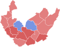
 West Virginia 2018 House Election Results by County.svg 810 × 719; 38 KB
-
 West Virginia 2nd District 2018 Election Results by County.svg 585 × 302; 93 KB
-
 West Virginia 3rd District 2018 Election Results by County.svg 412 × 317; 139 KB


