Category:2018 United States House of Representatives election maps of Wisconsin
Jump to navigation
Jump to search
States of the United States: Alabama · Alaska · Arizona · Arkansas · California · Colorado · Florida · Indiana · Iowa · Kansas · Kentucky · Massachusetts · Michigan · New Jersey · New Mexico · Ohio · Oklahoma · Oregon · Pennsylvania · South Carolina · Utah · West Virginia · Wisconsin
Media in category "2018 United States House of Representatives election maps of Wisconsin"
The following 12 files are in this category, out of 12 total.
-
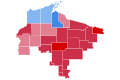
 2018 U.S. House elections in Wisconsin.svg 810 × 810; 77 KB
-

-

-

-
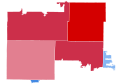
 2018 Wisconsin's 4th congressional district election results by county.svg 800 × 1,033; 34 KB
-
-

-
-

-

-

-
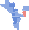 WI32018Results.svg 460 × 477; 92 KB

.png)


