Category:2018 maps of Indonesia
Jump to navigation
Jump to search
Media in category "2018 maps of Indonesia"
The following 20 files are in this category, out of 20 total.
-
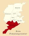
 (Peta Lokasi) Kecamatan Siantar Barat, Pematangsiantar.svg 512 × 640; 116 KB
-
 (Peta Lokasi) Kecamatan Siantar Marihat, Pematangsiantar.svg 512 × 640; 116 KB
-
 (Peta Lokasi) Kecamatan Siantar Marimbun, Pematangsiantar.svg 512 × 640; 116 KB
-
 (Peta Lokasi) Kecamatan Siantar Martoba, Pematangsiantar.svg 512 × 640; 116 KB
-
 (Peta Lokasi) Kecamatan Siantar Selatan, Pematangsiantar.svg 512 × 640; 116 KB
-
 (Peta Lokasi) Kecamatan Siantar Sitalasari, Pematangsiantar.svg 512 × 640; 116 KB
-
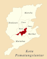
 (Peta Lokasi) Kecamatan Siantar Timur, Pematangsiantar.svg 512 × 640; 116 KB
-
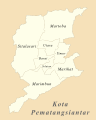
 (Peta Lokasi) Kecamatan Siantar Utara, Pematangsiantar.svg 512 × 640; 116 KB
-
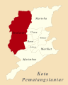
 (Peta Wilayah) Kota Pematangsiantar.svg 512 × 640; 116 KB
-
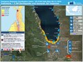
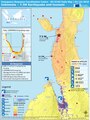
 20181025 EQ Indonesia EUresponse.pdf 1,500 × 1,125; 608 KB
-
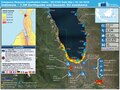
 20181108 EQ Indonesia EUresponse DailyMap.pdf 1,500 × 1,125; 806 KB
-
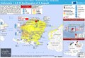
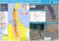
 ECDM 20180730 Indonesia EQ.pdf 1,625 × 1,125; 631 KB
-
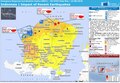
 ECDM 20180806 Indonesia EQ.pdf 1,625 × 1,125; 679 KB
-
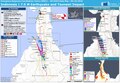
 ECDM 20180814 Indonesia EQs.pdf 1,625 × 1,125; 669 KB
-
 ECDM 20181001 EQ Indonesia.pdf 1,125 × 1,500; 608 KB
-
 ECDM 20181004 Indonesia EQ-Impact.pdf 1,625 × 1,125; 706 KB
-
 ECDM 20181009 Indonesia EQ-Update.pdf 1,625 × 1,125; 589 KB
-
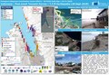 ECDM 20181116 Indonesia Tsunami Survey.pdf 1,625 × 1,125; 947 KB
-
 Location Map Depok.png 2,056 × 1,910; 4.85 MB
-
 Maritime South East Asia.svg 1,091 × 500; 754 KB
_Kecamatan_Siantar_Barat,_Pematangsiantar.svg)
_Kecamatan_Siantar_Marihat,_Pematangsiantar.svg)
_Kecamatan_Siantar_Marimbun,_Pematangsiantar.svg)
_Kecamatan_Siantar_Martoba,_Pematangsiantar.svg)
_Kecamatan_Siantar_Selatan,_Pematangsiantar.svg)
_Kecamatan_Siantar_Sitalasari,_Pematangsiantar.svg)
_Kecamatan_Siantar_Timur,_Pematangsiantar.svg)
_Kecamatan_Siantar_Utara,_Pematangsiantar.svg)
_Kota_Pematangsiantar.svg)

