Category:20th-century maps of Belgium
Jump to navigation
Jump to search
Countries of Europe: Albania · Armenia‡ · Austria · Azerbaijan‡ · Belarus · Belgium · Bosnia and Herzegovina · Bulgaria · Croatia · Cyprus‡ · Czech Republic · Denmark · Estonia · Finland · France‡ · Georgia‡ · Germany · Greece · Hungary · Iceland · Republic of Ireland · Italy · Kazakhstan‡ · Latvia · Lithuania · Luxembourg · Moldova · Montenegro · Netherlands‡ · North Macedonia · Norway · Poland · Portugal‡ · Romania · Russia‡ · Serbia · Slovakia · Slovenia · Spain‡ · Sweden · Switzerland · Turkey‡ · Ukraine · United Kingdom
Specific status: Gibraltar · Isle of Man – Limited recognition: Abkhazia‡
‡: partly located in Europe
Specific status: Gibraltar · Isle of Man – Limited recognition: Abkhazia‡
‡: partly located in Europe
Subcategories
This category has the following 13 subcategories, out of 13 total.
- 1910s maps of Belgium (38 F)
- 1920s maps of Belgium (13 F)
- 1930s maps of Belgium (6 F)
- 1960s maps of Belgium (7 F)
A
- 20th-century maps of Antwerp (24 F)
Media in category "20th-century maps of Belgium"
The following 4 files are in this category, out of 4 total.
-
 Belgium. LOC 2005626487.tif 2,485 × 3,074; 21.86 MB
-
 Malmedy (Karte des Deutschen Reiches, 480. Malmedy) - urn-nbn-de-0128-1-12655.jpg 5,613 × 4,432; 5.91 MB
-
 Péruwelz tram.jpg 3,483 × 2,248; 943 KB
-
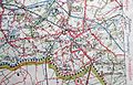
 Rossignol map.png 334 × 387; 332 KB
_-_urn-nbn-de-0128-1-12655.jpg)

