Category:20th-century maps of Gibraltar
Jump to navigation
Jump to search
Countries of Europe: Albania · Armenia‡ · Austria · Azerbaijan‡ · Belarus · Belgium · Bosnia and Herzegovina · Bulgaria · Croatia · Cyprus‡ · Czech Republic · Denmark · Estonia · Finland · France‡ · Georgia‡ · Germany · Greece · Hungary · Iceland · Republic of Ireland · Italy · Kazakhstan‡ · Latvia · Lithuania · Luxembourg · Moldova · Montenegro · Netherlands‡ · North Macedonia · Norway · Poland · Portugal‡ · Romania · Russia‡ · Serbia · Slovakia · Slovenia · Spain‡ · Sweden · Switzerland · Turkey‡ · Ukraine · United Kingdom
Specific status: Gibraltar · Isle of Man – Limited recognition: Abkhazia‡
‡: partly located in Europe
Specific status: Gibraltar · Isle of Man – Limited recognition: Abkhazia‡
‡: partly located in Europe
Media in category "20th-century maps of Gibraltar"
The following 13 files are in this category, out of 13 total.
-
 1908 Kings Lines Ordnance Survey map.jpg 2,358 × 1,275; 1.7 MB
-
 1908 Queens Lines and Princes Lines Ordnance Survey map.jpg 2,294 × 1,117; 1.42 MB
-
 1928 Inundation reclamation map.jpg 1,900 × 2,828; 1.94 MB
-
 1961 Military Map of Gibraltar (south east).jpg 806 × 960; 212 KB
-
 ATLAS JUSTUS PERTHES 08.jpg 4,547 × 3,933; 10.25 MB
-
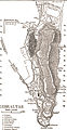 Gibraltar-1911 Encyclopedia bw.jpg 314 × 608; 75 KB
-
 Lange diercke sachsen europaeische landschaften gibraltar.jpg 1,251 × 1,052; 664 KB
-
 Map of Lower Galleries of Gibraltar - 1.jpg 3,848 × 3,859; 3.99 MB
-
 Map of Lower Galleries of Gibraltar - 2.jpg 3,888 × 3,938; 4.79 MB
-
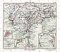
 Spain and Portugal- handbook for travellers (1901) (14589975490).jpg 1,556 × 2,572; 1.04 MB
-
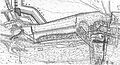
 The life of Sir John Leake, rear-admiral of Great Britain (1920) (14577342140).jpg 2,688 × 2,020; 838 KB
-
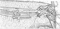
 The life of Sir John Leake, rear-admiral of Great Britain (1920) (14577391799).jpg 2,948 × 2,208; 1.29 MB
-


.jpg)


_(14589975490).jpg)
_(14577342140).jpg)
_(14577391799).jpg)
.jpg)