Category:20th-century maps of Sardinia
Jump to navigation
Jump to search
Media in category "20th-century maps of Sardinia"
The following 9 files are in this category, out of 9 total.
-
 Butler Italiæ Pars Media (Part Sardinia).jpg 576 × 688; 408 KB
-
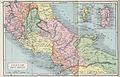 Butler Italiæ Pars Media.jpg 3,234 × 2,082; 2.21 MB
-
 Admiralty Chart No 3916 Golfo Dell'Asinara, Published 1944.jpg 16,501 × 11,294; 13.24 MB
-
 Admiralty Chart No 3919 Golfo di Palmas, Published 1944.jpg 12,274 × 8,436; 21.61 MB
-
 Admiralty Chart No 564 La Maddalena and approaches, Published 1969.jpg 16,422 × 11,335; 49.41 MB
-
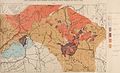 Bollettino del R. Comitato geologico d'Italia. (1922) (20205603599).jpg 4,208 × 2,560; 1.57 MB
-
 Chart No 3914 I. Monaci to Golfo degli Aranci, Published 1944.jpg 11,121 × 16,258; 37.14 MB
-

-

.jpg)


_(20205603599).jpg)

_(14576781799).jpg)
_(14576970597).jpg)