Category:A4117 road (England)
Jump to navigation
Jump to search
road in Shropshire England | |||||
| Upload media | |||||
| Instance of | |||||
|---|---|---|---|---|---|
| Location | Shropshire, West Midlands, England | ||||
| Transport network |
| ||||
| Inception |
| ||||
| Length |
| ||||
 | |||||
Subcategories
This category has the following 2 subcategories, out of 2 total.
T
Media in category "A4117 road (England)"
The following 21 files are in this category, out of 21 total.
-
A4117 Cornbrook Corner - geograph.org.uk - 1707908.jpg 4,000 × 3,000; 2.4 MB
-
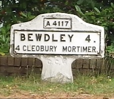
A4117 Far Forest.jpg 229 × 200; 26 KB
-
A4117 Lay-By - geograph.org.uk - 892927.jpg 640 × 421; 75 KB
-
A4117 Ludlow To Kiddy - geograph.org.uk - 855414.jpg 640 × 425; 45 KB
-
A4117 over Titterstone Clee Hill.jpg 640 × 480; 111 KB
-
A4117 to Bewdley (Lower Street) - geograph.org.uk - 892219.jpg 640 × 408; 78 KB
-
Church Street - geograph.org.uk - 1410735.jpg 640 × 464; 86 KB
-
Golden Cross, Clee Hill - geograph.org.uk - 286106.jpg 640 × 445; 55 KB
-
Horse and Jockey - geograph.org.uk - 287821.jpg 640 × 480; 89 KB
-
Middleton turn - geograph.org.uk - 197835.jpg 640 × 480; 102 KB
-
Milepost, Doddington - geograph.org.uk - 1053323.jpg 640 × 480; 57 KB
-
Milestone, Doddington - geograph.org.uk - 1053340.jpg 640 × 480; 42 KB
-
Old house, Lower Street - geograph.org.uk - 891978.jpg 640 × 427; 108 KB
-
Old Milepost by the A4117, Clee Hill, Coreley parish (geograph 6072664).jpg 1,000 × 1,500; 386 KB
-
Toposcope and A.4117 - geograph.org.uk - 1030857.jpg 640 × 480; 75 KB
-
UK road A4117.PNG 597 × 184; 6 KB
-
A4117 East Bound - geograph.org.uk - 1116953.jpg 640 × 428; 46 KB
-
Clee Hill Common - geograph.org.uk - 205700.jpg 640 × 480; 65 KB
-
High Street-Ludlow Road, Cleehill - geograph.org.uk - 154291.jpg 640 × 480; 83 KB


