Category:Aberlour (civil parish)
Jump to navigation
Jump to search
Scottish parish in Moray, Scotland, UK | |||||
| Upload media | |||||
| Instance of | |||||
|---|---|---|---|---|---|
| Named after | |||||
| Location |
| ||||
| Population |
| ||||
| Area |
| ||||
 | |||||
Subcategories
This category has the following 7 subcategories, out of 7 total.
A
- Aberlour House (building) (3 F)
C
- Carron Bridge, Moray (6 F)
D
- Dailuaine distillery (10 F)
G
M
- Milltown of Edinvillie (10 F)
Media in category "Aberlour (civil parish)"
The following 200 files are in this category, out of 371 total.
(previous page) (next page)-
 "Let there be fish...." - geograph.org.uk - 5677518.jpg 1,600 × 1,068; 1.29 MB
-
 "No, nothin' doin'" - geograph.org.uk - 4836572.jpg 800 × 600; 129 KB
-
 "The Slabs" of the Macallan beat viewed downstream - geograph.org.uk - 5761110.jpg 1,600 × 1,071; 1.03 MB
-
 70-72 High Street - geograph.org.uk - 5717722.jpg 640 × 427; 309 KB
-
 A bridge too far... - geograph.org.uk - 5677527.jpg 1,600 × 1,070; 558 KB
-
 A gated track to Ben Rinnes - geograph.org.uk - 4392776.jpg 3,870 × 2,435; 1.82 MB
-
 A leap of faith on Ben Rinnes - geograph.org.uk - 3545012.jpg 640 × 480; 94 KB
-

-
 A Park o Neeps - geograph.org.uk - 5675312.jpg 640 × 427; 534 KB
-
 A privileged view... - geograph.org.uk - 5677551.jpg 1,600 × 1,070; 707 KB
-
 A Rearing Branch - geograph.org.uk - 5713116.jpg 462 × 640; 433 KB
-
 A941 between Craigellachie and Dufftown - geograph.org.uk - 1874202.jpg 800 × 531; 159 KB
-
 A941 between Craigellachie and Dufftown - geograph.org.uk - 1874215.jpg 800 × 531; 178 KB
-
 A941 Craigellachie Bridge - geograph.org.uk - 5646486.jpg 3,888 × 2,592; 3.63 MB
-
 A95 Lay-by - geograph.org.uk - 4698222.jpg 640 × 480; 64 KB
-
 Aberlour and River Spey - geograph.org.uk - 3550776.jpg 640 × 427; 415 KB
-
 Aberlour and the River Spey - geograph.org.uk - 3165468.jpg 640 × 480; 91 KB
-

-
 Aberlour Veterinary Centre - geograph.org.uk - 5580021.jpg 640 × 427; 278 KB
-
 Above Aberlour - geograph.org.uk - 2682780.jpg 640 × 427; 435 KB
-
 Above Aultbeg - geograph.org.uk - 2053833.jpg 640 × 427; 273 KB
-
 Above Aultbeg - geograph.org.uk - 2053840.jpg 640 × 427; 254 KB
-
 Above the Burn - geograph.org.uk - 5675022.jpg 640 × 427; 454 KB
-
 Access to Allt-a-Bhainne Distillery (Chivas) - geograph.org.uk - 4390615.jpg 4,608 × 3,456; 3.21 MB
-
 Access to Cairn 'o' Mhor (first left) - geograph.org.uk - 4390619.jpg 4,608 × 3,456; 3.18 MB
-
 After cutting silage - geograph.org.uk - 4111289.jpg 640 × 480; 254 KB
-
 Airngarrow - geograph.org.uk - 5580016.jpg 640 × 427; 323 KB
-
 All is safely gathered in..... - geograph.org.uk - 5684805.jpg 1,600 × 1,200; 663 KB
-
 Allt-a-Bhainne (the milk burn) Distillery in Glen Rinnes - geograph.org.uk - 5042359.jpg 1,800 × 1,013; 1.48 MB
-
 And they're off^^ - geograph.org.uk - 6056946.jpg 1,600 × 1,070; 1.27 MB
-
 Anglers by the Craigellachie fishing hut - geograph.org.uk - 5134896.jpg 599 × 800; 185 KB
-
 Arable land near Boginduie - geograph.org.uk - 4430463.jpg 4,608 × 3,456; 4.32 MB
-
 Aultbeg Farm - geograph.org.uk - 2053848.jpg 640 × 427; 253 KB
-
 Aurora borealis from Aberlour - geograph.org.uk - 3866149.jpg 640 × 427; 23 KB
-
 Autumn Colour - geograph.org.uk - 5580034.jpg 640 × 427; 501 KB
-
 Autumn Larches - geograph.org.uk - 2682731.jpg 427 × 640; 469 KB
-
 Autumn Leaves - geograph.org.uk - 5580046.jpg 480 × 640; 688 KB
-
 B9009 past Bridge of Aultbeg - geograph.org.uk - 3698773.jpg 640 × 428; 76 KB
-
 Backshians - geograph.org.uk - 1339814.jpg 640 × 480; 44 KB
-
 Backshians cottage - geograph.org.uk - 1880549.jpg 2,816 × 2,112; 2.82 MB
-
 Backshians from the back^ - geograph.org.uk - 1880543.jpg 2,816 × 2,112; 2.97 MB
-
 Ballenteem - geograph.org.uk - 5580042.jpg 640 × 427; 485 KB
-
 Balliemullich. - geograph.org.uk - 384567.jpg 640 × 480; 113 KB
-
 Barley, Daluaine - geograph.org.uk - 4111297.jpg 640 × 480; 282 KB
-
 Barrel shelter at Speyside Cooperage - geograph.org.uk - 1968350.jpg 640 × 480; 147 KB
-
 Barrels at Speyside Cooperage - geograph.org.uk - 1968115.jpg 640 × 480; 76 KB
-
 Ben Rinnes - geograph.org.uk - 5646489.jpg 3,888 × 2,592; 3.8 MB
-
 Ben Rinnes - geograph.org.uk - 5647497.jpg 3,888 × 2,592; 3.05 MB
-
 Ben Rinnes - geograph.org.uk - 5647754.jpg 640 × 427; 48 KB
-
 Ben Rinnes - geograph.org.uk - 5960318.jpg 640 × 424; 269 KB
-
 Ben Rinnes - geograph.org.uk - 5970067.jpg 640 × 427; 350 KB
-
 Ben Rinnes from Blairfindy - geograph.org.uk - 4185973.jpg 640 × 365; 288 KB
-
 Ben Rinnes from Carn Eachie - geograph.org.uk - 3997999.jpg 4,350 × 2,900; 1.31 MB
-
 Ben Rinnes from Scurran of Morinsh - geograph.org.uk - 5647781.jpg 640 × 427; 51 KB
-
 Ben Rinnes Path - geograph.org.uk - 2280396.jpg 427 × 640; 326 KB
-
 Ben Rinnes Path - geograph.org.uk - 2280574.jpg 640 × 427; 422 KB
-
 Bio plant - geograph.org.uk - 1076865.jpg 640 × 427; 79 KB
-
 Birch by the Burn - geograph.org.uk - 5675129.jpg 480 × 640; 462 KB
-
 Birch Woods - geograph.org.uk - 5751491.jpg 640 × 427; 451 KB
-
 Black Banks - geograph.org.uk - 2280392.jpg 640 × 427; 407 KB
-
 Black Banks - geograph.org.uk - 3223362.jpg 1,500 × 1,125; 1.43 MB
-
 Blue Hill - geograph.org.uk - 3190227.jpg 640 × 427; 463 KB
-
 Blue Hill - geograph.org.uk - 5675287.jpg 640 × 427; 351 KB
-
 Blue Hill Quarry - geograph.org.uk - 2682687.jpg 640 × 415; 344 KB
-
 Blue Hill Quarry - geograph.org.uk - 2682718.jpg 427 × 640; 351 KB
-
 Bluehill Quarry - geograph.org.uk - 2682691.jpg 640 × 403; 348 KB
-
 Bond and Pond - geograph.org.uk - 4185866.jpg 640 × 427; 446 KB
-

-
 Bregach - geograph.org.uk - 1300973.jpg 640 × 427; 223 KB
-
 Bregach farm - geograph.org.uk - 1339772.jpg 640 × 480; 103 KB
-
 Bridge Abutment - geograph.org.uk - 5924043.jpg 640 × 427; 543 KB
-
 Bridge of Tomachlaven - geograph.org.uk - 4392785.jpg 4,233 × 2,608; 1.71 MB
-

-
 Bridge over the Speyside Way - geograph.org.uk - 5751303.jpg 480 × 640; 440 KB
-
 Bridge Pool - geograph.org.uk - 5751288.jpg 640 × 427; 342 KB
-
 Broomfield Square Charleston of Aberlour - geograph.org.uk - 5809684.jpg 800 × 800; 204 KB
-
 Burn of Allachie - geograph.org.uk - 5675019.jpg 640 × 427; 443 KB
-
 Burn of Allachoy - geograph.org.uk - 5200364.jpg 1,024 × 768; 367 KB
-
 Bus Shelter - geograph.org.uk - 5580017.jpg 640 × 427; 444 KB
-

-
 Cairn on Roy's Hill - geograph.org.uk - 2280579.jpg 640 × 427; 391 KB
-
 Carron House - geograph.org.uk - 1626958.jpg 640 × 520; 155 KB
-
 Cask Ends - geograph.org.uk - 2682674.jpg 427 × 640; 402 KB
-
 Casting on the Spey - geograph.org.uk - 5713054.jpg 640 × 427; 363 KB
-
 Cattle farming at Esquiebuie - geograph.org.uk - 5089935.jpg 1,600 × 1,034; 366 KB
-
 Cattle in Glen Rinnes - geograph.org.uk - 4430455.jpg 4,608 × 3,456; 3.99 MB
-
 Charring the casks - geograph.org.uk - 6278873.jpg 1,280 × 960; 231 KB
-

-
 Cooperage - geograph.org.uk - 4698234.jpg 640 × 480; 67 KB
-
 Coopers at work on Speyside - geograph.org.uk - 4739756.jpg 3,623 × 2,418; 6.36 MB
-
 Cottage near Carron House - geograph.org.uk - 5750977.jpg 640 × 427; 382 KB
-
 Cottages at Kinermony - geograph.org.uk - 4185863.jpg 640 × 427; 495 KB
-
 Cottages near Tom na Bent - geograph.org.uk - 5580048.jpg 640 × 427; 348 KB
-
 Cottages near Tom Na Bent woods - geograph.org.uk - 4430478.jpg 4,608 × 3,456; 3.38 MB
-
 Craigellachie from Drumfurrich - geograph.org.uk - 2682645.jpg 640 × 427; 375 KB
-
 Craigellachie Reservoir - geograph.org.uk - 2682650.jpg 640 × 312; 372 KB
-
 Craigellachie Station - geograph.org.uk - 5924068.jpg 640 × 427; 525 KB
-
 Craigellachie Station, 1965 - geograph.org.uk - 6159403.jpg 1,280 × 832; 303 KB
-
 Craighead - geograph.org.uk - 4185888.jpg 640 × 427; 456 KB
-
 Daddy bale mummy bale and baby bale - geograph.org.uk - 5186804.jpg 1,600 × 1,200; 579 KB
-
 Dailuaine Bio Plant - geograph.org.uk - 5751398.jpg 640 × 427; 319 KB
-
 Dailuaine Distillery - geograph.org.uk - 6172781.jpg 640 × 640; 130 KB
-
 Dailuaine Distillery - geograph.org.uk - 6172786.jpg 512 × 640; 141 KB
-
 Daugh of Carron - geograph.org.uk - 1229079.jpg 640 × 427; 45 KB
-
 Daugh of Ruthrie - geograph.org.uk - 4185882.jpg 640 × 427; 378 KB
-
 Davy at the Lour burn - geograph.org.uk - 5677543.jpg 1,600 × 1,068; 1.15 MB
-
 Dellagyle Lodge - geograph.org.uk - 5713094.jpg 640 × 427; 446 KB
-
 Dellagyle Pool - geograph.org.uk - 5713069.jpg 640 × 427; 470 KB
-
 Delmore - geograph.org.uk - 5580056.jpg 640 × 427; 405 KB
-
 Drystane Dyke - geograph.org.uk - 5751496.jpg 640 × 427; 318 KB
-
 Dutch inspired wallpaper - geograph.org.uk - 1880546.jpg 2,112 × 2,816; 2.82 MB
-
 Early Morning Light on Ben Rinnes - geograph.org.uk - 5647680.jpg 1,067 × 1,600; 254 KB
-
 Effluent Plant - geograph.org.uk - 5751410.jpg 640 × 427; 409 KB
-
 Electricity Sub-station - geograph.org.uk - 5580010.jpg 640 × 427; 309 KB
-
 Enjoying the View - geograph.org.uk - 2280519.jpg 409 × 640; 329 KB
-
 Erosion in Action - geograph.org.uk - 2682752.jpg 427 × 640; 448 KB
-
 Estate Track to Ben Rinnes - geograph.org.uk - 5647692.jpg 640 × 427; 54 KB
-
 Extended cottage at Lochterlandhead - geograph.org.uk - 4390594.jpg 4,027 × 2,394; 2.13 MB
-
 Fertile Glen Rinnes - geograph.org.uk - 4430473.jpg 4,608 × 3,456; 3.82 MB
-
 Fiddich Footpath - geograph.org.uk - 2551524.jpg 3,456 × 2,304; 2.02 MB
-
 Field by Benrinnes distillery - geograph.org.uk - 4430485.jpg 4,608 × 3,456; 3.61 MB
-
 Field near Edinvillie - geograph.org.uk - 4430467.jpg 4,608 × 3,456; 3.93 MB
-
 Field near Kinermony - geograph.org.uk - 5580060.jpg 640 × 427; 443 KB
-
 Field near Milltown of Edinvillie - geograph.org.uk - 1967971.jpg 640 × 480; 96 KB
-
 Field near Rinnachat - geograph.org.uk - 5580031.jpg 640 × 427; 351 KB
-
 Field on Hill of Carron - geograph.org.uk - 5675333.jpg 640 × 480; 417 KB
-
 Field west of Milltown of Edinvillie - geograph.org.uk - 1967959.jpg 640 × 480; 71 KB
-
 Fields around Restocknach - geograph.org.uk - 1339579.jpg 640 × 480; 38 KB
-
 Fields at Edinvillie - geograph.org.uk - 4185899.jpg 640 × 427; 434 KB
-
 Fields at Shenval - geograph.org.uk - 4430470.jpg 4,608 × 3,456; 4.18 MB
-
 Fields near Ballenteem - geograph.org.uk - 5580043.jpg 640 × 427; 430 KB
-
 Fields near Carron House - geograph.org.uk - 5751389.jpg 640 × 427; 283 KB
-
 Fishing Hut - geograph.org.uk - 5713104.jpg 640 × 427; 321 KB
-
 Fishing Hut at Delagyle - geograph.org.uk - 5713098.jpg 640 × 427; 418 KB
-
 Floral display - geograph.org.uk - 1968340.jpg 640 × 480; 146 KB
-
 Forest Clearing - geograph.org.uk - 5675138.jpg 640 × 427; 336 KB
-
 Forest Gate - geograph.org.uk - 5675310.jpg 640 × 427; 387 KB
-
 Forest near Gownie - geograph.org.uk - 2682736.jpg 640 × 427; 437 KB
-
 Forest on Hill of Carron - geograph.org.uk - 5675322.jpg 640 × 427; 331 KB
-
 Forest Operations - geograph.org.uk - 2682695.jpg 427 × 640; 409 KB
-
 Forest Path - geograph.org.uk - 2682729.jpg 427 × 640; 492 KB
-
 Forest Road - geograph.org.uk - 2682733.jpg 640 × 427; 450 KB
-
 Forest Track - geograph.org.uk - 5675086.jpg 640 × 427; 451 KB
-
 Forest Track - geograph.org.uk - 5675157.jpg 640 × 480; 425 KB
-
 Forest Track - geograph.org.uk - 5675255.jpg 640 × 480; 431 KB
-
 Forest Track - geograph.org.uk - 5675306.jpg 640 × 427; 447 KB
-
 Forest Track - geograph.org.uk - 5675328.jpg 640 × 427; 513 KB
-
 Forestry Plantations - geograph.org.uk - 5647762.jpg 640 × 427; 54 KB
-
 Former Forest - geograph.org.uk - 4186107.jpg 640 × 427; 389 KB
-
 Frozen Snowflakes - geograph.org.uk - 5675189.jpg 640 × 427; 537 KB
-
 Fungus - geograph.org.uk - 5675096.jpg 640 × 427; 513 KB
-
 Gardens at Speyside Cooperage - geograph.org.uk - 1968336.jpg 640 × 480; 96 KB
-
 Geantree Pool - geograph.org.uk - 5713113.jpg 640 × 427; 317 KB
-
 Glenrinnes Community Centre - geograph.org.uk - 4390604.jpg 640 × 504; 98 KB
-
 Gownie House - geograph.org.uk - 5675313.jpg 640 × 427; 364 KB
-
 Green Moss - geograph.org.uk - 5675275.jpg 640 × 427; 368 KB
-
 Green Moss - geograph.org.uk - 5675304.jpg 640 × 427; 404 KB
-
 Greens and pinks - geograph.org.uk - 3866142.jpg 640 × 427; 24 KB
-
 Grey Wagtail - geograph.org.uk - 6221371.jpg 1,024 × 718; 170 KB
-
 Half way through a double Spey cast - geograph.org.uk - 5677534.jpg 1,600 × 1,067; 1,010 KB
-
 Heather trimming, Tarf Moss - geograph.org.uk - 1203495.jpg 640 × 405; 310 KB
-
 Heathery Isle - geograph.org.uk - 5924050.jpg 640 × 427; 433 KB
-
 Hill of Carron - geograph.org.uk - 5675321.jpg 640 × 427; 352 KB
-
 Home Farm - geograph.org.uk - 5580059.jpg 640 × 427; 364 KB
-
 House at the Crossroads - geograph.org.uk - 5580020.jpg 640 × 427; 308 KB
-
 Is it or isn't it^ - geograph.org.uk - 5677563.jpg 1,600 × 1,069; 1.31 MB
-

-
 John Street in Craigellachie - geograph.org.uk - 5964974.jpg 4,000 × 3,000; 3.95 MB
-
 Junction on the A95 - geograph.org.uk - 4430491.jpg 4,608 × 3,456; 112 KB
-
 Kelt dimensions - geograph.org.uk - 5684829.jpg 1,204 × 1,600; 674 KB
-
 Knock of Gownie - geograph.org.uk - 5675261.jpg 640 × 427; 450 KB
-
 Knockside - geograph.org.uk - 5186852.jpg 1,600 × 1,200; 303 KB
-
 Larch and Spruce - geograph.org.uk - 5675077.jpg 640 × 427; 481 KB
-
 Last cast of the salmon season on the Spey - geograph.org.uk - 6282397.jpg 1,600 × 1,067; 1.24 MB
-
 Last one on top - geograph.org.uk - 6291881.jpg 1,280 × 960; 365 KB
-
 Lichen No 1 - geograph.org.uk - 5675164.jpg 480 × 640; 469 KB
-
 Lichen No 2 - geograph.org.uk - 5675170.jpg 640 × 427; 393 KB
-
 Lichen No 3 - geograph.org.uk - 5675172.jpg 480 × 640; 409 KB
-
 Lichen Tree - geograph.org.uk - 5675161.jpg 427 × 640; 421 KB
-
 Light at Last - geograph.org.uk - 5675026.jpg 640 × 480; 509 KB
-
 Linn of Ruthrie, Burn of Aberlour - geograph.org.uk - 2993244.jpg 4,320 × 3,240; 3.4 MB
-
 Log Bridge^ - geograph.org.uk - 5675326.jpg 480 × 640; 463 KB
-

-
 Looking down the Ben Rinnes track - geograph.org.uk - 5647760.jpg 427 × 640; 82 KB
-
 Looking down the gully of Allt Beag - geograph.org.uk - 5647717.jpg 640 × 427; 78 KB
-
 Looking East from Ben Rinnes - geograph.org.uk - 3330993.jpg 4,000 × 2,672; 3.88 MB
-
 Looking towards Glenlivet - geograph.org.uk - 5647749.jpg 640 × 427; 64 KB
-
 Looking towards Little Conval - geograph.org.uk - 5675243.jpg 640 × 427; 377 KB
-
 Looking towards Moss-side Croft - geograph.org.uk - 5580055.jpg 640 × 427; 387 KB
-
 Looking towards Roy's Hill - geograph.org.uk - 2280570.jpg 640 × 427; 397 KB
-
 Lower Blainain - geograph.org.uk - 1229111.jpg 640 × 427; 49 KB
-
 Milton of Edinvillie - geograph.org.uk - 4185884.jpg 640 × 409; 402 KB
-
 Minor road near Carron - geograph.org.uk - 2203982.jpg 800 × 531; 243 KB
-
 Minor road to Carron - geograph.org.uk - 2203975.jpg 800 × 531; 182 KB
-
 Moor Cottage - geograph.org.uk - 642087.jpg 640 × 480; 85 KB
-
 Moorland above Blackstank - geograph.org.uk - 1968061.jpg 640 × 480; 74 KB
-
 Moorland at Knowe of Blairnain - geograph.org.uk - 4430441.jpg 4,608 × 3,456; 5.71 MB
-
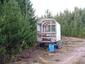 Moorland transport - geograph.org.uk - 641482.jpg 640 × 480; 104 KB
-
 Natural Ice Sculpture - geograph.org.uk - 2280467.jpg 427 × 640; 394 KB
-
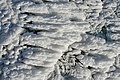 Natural Ice Sculpture - geograph.org.uk - 2281731.jpg 640 × 427; 375 KB


_-_geograph.org.uk_-_4390615.jpg)
_-_geograph.org.uk_-_4390619.jpg)


_Distillery_in_Glen_Rinnes_-_geograph.org.uk_-_5042359.jpg)


&filefrom=Near+Gownie+-+geograph.org.uk+-+2682727.jpg#mw-category-media)