Category:Across the Continent on the Kansas Pacific Railway (Route of the 35th Parallel)
Jump to navigation
Jump to search
|
Across the continent on the Kansas Pacific Railroad: route of the 35th parallel / by Alexander Gardner, photographer.
Marien, Mary Warner (2006). Photography: a cultural history. London: Laurence King Publishing Ltd. Page 132 Images of this document have been scanned by Boston Public Library and released on their Digital Commonwealth site. There is also a Flickr stream with much lower-resolution files. |
.jpg)
Media in category "Across the Continent on the Kansas Pacific Railway (Route of the 35th Parallel)"
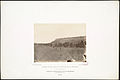
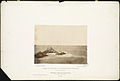
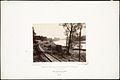
The following 165 files are in this category, out of 165 total.
-

-
-

-

-

-
-
-
-

-
-
-

-

-

-

-
 1867 Topeka Kansas USA 5199797174.png 657 × 228; 168 KB
-

-
-
 Ancient Pueblo Town of Zuni, Western New Mexico (cropped).jpg 557 × 475; 105 KB
-

-
 Ancient Pueblo Town of Zuni, Western New Mexico.jpg 1,500 × 1,002; 215 KB
-

-

-

-
-

-
 Bill Williams' Mountain (Boston Public Library).jpg 1,500 × 1,006; 175 KB
-

-

-
-

-

-

-

-

-

-

-

-

-
-
-

-
-

-

-
-
 Crossing of the Sierras at Tehachapa Pass, California, (Boston Public Library).jpg 1,500 × 1,009; 237 KB
-

-

-

-

-
 Depot of Pacific Railroad, St. Louis, Mo. (Boston Public Library).jpg 1,500 × 1,001; 285 KB
-

-
-

-
 Engineer camp in New Mexico. (Boston Public Library).jpg 1,500 × 997; 200 KB
-
-

-

-
 Fort Harker, Kansas, 218 miles west of Missouri River. (Boston Public Library).jpg 1,500 × 1,007; 208 KB
-

-
 Fort Leavenworth, Kansas, on Missouri River. (Boston Public Library).jpg 1,500 × 1,001; 215 KB
-

-
 Fort Riley, Kansas, 135 miles west of Missouri River. (Boston Public Library).jpg 1,500 × 1,000; 194 KB
-

-
 Great Bend, Missouri River, at Kansas City (Boston Public Library).jpg 1,500 × 1,001; 210 KB
-
-

-
-

-

-

-
 In the Valley of the Rio Grande, near Belin, New Mexico. (Boston Public Library).jpg 1,500 × 1,003; 202 KB
-

-

-
 Indian farm at Stranger, Kansas. (Boston Public Library).jpg 1,500 × 1,000; 223 KB
-

-

-

-

-

-
-
 Junction City, Kansas, 138 miles west of Missouri River. (Boston Public Library).jpg 1,500 × 1,003; 193 KB
-

-
-
 Leavenworth, Kansas. (Boston Public Library).jpg 1,500 × 1,002; 228 KB
-

-
-
 Lecompton, Kansas, in 1867, 50 miles west of Missouri River. (Boston Public Library).jpg 1,500 × 1,003; 224 KB
-

-

-

-

-

-

-
-
 Mojave Indians, on the Colorado, Arizona. (Boston Public Library).jpg 1,500 × 1,007; 221 KB
-
 Mount Agassiz, Arizona, Extinct Crater (Boston Public Library).jpg 1,500 × 1,000; 197 KB
-
 Mount Agassiz, Arizona, on the Mogoyon Range, in Tonto Pass.jpg 1,500 × 1,002; 207 KB
-

-

-
-
-

-

-

-

-
 On the Great Plains, Kansas, 294 miles west of Missouri River. (redo 2016).jpg 4,032 × 2,268; 2.27 MB
-

-
-
 On the Kansas Plains, 185 miles west of Missouri River. (Boston Public Library).jpg 1,003 × 1,500; 230 KB
-
 On the Line, in California. (Boston Public Library).jpg 889 × 759; 388 KB
-
 On the Rio Grande, between Albuquerque and Fort Craig. (Boston Public Library).jpg 1,500 × 1,000; 195 KB
-

-
 Overlooking Lawerence and the Kansas River. (Boston Public Library).jpg 1,500 × 1,006; 193 KB
-

-

-
-

-
 Railroad Bridge across the Kaw at state line, Kansas. (Boston Public Library).jpg 1,500 × 1,000; 193 KB
-
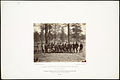
 Runk's Division of the Engineer Corps on the Plains. (Boston Public Library).jpg 1,500 × 1,000; 217 KB
-

-

-

-

-
 Salt Creek Valley, Kansas. (Boston Public Library).jpg 1,500 × 1,002; 222 KB
-

-

-

-
-
 Sinks of Tehachapa, California. (Boston Public Library).jpg 1,500 × 1,002; 209 KB
-

-
-

-

-

-

-

-

-

-
-

-
 Tecalote Creek, New Mexico, 775 miles from Missouri River. (Boston Public Library).jpg 1,500 × 1,004; 216 KB
-

-

-
 Tehachapa Pass, in the Sierra Nevada, California. (Boston Public Library).jpg 1,500 × 998; 208 KB
-

-

-

-
 The two races, at Fort Mojave, Arizona. (Boston Public Library).jpg 1,500 × 999; 191 KB
-
-

-

-

-
 Tulare Valley, California; gathering flowers in February, (Boston Public Library).jpg 1,500 × 1,004; 192 KB
-

-

-
-

-
 View on Kaw River, in Delaware Reservation, Kansas. (Boston Public Library).jpg 1,500 × 1,001; 239 KB
-
 Waukerusa Valley, south from Lawrence, Kansas. (Boston Public Library).jpg 1,500 × 1,005; 195 KB
-

-

-
 Zuni Indians, near border of New Mexico and Arizona. (Boston Public Library).jpg 1,500 × 1,000; 220 KB
-


.jpg)
_(cropped).jpg)
.jpg)
.jpg)
.jpg)
.jpg)
.jpg)
.jpg)
.jpg)

_1,000_miles_west_of_Missouri_River._(Boston_Public_Library)_(cropped).jpg)
_1,000_miles_west_of_Missouri_River._(Boston_Public_Library).jpg)
.jpg)


.jpg)
_(cropped).jpg)
.jpg)
.jpg)
.jpg)
.jpg)
.jpg)
.jpg)
_(cropped).jpg)
.jpg)
.jpg)
.jpg)
_(cropped).jpg)
.jpg)
.jpg)
.jpg)
.jpg)
.jpg)
.jpg)
.jpg)

.jpg)
.jpg)
.jpg)
.jpg)
.jpg)
.jpg)
.%22_Perry_Collection_-_1.jpg)
_(cropped).jpg)
.jpg)
.jpg)

.jpg)
.jpg)
.jpg)
.jpg)
.jpg)
.jpg)
_(cropped).jpg)
.jpg)
_(cropped).jpg)
.jpg)
_(cropped).jpg)
.jpg)
.jpg)
.jpg)
.jpg)
.jpg)
.jpg)
.jpg)
.jpg)
.jpg)
.jpg)
.jpg)
.jpg)
.jpg)
_(cropped).jpg)
.jpg)
_(cropped).jpg)
.jpg)
.jpg)
.jpg)
.jpg)
.%22_John_D._Perry_Collection,_plate_-_6.jpg)
_(cropped).jpg)
.jpg)
.jpg)
.jpg)
_(cropped).jpg)
.jpg)
_(cropped).jpg)
.jpg)
_(cropped).jpg)
.jpg)
.jpg)

.jpg)
.jpg)
.jpg)
.jpg)
.jpg)
.jpg)
.jpg)
.jpg)
.jpg)
_(cropped).jpg)
.jpg)
.jpg)
.jpg)
.jpg)
_(cropped).jpg)
.jpg)
.jpg)
.jpg)
.jpg)
_(cropped).jpg)
.jpg)
.jpg)
_975_miles_from_Missouri_River._(Boston_Public_Library).jpg)
.jpg)
_(cropped).jpg)
.jpg)
.jpg)
_(cropped).jpg)
.jpg)
.jpg)
.jpg)
.jpg)
_(cropped_2).jpg)
_(cropped).jpg)
.jpg)
_(cropped).jpg)
.jpg)
.jpg)
.jpg)
_cropped.jpg)
.jpg)
.jpg)
_970_miles_west_of_Missouri_River._(Boston_Public_Library).jpg)
.jpg)
.jpg)
.jpg)
.jpg)
.jpg)
.jpg)
_(cropped).jpg)
.jpg)
_west_slope_of_Raton_Mountain,_New_Mexico,_630_miles_from_Missouri_River._(Boston_Public_Library).jpg)
.jpg)
.jpg)
.jpg)
.jpg)
.jpg)

_(cropped).jpg)
.jpg)
.jpg)
.jpg)
.jpg)
.jpg)
.jpg)
_November,_1867;_980_miles_west_of_Missouri_River._(Boston_Public_Library).jpg)
_(cropped)_(cropped).jpg)