Category:Adlisberg
Jump to navigation
Jump to search
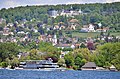
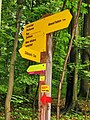
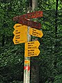
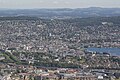
English: Adlisberg (el. 701 metres (2,300 ft)) is a wooded mountain overlooking the Zürichsee (Lake Zürich). It is located to the east of the city of Zürich, between the Glatt river valley and Lake Zürich. On the southern and western flanks of the Adlisberg the Zurich quarters Hottingen, Hirslanden and Witikon are located; Gockhausen and Geeren on its northern side, both villages of the city of Dübendorf.
| Object location | | View all coordinates using: OpenStreetMap |
|---|
mountain in Kanton Zürich, Switzerland  | |||||
| Upload media | |||||
| Instance of | |||||
|---|---|---|---|---|---|
| Part of | |||||
| Named after |
| ||||
| Location | Canton of Zürich, Switzerland | ||||
| Mountain range | |||||
| Topographic prominence |
| ||||
| Elevation above sea level |
| ||||
 | |||||
Subcategories
This category has the following 11 subcategories, out of 11 total.
A
- Adlisbergbachweg (Zürich) (4 F)
- Alter Brunnen Adlisberg (2 F)
B
- Burg Dübelstein (9 F)
D
E
- Erdbebenwarte Degenried (5 F)
G
- Gockhausen (7 F)
- Grand Hotel Dolder (95 F)
L
R
- Remote views of Adlisberg (41 F)
S
Media in category "Adlisberg"
The following 48 files are in this category, out of 48 total.
-
 Adlisberg - Dolder-Sonnenberg - Seefeldquai - Zürichsee - Landiwiese 2015-05-06 14-30-06.JPG 4,928 × 3,264; 8.28 MB
-
-

-
 Adlisberg - Grand Hotel Dolder - ZSG Pfannenstiel 2013-09-09 15-14-32.JPG 3,600 × 2,400; 3.35 MB
-
 Adlisberg - Grandhotel Dolder - Dampfschiff Stadt Rapperswil 2013-09-13 15-38-54.JPG 4,928 × 3,264; 5.84 MB
-
 Adlisberg - Hotel Zürichberg IMG 1297.JPG 3,888 × 2,592; 7.4 MB
-
 Adlisberg - Loorenchop IMG 4224.JPG 4,288 × 2,848; 5.79 MB
-
 Adlisberg - Loorenchop IMG 4266.JPG 3,264 × 2,448; 3.68 MB
-
 Adlisberg - Loorenchopf IMG 4263.jpg 3,264 × 2,448; 2.78 MB
-

-
 Adlisberg - Wikikon - Weinegg - Zürichhorn - Zürichsee - Wollishofen 2015-05-06 14-30-21.JPG 4,695 × 3,130; 3.76 MB
-
 Adlisberg 2010-08-19 13-55-12.JPG 4,288 × 2,848; 3.35 MB
-
 Adlisberg 2010-08-19 14-07-44.JPG 4,288 × 2,848; 6.31 MB
-
 Adlisberg 2010-08-19 14-08-48.jpg 4,176 × 2,772; 2.67 MB
-
 Adlisberg 2010-08-19 14-10-46 ShiftN.jpg 2,406 × 3,609; 2.04 MB
-
 Adlisberg 2010-08-19 14-11-46 ShiftN.jpg 4,182 × 2,712; 7.59 MB
-
 Adlisberg 2010-08-19 14-12-08.jpg 4,176 × 2,772; 3.23 MB
-
 Adlisberg IMG 0969.jpg 3,508 × 2,339; 1.71 MB
-
 Adlisberg IMG 4186.JPG 3,264 × 2,448; 2.17 MB
-
 Adlisberg IMG 4187.JPG 4,288 × 2,848; 6.3 MB
-
 Adlisberg IMG 4190.JPG 3,264 × 2,448; 1.61 MB
-
 Adlisberg IMG 4207.JPG 3,264 × 2,448; 2.44 MB
-
 Adlisberg IMG 4210.JPG 3,264 × 2,448; 2.49 MB
-
 Adlisberg IMG 4211.JPG 3,264 × 2,448; 2.41 MB
-
 Adlisberg IMG 4213.JPG 2,448 × 3,264; 3.08 MB
-
 Adlisberg IMG 4214.JPG 2,448 × 3,264; 2.91 MB
-
 Adlisberg IMG 4217.JPG 4,288 × 2,848; 5.9 MB
-
 Adlisberg IMG 4219.JPG 2,448 × 3,264; 3.02 MB
-
 Blick vom Üetliberg - panoramio.jpg 2,048 × 1,536; 855 KB
-
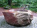
 Brunnen Stöckentobelweg.jpg 4,032 × 3,024; 4.13 MB
-
 Brücke über Wolfbach am Adlisberg.jpg 4,272 × 2,848; 4.66 MB
-
 Bäche Adlisberg-Nordseite.png 985 × 889; 77 KB
-
 Degenried Weiher.JPG 4,000 × 3,000; 5.1 MB
-
 ETH-BIB-Dolder, Zürich-Inlandflüge-LBS MH05-11-08.tif 3,508 × 2,353; 23.72 MB
-
 ETH-BIB-Dolder, Zürich-Inlandflüge-LBS MH05-11-09.tif 3,508 × 2,328; 23.46 MB
-
 ETH-BIB-Erdbebenwarte Degenried-Dia 247-14676.tif 2,979 × 3,402; 9.76 MB
-
 From Adlisberg to Uetliberg.jpg 4,032 × 1,960; 6.09 MB
-
 Heutobelweg.jpg 2,448 × 3,264; 9.21 MB
-
 LegishaldenDuebendorfI.jpg 3,008 × 1,588; 2.25 MB
-
 Sagentobelstrasse Tscharli Platz.jpg 4,032 × 3,024; 5.22 MB
-
 TuriciprospectusI.jpg 3,008 × 2,008; 5.31 MB
-
 Wolfbachtobel.jpg 2,272 × 1,704; 873 KB
-
 Zurich - panoramio (169).jpg 4,272 × 2,848; 3.33 MB
-
 Zurich - panoramio (171).jpg 4,272 × 2,848; 3.38 MB
-
 Zurich - panoramio (173).jpg 4,272 × 2,848; 2.26 MB
-
 Zurich - panoramio (175).jpg 4,272 × 2,848; 3 MB
-
 Zurich - panoramio (177).jpg 4,272 × 2,848; 2.93 MB
-
 Zürich Adlisbergstrasse 01.jpg 7,360 × 4,912; 31.23 MB


.jpg)
.jpg)
.jpg)
.jpg)
.jpg)
