Category:Agdenes fyrstasjon
Jump to navigation
Jump to search
| Object location | | View all coordinates using: OpenStreetMap |
|---|
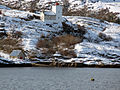
English: Agdenes Lighthouse
lighthouse in Norway  | |||||
| Upload media | |||||
| Instance of | |||||
|---|---|---|---|---|---|
| Location | |||||
| Located in or next to body of water | |||||
| Service entry |
| ||||
| Service retirement |
| ||||
| Inception |
| ||||
| Height |
| ||||
 | |||||
Media in category "Agdenes fyrstasjon"
The following 16 files are in this category, out of 16 total.
-
 05 Trondheim fjord, Agdenes Fyr (5669410206).jpg 3,648 × 2,736; 1.6 MB
-
 Agdenes fyr 01.jpg 2,916 × 2,156; 796 KB
-
 Agdenes fyr TZ (5829810988).jpg 1,024 × 680; 58 KB
-
 Agdenes fyr.jpg 1,024 × 743; 265 KB
-
 Agdenes fyrstasjon (2020.07.27).jpg 4,256 × 2,832; 10.32 MB
-
 Agdenes fyrstasjon 1.jpg 3,008 × 2,000; 1.51 MB
-
 Agdenes Fyrstasjon, Norway.jpg 1,200 × 1,552; 624 KB
-
 Agdenes fyrstasjon.jpg 3,008 × 2,000; 1.32 MB
-
 Agdenes lighthouse.jpg 3,344 × 2,224; 1.62 MB
-
 Agdenes, Agdenes - S-1602U2 101.jpg 4,000 × 3,177; 4.41 MB
-
 Agdenes, Agdenes - S-1602U2 102.jpg 4,000 × 3,128; 3.43 MB
-
 Agdenes, Agdenes - S-1602U2 103.jpg 4,000 × 3,094; 3.33 MB
-
 Agdenes, Agdenes - S-1602U2 104.jpg 4,000 × 3,091; 3.77 MB
-
 Agdenes, Agdenes - S-1602U2 105.jpg 4,000 × 3,031; 3.34 MB
-
 Agdenes, Agdenes - S-1602U2 106.jpg 4,000 × 3,102; 3.07 MB
-
 Agdenes, Agdenes - S-1602U2 107.jpg 4,000 × 3,125; 3.65 MB
.jpg)

.jpg)

.jpg)


