Category:Age of Discovery
Jump to navigation
Jump to search
period of European global exploration from early 15th century to 17th century  Le planisphère de Cantino réalisé en 1502 est l'une des plus anciennes représentations des voyages de Christophe Colomb dans les Caraïbes, de Gaspar Corte-Real à Terre-Neuve, de Pedro Álvares Cabral au Brésil et de Vasco de Gama en Inde. | |||||
| Upload media | |||||
| Pronunciation audio | |||||
|---|---|---|---|---|---|
| Instance of |
| ||||
| Start time |
| ||||
| End time |
| ||||
| Follows | |||||
| Followed by |
| ||||
| |||||
Subcategories
This category has the following 18 subcategories, out of 18 total.
A
C
D
F
G
M
P
Q
S
T
- Maximilianus Transylvanus (3 F)
- Treaty of Alcaçovas (6 F)
W
- William Weston (explorer) (3 F)
Media in category "Age of Discovery"
The following 51 files are in this category, out of 51 total.
-

-
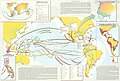
 16th century Portuguese Spanish trade routes.png 2,835 × 1,188; 2 MB
-
 16th century Spanish trade routes.png 2,835 × 1,188; 775 KB
-
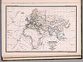
 Age of Discovery explorations in Arabic.png 1,172 × 489; 446 KB
-
 Age of Discovery explorations in English.png 1,056 × 492; 484 KB
-
 An introduction to American history, European beginnings (1919) (14780285802).jpg 2,816 × 1,828; 1.16 MB
-
 Discovery of America.jpg 1,914 × 1,504; 467 KB
-
 Doncker sea atlas world map.jpg 760 × 575; 200 KB
-
 Découvertes maritimes.jpg 2,455 × 1,297; 927 KB
-
 Early voyagers, 1492.jpg 1,902 × 1,466; 1.03 MB
-
 El hemisferio hispánico.jpg 3,783 × 2,566; 3.18 MB
-
-
 Etat du Monde avant pendant la Decouverte des deux Indes, 1273 - 1519.jpg 4,624 × 3,437; 3.5 MB
-
 European discoveries in the 15th, 16th and 17th centuries.jpg 2,000 × 1,444; 1.03 MB
-
 Exploraciones español.png 1,056 × 492; 486 KB
-
 Exploraciones transatlánticas.png 3,398 × 2,616; 682 KB
-
 Explos.png 1,356 × 768; 73 KB
-
-
 La expansión de los pueblos ibéricos.jpg 1,793 × 2,553; 1.67 MB
-

-
 McConnell's historical map, Early Grants.jpg 3,299 × 2,359; 1.51 MB
-
 McConnell's historical map, Early Voyages and Discoveries.jpg 3,289 × 2,366; 1.53 MB
-
 McConnell's historical map, English Explorations.jpg 3,307 × 2,393; 1.6 MB
-
 McConnell's historical map, French Explorations.jpg 3,304 × 2,387; 1.46 MB
-
 McConnell's historical map, National Claims.jpg 3,302 × 2,375; 1.42 MB
-
 McConnell's historical map, Spanish Explorations.jpg 3,306 × 2,398; 1.42 MB
-
 Mediaeval and modern history (1905) (14594635509).jpg 2,005 × 2,878; 691 KB
-
 Ortogonalis polikonikus kepzetes kupvetulet.svg 1,381 × 927; 2.91 MB
-
 Planche VII - Découvertes du monde de 1400 a 1550 - liv3-ch10.png 4,000 × 2,968; 2 MB
-
 Portuguese Black Ship Namban.jpg 1,024 × 995; 311 KB
-
 Portuguese Chapel Malindi niche.jpg 2,480 × 2,649; 1.36 MB
-
 Quir Relatio Memorialis.pdf 2,133 × 2,910, 36 pages; 2.11 MB
-
 Spain and Portugal-ar.png 1,500 × 771; 225 KB
-
 Spain and Portugal-fr.png 1,500 × 771; 188 KB
-
 Spain and Portugal.png 1,500 × 771; 92 KB
-
 SpanishPacific-es.svg 1,250 × 1,075; 4.1 MB
-
 SpanishPacific.svg 1,250 × 1,075; 2.04 MB
-
 Středověký trh.jpg 425 × 310; 57 KB
-
 The Old World - Early explorers.jpg 1,649 × 1,366; 1.3 MB
-
 The world at the Treaty of Saragossa, 1529.jpg 2,933 × 1,535; 1.17 MB
-
 The World at the Treaty of Saragossa, 1529.jpg 2,496 × 1,642; 1.12 MB
-
 The world, 1600-1650.jpg 2,948 × 1,508; 1.13 MB
-
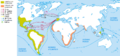
 Transatlantic explorations.png 3,398 × 2,616; 658 KB
-
 Un nuevo continente, América.jpg 3,783 × 2,563; 3.2 MB
-
 Vasco da Gama Pillar cross Malindi.jpg 1,625 × 1,413; 804 KB
-
 Viajes de Colón y exploraciones simultáneas, 1492-1504.jpg 1,388 × 1,135; 331 KB
-
 World 1340 1600.jpg 4,593 × 2,222; 1.49 MB
-
 World, 1492 vs 1904.jpg 2,454 × 895; 578 KB
-
 Wpdms early grants 1621 1639.png 426 × 491; 87 KB
-
 Zámořské cesty Portugalců a Španělů.jpg 1,056 × 492; 270 KB
-
 מפת חוזה סרגוסה.svg 1,219 × 627; 643 KB


_(14780285802).jpg)


,_etc%27_(11301019325).jpg)

,_H._G._Wells%27_Outline_of_History,_page_397.jpg)


_(14594635509).jpg)


