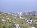
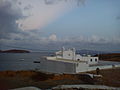
Category:Agios Sostis (Tinos)
Jump to navigation
Jump to search
| Object location | | View all coordinates using: OpenStreetMap |
|---|
human settlement in Greece  | |||||
| Upload media | |||||
| Instance of | |||||
|---|---|---|---|---|---|
| Location |
| ||||
| Population |
| ||||
 | |||||
Media in category "Agios Sostis (Tinos)"
The following 7 files are in this category, out of 7 total.
-
 AgiosSostis Tinos Greece 2018040616460N00604.jpg 2,272 × 1,704; 825 KB
-
 AgiosSostis Tinos Greece 2018040715330N00756.jpg 2,272 × 1,704; 789 KB
-
 AgiosSostis Tinos Greece 2018040715330N00757.jpg 2,272 × 1,704; 811 KB
-
 AgiosSostis Tinos Greece 2018041013190N01689.jpg 2,272 × 1,704; 791 KB
-
 AgiosSostis Tinos Greece 2018041013200NP1698.jpg 5,458 × 1,133; 1.49 MB
-
 AgiosSostis Tinos Greece 2018041013210N01709.jpg 2,272 × 1,704; 789 KB
-
 Saint Sostis church in Tinos island, Greece.jpg 2,048 × 1,536; 223 KB


