Category:Alcona County, Michigan
Zur Navigation springen
Zur Suche springen
Counties of Michigan: Alcona · Alger · Allegan · Alpena · Antrim · Arenac · Baraga · Barry · Bay · Benzie · Berrien · Branch · Calhoun · Cass · Charlevoix · Cheboygan · Chippewa · Clare · Clinton · Crawford · Delta · Dickinson · Eaton · Emmet · Genesee · Gladwin · Gogebic · Grand Traverse · Gratiot · Hillsdale · Houghton · Huron · Ingham · Ionia · Iosco · Iron · Isabella · Jackson · Kalamazoo · Kalkaska · Kent · Keweenaw · Lake · Lapeer · Leelanau · Lenawee · Livingston · Luce · Mackinac · Macomb · Manistee · Marquette · Mason · Mecosta · Menominee · Midland · Missaukee · Monroe · Montcalm · Montmorency · Muskegon · Newaygo · Oakland · Oceana · Ogemaw · Ontonagon · Osceola · Oscoda · Otsego · Ottawa · Presque Isle · Roscommon · Saginaw · Sanilac · Schoolcraft · Shiawassee · St. Clair · St. Joseph · Tuscola · Van Buren · Washtenaw · Wayne · Wexford
County im US-Bundesstaat Michigan   | |||||
| Medium hochladen | |||||
| Ist ein(e) | |||||
|---|---|---|---|---|---|
| Ort | Michigan | ||||
| Hauptstadt | |||||
| Datum der Gründung, Erstellung, Entstehung, Erbauung |
| ||||
| Einwohnerzahl |
| ||||
| Fläche |
| ||||
| offizielle Website | |||||
 | |||||
Unterkategorien
Es werden 12 von insgesamt 12 Unterkategorien in dieser Kategorie angezeigt:
In Klammern die Anzahl der enthaltenen Kategorien (K), Seiten (S), Dateien (D)
Medien in der Kategorie „Alcona County, Michigan“
Folgende 31 Dateien sind in dieser Kategorie, von 31 insgesamt.
-
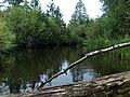
 AuSable River Riffles - panoramio.jpg 2.048 × 1.536; 1,87 MB
-
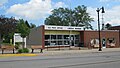
 Barton City, MI post office.jpg 5.183 × 2.916; 3,99 MB
-
 Buff Creek - panoramio.jpg 3.264 × 2.448; 4,07 MB
-
 Comstock Creek - panoramio.jpg 3.264 × 2.448; 3,99 MB
-
 Comstock Creek upstream - panoramio.jpg 3.264 × 2.448; 4,08 MB
-
 Curran, MI community.jpg 5.183 × 2.916; 2,56 MB
-
 Curran, MI post office.jpg 5.184 × 3.888; 4,23 MB
-
 Lincoln, MI Post Office.jpg 5.183 × 2.916; 2,78 MB
-
 Little North Creek - panoramio.jpg 3.264 × 2.448; 3,59 MB
-
 Little North Creek - upstream - panoramio.jpg 3.264 × 2.448; 3,64 MB
-
 Lost Lake Woods, Michigan.jpg 5.183 × 2.916; 4,25 MB
-
 MIMap-doton-BartonCity.PNG 261 × 300; 13 KB
-
 MIMap-doton-BlackRiver.PNG 261 × 300; 13 KB
-
 MIMap-doton-Greenbush.PNG 261 × 300; 13 KB
-
 MIMap-doton-HubbardLake.PNG 261 × 300; 13 KB
-
 MIMap-doton-Lincoln.PNG 261 × 300; 13 KB
-
 MIMap-doton-LostLakeWoods.PNG 261 × 300; 13 KB
-
 Mouth of Sucker Creek - panoramio.jpg 3.264 × 2.448; 3,97 MB
-
 Mt Mariah - panoramio.jpg 3.264 × 2.448; 4 MB
-
 Mt Mariah - view from Hubbard Lake - panoramio.jpg 3.264 × 2.448; 3,62 MB
-
 Mt Mariah - view from West Branch River - panoramio.jpg 3.264 × 2.448; 3,57 MB
-
 Mt. Mariah - view from north on Hubbard Lake - panoramio.jpg 3.264 × 2.448; 3,75 MB
-
 Soil Survey of Alcona County, Michigan.pdf 1.275 × 1.650, 481 Seiten; 128,36 MB
-
 The Iron Skillet Family Restaurant - panoramio.jpg 3.264 × 2.448; 3,46 MB
-
 USA Alcona County, Michigan age pyramid.svg 520 × 600; 8 KB
-
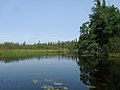
 West Branch River - downstream - panoramio.jpg 3.264 × 2.448; 3,54 MB
-
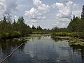
 West Branch River - marsh west end - downstream - panoramio.jpg 3.264 × 2.448; 3,39 MB
-
 West Branch River - marsh west end - upstream - panoramio.jpg 3.264 × 2.448; 3,41 MB
-
 West Branch River - panoramio.jpg 3.264 × 2.448; 3,66 MB
-
 West Branch River - upstream - panoramio.jpg 3.264 × 2.448; 3,52 MB
-
 West Branch River - upstream from mouth - panoramio.jpg 3.264 × 2.448; 3,38 MB


