Category:Gogebic County, Michigan
Jump to navigation
Jump to search
Counties of Michigan: Alcona · Alger · Allegan · Alpena · Antrim · Arenac · Baraga · Barry · Bay · Benzie · Berrien · Branch · Calhoun · Cass · Charlevoix · Cheboygan · Chippewa · Clare · Clinton · Crawford · Delta · Dickinson · Eaton · Emmet · Genesee · Gladwin · Gogebic · Grand Traverse · Gratiot · Hillsdale · Houghton · Huron · Ingham · Ionia · Iosco · Iron · Isabella · Jackson · Kalamazoo · Kalkaska · Kent · Keweenaw · Lake · Lapeer · Leelanau · Lenawee · Livingston · Luce · Mackinac · Macomb · Manistee · Marquette · Mason · Mecosta · Menominee · Midland · Missaukee · Monroe · Montcalm · Montmorency · Muskegon · Newaygo · Oakland · Oceana · Ogemaw · Ontonagon · Osceola · Oscoda · Otsego · Ottawa · Presque Isle · Roscommon · Saginaw · Sanilac · Schoolcraft · Shiawassee · St. Clair · St. Joseph · Tuscola · Van Buren · Washtenaw · Wayne · Wexford
county in Michigan, United States   | |||||
| Upload media | |||||
| Instance of | |||||
|---|---|---|---|---|---|
| Location | Michigan | ||||
| Capital | |||||
| Inception |
| ||||
| Population |
| ||||
| Area |
| ||||
| official website | |||||
 | |||||
Subcategories
This category has the following 5 subcategories, out of 5 total.
B
G
P
Media in category "Gogebic County, Michigan"
The following 29 files are in this category, out of 29 total.
-
 A souvenir of Gogebic County, Mich (IA 3117255.0001.001.umich.edu).pdf 1,483 × 979, 109 pages; 8.86 MB
-
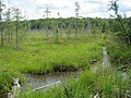 Bog - panoramio (1).jpg 2,816 × 2,112; 2.33 MB
-
 Bog pool - panoramio (1).jpg 2,816 × 2,112; 1.93 MB
-
 Bog pool - panoramio.jpg 2,272 × 1,704; 1.26 MB
-
 Duck Creek - panoramio (3).jpg 2,048 × 1,369; 1.13 MB
-
 Ethelwood - panoramio.jpg 2,816 × 2,112; 2.61 MB
-
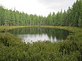
 Former beaver pond - panoramio.jpg 2,816 × 2,112; 2.02 MB
-
 Gogebic Station - panoramio.jpg 2,272 × 1,704; 964 KB
-
 Granite Rapids Falls - panoramio.jpg 2,048 × 1,536; 1.39 MB
-
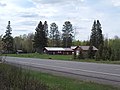
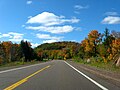 M-28 M-64 Duplex Near Lake Gogebic.JPG 2,939 × 2,204; 2.86 MB
-
 Moraine Creek - panoramio.jpg 2,272 × 1,704; 1.58 MB
-
 Nelson Canyon Falls - panoramio.jpg 1,360 × 2,048; 2.34 MB
-
 Nokomis Falls - panoramio.jpg 2,048 × 1,536; 1.37 MB
-
 Orchard Creek - panoramio.jpg 2,048 × 1,536; 1.42 MB
-
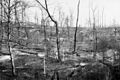
 Photograph of a Fire Four Miles South of Marenisco, Michigan - NARA - 2127485.jpg 1,584 × 931; 1.02 MB
-

-
 Photograph of a Fire One Mile South of Marenisco, Michigan - NARA - 2127487.jpg 1,400 × 935; 1,003 KB
-
 Photograph of a Fire One Mile South of Marenisco, Michigan - NARA - 2127487.tif 1,400 × 935; 1.25 MB
-

-
 Pomeroy Creek Overlook - panoramio.jpg 2,816 × 2,112; 1.84 MB
-
 Pond near Duck Creek - panoramio.jpg 2,048 × 1,368; 1.18 MB
-
 Rocky Forty Falls - panoramio.jpg 2,048 × 1,536; 1.38 MB
-
 Sand Island Creek - panoramio.jpg 1,600 × 1,200; 588 KB
-
 Sandstone Falls.jpg 1,600 × 1,200; 1.78 MB
-
 Tenderfoot Creek - panoramio.jpg 2,048 × 1,536; 1.4 MB
-
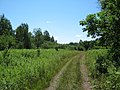
 Upland Opening - panoramio (1).jpg 2,272 × 1,704; 1.79 MB
-
 USA Gogebic County, Michigan age pyramid.svg 520 × 600; 8 KB
-
 Wetland along old railroad grade - panoramio.jpg 2,048 × 1,536; 1.43 MB
-
 Wetland Near Duck Creek - panoramio.jpg 2,048 × 1,536; 1.29 MB
.jpg)
.jpg)

.jpg)


.jpg)


