Category:Van Buren County, Michigan
Jump to navigation
Jump to search
Counties of Michigan: Alcona · Alger · Allegan · Alpena · Antrim · Arenac · Baraga · Barry · Bay · Benzie · Berrien · Branch · Calhoun · Cass · Charlevoix · Cheboygan · Chippewa · Clare · Clinton · Crawford · Delta · Dickinson · Eaton · Emmet · Genesee · Gladwin · Gogebic · Grand Traverse · Gratiot · Hillsdale · Houghton · Huron · Ingham · Ionia · Iosco · Iron · Isabella · Jackson · Kalamazoo · Kalkaska · Kent · Keweenaw · Lake · Lapeer · Leelanau · Lenawee · Livingston · Luce · Mackinac · Macomb · Manistee · Marquette · Mason · Mecosta · Menominee · Midland · Missaukee · Monroe · Montcalm · Montmorency · Muskegon · Newaygo · Oakland · Oceana · Ogemaw · Ontonagon · Osceola · Oscoda · Otsego · Ottawa · Presque Isle · Roscommon · Saginaw · Sanilac · Schoolcraft · Shiawassee · St. Clair · St. Joseph · Tuscola · Van Buren · Washtenaw · Wayne · Wexford
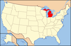
English: Van Buren County is a county in the U.S. state of Michigan. At the 2000 census, the population was 76,263. It is part of the Kalamazoo-Portage Metropolitan Area. The county seat is the village of Paw Paw.
county in Michigan, United States | |||||
| Upload media | |||||
| Instance of | |||||
|---|---|---|---|---|---|
| Named after | |||||
| Location | Michigan | ||||
| Capital | |||||
| Inception |
| ||||
| Population |
| ||||
| Area |
| ||||
| Different from | |||||
| official website | |||||
 | |||||
Subcategories
This category has the following 11 subcategories, out of 11 total.
Media in category "Van Buren County, Michigan"
The following 23 files are in this category, out of 23 total.
-
Birth of a reformation; or, The life and labors of Daniel S. Warner (1921) (14780789485).jpg 2,992 × 1,860; 1.06 MB
-
Charles Morris (1).jpg 1,684 × 2,249; 944 KB
-
Covert, MI, USA - panoramio.jpg 4,874 × 3,206; 6.28 MB
-
History of Berrien and Van Buren counties, Michigan (IA historyofberrien00ensi).pdf 960 × 1,306, 826 pages; 83.68 MB
-
I-196 Black River Bridge South Haven.jpg 3,296 × 2,472; 1,020 KB
-
Maple lake - panoramio.jpg 1,024 × 768; 415 KB
-
NRCSMI01011 - Michigan (4611)(NRCS Photo Gallery).jpg 2,100 × 1,500; 5.76 MB
-
NRCSMI01012 - Michigan (4613)(NRCS Photo Gallery).jpg 2,100 × 1,500; 6.07 MB
-
NRCSMI01022 - Michigan (4633)(NRCS Photo Gallery).jpg 1,500 × 2,100; 6.82 MB
-
NRCSMI01023 - Michigan (4635)(NRCS Photo Gallery).jpg 2,100 × 1,500; 6.86 MB
-
NRCSMI01024 - Michigan (4637)(NRCS Photo Gallery).jpg 1,500 × 2,100; 6.75 MB
-
NRCSMI01025 - Michigan (4639)(NRCS Photo Gallery).jpg 2,100 × 1,500; 5.47 MB
-
NRCSMI01026 - Michigan (4641)(NRCS Photo Gallery).jpg 1,500 × 2,100; 5.89 MB
-
NRCSMI01027 - Michigan (4643)(NRCS Photo Gallery).jpg 1,500 × 2,100; 6.41 MB
-
NRCSMI01033 - Michigan (4655)(NRCS Photo Gallery).jpg 2,100 × 1,500; 5.9 MB
-
NRCSMI01034 - Michigan (4657)(NRCS Photo Gallery).jpg 2,100 × 1,500; 6.53 MB
-
Paw Paw River.jpg 2,272 × 1,704; 1.74 MB
-
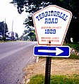
Territorial Road marker sign Keeler 1999.jpg 652 × 698; 217 KB
-
Territorial Road plaque Keeler 1999.jpg 500 × 818; 207 KB
-
Timber ridge.jpg 500 × 310; 112 KB
-
USA Van Buren County, Michigan age pyramid.svg 520 × 600; 9 KB


