Category:Altes Schulhaus / Altes Gemeindehaus (Hauptstrasse 20, Niederlenz)
Jump to navigation
Jump to search
| Object location | | View all coordinates using: OpenStreetMap |
|---|
| NO WIKIDATA ID FOUND! Search for Altes Schulhaus / Altes Gemeindehaus (Hauptstrasse 20, Niederlenz) on Wikidata | |
| Upload media |
Media in category "Altes Schulhaus / Altes Gemeindehaus (Hauptstrasse 20, Niederlenz)"
This category contains only the following file.
-
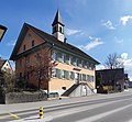 Altes Gemeindehaus in Niederlenz, 2021.jpg 4,445 × 4,115; 5.38 MB
