Category:Altnaharra
Jump to navigation
Jump to search
human settlement in Highland, Scotland, UK  Kirken i Altnaharra | |||||
| Upload media | |||||
| Instance of | |||||
|---|---|---|---|---|---|
| Location |
| ||||
 | |||||
Deutsch: Altnaharra ( gäl.: Allt-na-h-Aire) ist ein Weiler in der Grafschaft Sutherland in der nordschottischen Region Highland. Er liegt an der Fernstraße A836 am oberen Ende des Loch Naver. Die nächstgelegenen Dörfer sind Lairg und Tongue.
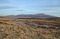
English: Altnaharra is a small hamlet in Sutherland in the Highland region of northern Scotland. The hamlet is on the A836 road, close to its junction with the B873. The nearest villages are Lairg and Tongue. Lochs in the area include Loch Naver and Loch Eriboll.
Gàidhlig: 'S e clachan air a’ Ghàidhealtachd a tha ann an Allt-na-h-Eirbhe (Beurla: Altnaharra). 'S e an Luirg is Tunga na bailtean a tha faisg air. Tha e suidhichte air a' mhòr-rathaid A836. 'S e seo na co-chomharran aige: 58° 16′ 48″ Tuath agus 4° 27′ 0″ Iar.
Nederlands: Altnaharra ( Gaelisch: Allt-na-h-Aire) is een kleine nederzetting in het Schotse raadsgebied (council area) Highland en de lieutenancy area Sutherland.
Norsk bokmål: Altnaharra er en liten grend i Sutherland i høylandsregionen av nordlige Skottland. Grenden ligger ved vegen A836, rett ved forbindelse med B873. De nærmeste landsbyene er Lairg og Tongue. De innsjøer (lochs) som er i området er blant annet Loch Naver og Loch Eriboll.
Subcategories
This category has the following 2 subcategories, out of 2 total.
B
G
- Grummore Broch (3 F)
Media in category "Altnaharra"
The following 112 files are in this category, out of 112 total.
-

-
 A Ford At the Crask - geograph.org.uk - 71756.jpg 640 × 480; 132 KB
-
 A Shed beside the River Vagastie - geograph.org.uk - 71644.jpg 640 × 480; 111 KB
-
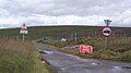
 A simple crossroads, Altnaharra - geograph.org.uk - 1914076.jpg 640 × 480; 110 KB
-
 A Surfeit Of Umlauts - geograph.org.uk - 248815.jpg 640 × 480; 100 KB
-

-
 A water Fall on the River Vagastie - geograph.org.uk - 71632.jpg 640 × 480; 128 KB
-
 A836 descending towards Altnaharra - geograph.org.uk - 5379618.jpg 1,800 × 1,013; 1.25 MB
-
 A836 near Altnaharra - geograph.org.uk - 4618777.jpg 800 × 450; 112 KB
-
 A836 north of Altnaharra - geograph.org.uk - 2403734.jpg 1,000 × 750; 187 KB
-
 A836 starting to descend to Altnaharra - geograph.org.uk - 4456554.jpg 1,800 × 1,012; 1.42 MB
-
 A836, Altnaharra - geograph.org.uk - 1917388.jpg 640 × 480; 107 KB
-
-

-
 Altnaharra - geograph.org.uk - 4616420.jpg 800 × 450; 140 KB
-
 Altnaharra - geograph.org.uk - 911370.jpg 640 × 359; 50 KB
-
 Altnaharra - Strathnaver road - geograph.org.uk - 911374.jpg 640 × 359; 53 KB
-
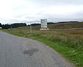
 Altnaharra and ice warning signs - geograph.org.uk - 4616380.jpg 800 × 450; 206 KB
-
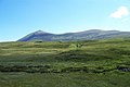
 Altnaharra Ben Hope geograph-2126546-by-Ben-Brooksbank.jpg 1,024 × 558; 300 KB
-
 Altnaharra Church - geograph.org.uk - 1718297.jpg 640 × 480; 152 KB
-
 Altnaharra church - geograph.org.uk - 5829500.jpg 1,187 × 1,600; 569 KB
-
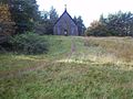 Altnaharra Church.jpg 640 × 480; 107 KB
-
 Altnaharra from across the bridge - geograph.org.uk - 3251962.jpg 2,081 × 1,404; 929 KB
-
 Altnaharra Hotel - geograph.org.uk - 2919032.jpg 640 × 480; 80 KB
-
 Altnaharra Hotel - geograph.org.uk - 5123632.jpg 640 × 480; 265 KB
-
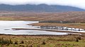
 Altnaharra Lodge policies and Loch Naver - geograph.org.uk - 5829502.jpg 1,600 × 1,067; 453 KB
-
 Altnaharra northward view to Ben Loyal geograph-2126566-by-Ben-Brooksbank.jpg 1,024 × 650; 579 KB
-
 Altnaharra Primary School - geograph.org.uk - 1917358.jpg 640 × 480; 122 KB
-
 Altnaharra Primary School - geograph.org.uk - 4616404.jpg 800 × 450; 187 KB
-

-
 Altnaharra weather station - geograph.org.uk - 3903376.jpg 640 × 427; 235 KB
-
 Altnaharra Wood - geograph.org.uk - 1917366.jpg 640 × 480; 149 KB
-
-
 Bridge over River Mudale at Altnaharra (geograph 3570152).jpg 4,000 × 3,000; 3.46 MB
-
 Corner of forest - geograph.org.uk - 493034.jpg 640 × 480; 102 KB
-
 Deer in Strath Vagastie - geograph.org.uk - 645316.jpg 640 × 480; 494 KB
-
 Dornaigil.jpg 960 × 960; 99 KB
-
 Farm shed near Altnaharra - geograph.org.uk - 2224404.jpg 800 × 531; 203 KB
-
 Farm shed near Altnaharra - geograph.org.uk - 2224418.jpg 800 × 531; 173 KB
-
 Fence and path - geograph.org.uk - 46547.jpg 480 × 640; 130 KB
-
 Forestry by the Loch Hope road, near Altnaharra - geograph.org.uk - 4557134.jpg 2,592 × 1,944; 1.2 MB
-
 Former Petrol Pumps, Altnaharra - geograph.org.uk - 2919035.jpg 640 × 460; 113 KB
-
 Foxglove and pine, Altnaharra Wood - geograph.org.uk - 3563176.jpg 1,024 × 682; 186 KB
-

-
 North of Altnaharra - geograph.org.uk - 784558.jpg 640 × 514; 59 KB
-
 Northern Highlands - Altnaharra - Ben Hope.jpg 800 × 600; 50 KB
-
 Northwest of Ben Klibreck in Sutherland (geograph 4422461).jpg 2,464 × 1,632; 1.68 MB
-
 River Mudale at Altnaharra (geograph 3960530).jpg 1,500 × 1,125; 1.28 MB
-
 River Mugdale entering Loch Naver - geograph.org.uk - 647806.jpg 640 × 360; 57 KB
-
 River Vargastie - geograph.org.uk - 46500.jpg 640 × 480; 205 KB
-
 Road junction at Altnaharra - geograph.org.uk - 2224368.jpg 800 × 531; 115 KB
-
 Snow fence^ - geograph.org.uk - 492983.jpg 640 × 480; 137 KB
-
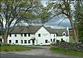 The Altnaharra Hotel, Sutherland - geograph.org.uk - 1809.jpg 576 × 403; 70 KB
-
 The end (or start) of the Loch Hope road, at Altnaharra - geograph.org.uk - 4557141.jpg 2,592 × 1,944; 1.27 MB
-
 The Hope Road (closed again) - geograph.org.uk - 4616415.jpg 800 × 450; 143 KB
-
 The road to Hope, 1986 - geograph.org.uk - 5726950.jpg 1,600 × 1,070; 251 KB
-
 Weather Station - geograph.org.uk - 381670.jpg 640 × 500; 72 KB
-
 A Bleak Day in Altnaharra - geograph.org.uk - 226589.jpg 640 × 480; 114 KB
-
 A complicated road junction at Altnaharra - geograph.org.uk - 946149.jpg 640 × 480; 150 KB
-
 A Highland Burn - geograph.org.uk - 172408.jpg 640 × 480; 276 KB
-
 A Highland Burn - geograph.org.uk - 172430.jpg 640 × 480; 252 KB
-
 A'Chioch ridge - geograph.org.uk - 1510012.jpg 640 × 480; 79 KB
-
 Altan Buidhe plantation - geograph.org.uk - 493026.jpg 640 × 480; 108 KB
-
 Altnaharra from the Loch Naver Road - geograph.org.uk - 647802.jpg 640 × 360; 45 KB
-
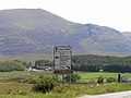
 Altnaharra sign - geograph.org.uk - 630763.jpg 640 × 480; 58 KB
-
 Bare rock on the hillside - geograph.org.uk - 493023.jpg 640 × 480; 108 KB
-
 Ben Klibrech, Altnaharra - geograph.org.uk - 478954.jpg 640 × 480; 68 KB
-
 Boggy ground with hillside above - geograph.org.uk - 1456346.jpg 640 × 424; 104 KB
-
 Bridge - geograph.org.uk - 493042.jpg 640 × 480; 93 KB
-
 Brow of hill - geograph.org.uk - 493016.jpg 640 × 480; 102 KB
-
 Cairn - geograph.org.uk - 403569.jpg 640 × 527; 161 KB
-
 Cairn near point 528m - geograph.org.uk - 1456353.jpg 640 × 424; 95 KB
-
 Cnoc Sgriodain - geograph.org.uk - 46503.jpg 640 × 480; 108 KB
-
 Creag an Lochain - geograph.org.uk - 402353.jpg 640 × 462; 152 KB
-
 Creag an Lochain - geograph.org.uk - 402359.jpg 640 × 445; 159 KB
-
 Creag Riabhach - geograph.org.uk - 46496.jpg 640 × 480; 120 KB
-
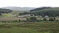
 Entering Altnaharra - geograph.org.uk - 547298.jpg 640 × 491; 125 KB
-
 Flooding River Mugdale, Altnaharra - geograph.org.uk - 662733.jpg 640 × 480; 388 KB
-
 Forest - geograph.org.uk - 492994.jpg 640 × 480; 116 KB
-
 Forest at west end of Loch Naver - geograph.org.uk - 490956.jpg 640 × 480; 110 KB
-
 Forest plantation - geograph.org.uk - 492976.jpg 640 × 480; 97 KB
-
 Forest track - geograph.org.uk - 492998.jpg 640 × 480; 114 KB
-
 Frog by Loch Staing - geograph.org.uk - 493006.jpg 640 × 443; 92 KB
-
 Loch Gaineamhach - geograph.org.uk - 70848.jpg 640 × 480; 79 KB
-
 Loch Gaineamhach and a Ford - geograph.org.uk - 70850.jpg 640 × 480; 143 KB
-
 Loch na Glas-choille - geograph.org.uk - 46506.jpg 640 × 480; 187 KB
-
 Loch Naver - geograph.org.uk - 401383.jpg 640 × 507; 118 KB
-
 Loch Naver at Altnaharra - geograph.org.uk - 490959.jpg 640 × 480; 96 KB
-
 Looking back towards Altnaharra - geograph.org.uk - 172403.jpg 640 × 480; 244 KB
-

-
 Looking into the Village of Altnaharra - geograph.org.uk - 71699.jpg 640 × 480; 82 KB
-
 Looking towards Clebrig from Altnaharra - geograph.org.uk - 71710.jpg 640 × 480; 100 KB
-
 Moorland - geograph.org.uk - 172416.jpg 640 × 480; 288 KB
-
 Moorland - geograph.org.uk - 172424.jpg 640 × 480; 253 KB
-
 Mudale Farm - geograph.org.uk - 172420.jpg 640 × 480; 220 KB
-
 Red Deer at Altnaharra - geograph.org.uk - 548228.jpg 640 × 427; 88 KB
-
 River Mugdale at Alnaharra - geograph.org.uk - 548225.jpg 640 × 427; 90 KB
-
 River Vagastie - geograph.org.uk - 226594.jpg 640 × 480; 158 KB
-
 Road beside Loch Naver - geograph.org.uk - 293196.jpg 640 × 480; 64 KB
-
 Road junction Altnaharra - geograph.org.uk - 547292.jpg 640 × 442; 58 KB
-
 Road markers for snowy conditions - geograph.org.uk - 493010.jpg 640 × 480; 73 KB
-
 Road through Altan Buidhe plantation - geograph.org.uk - 493045.jpg 640 × 480; 118 KB
-
 Small moorland pond - geograph.org.uk - 492972.jpg 640 × 480; 101 KB
-
 Strath a' Chraisg - geograph.org.uk - 395411.jpg 640 × 506; 132 KB
-
 Strath Vagastie - geograph.org.uk - 248823.jpg 640 × 480; 108 KB
-
 Strath Vagastie - geograph.org.uk - 292276.jpg 480 × 640; 114 KB
-
 Strath Vagastie and Ben Klibreck - geograph.org.uk - 71167.jpg 640 × 480; 80 KB
-
 Strath Vagastie and Ben Klibreck - geograph.org.uk - 71583.jpg 640 × 480; 95 KB
-

-
 The River Vagastie - geograph.org.uk - 71615.jpg 640 × 480; 143 KB
-

-


.jpg)


.jpg)
.jpg)


_of_the_Loch_Hope_road,_at_Altnaharra_-_geograph.org.uk_-_4557141.jpg)
_-_geograph.org.uk_-_4616415.jpg)


