Category:Alverthorpe
Jump to navigation
Jump to search
suburb in Wakefield, West Yorkshire, UK  | |||||
| Upload media | |||||
| Instance of | |||||
|---|---|---|---|---|---|
| Location | Wakefield, West Yorkshire, Yorkshire and the Humber, England | ||||
 | |||||
Subcategories
This category has the following 7 subcategories, out of 7 total.
Media in category "Alverthorpe"
The following 38 files are in this category, out of 38 total.
-

-
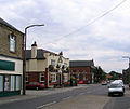 Alverthorpe Wakefield - geograph.org.uk - 31072.jpg 640 × 541; 74 KB
-
 Armitage Road - Batley Road - geograph.org.uk - 3647214.jpg 640 × 480; 57 KB
-

-

-
 Blakey Road - Walnut Crescent - geograph.org.uk - 3764874.jpg 640 × 480; 89 KB
-

-

-
 Brick Street - Flanshaw Lane - geograph.org.uk - 3748933.jpg 640 × 480; 61 KB
-

-

-
 Craven (5859058787) (2).jpg 3,648 × 2,056; 2.44 MB
-

-
-

-
 Footpath - Darnley Avenue - geograph.org.uk - 3739505.jpg 480 × 640; 118 KB
-
 Footpath - off Meadow Lane - geograph.org.uk - 3764972.jpg 480 × 640; 74 KB
-
 Footpath - Saffron Court - geograph.org.uk - 3749175.jpg 480 × 640; 91 KB
-

-

-

-

-
 Gelder Court - Geary Drive - geograph.org.uk - 3647223.jpg 640 × 480; 58 KB
-
 Gelder Croft - Geary Drive - geograph.org.uk - 3647224.jpg 640 × 480; 56 KB
-

-
 Looking over the hedge - geograph.org.uk - 983746.jpg 640 × 480; 110 KB
-
 Pacaholme Road - Batley Road - geograph.org.uk - 3646471.jpg 640 × 456; 89 KB
-
 Padgett Way - Weavers Chase - geograph.org.uk - 3749042.jpg 640 × 480; 67 KB
-
 Play Area - off Batley Road - geograph.org.uk - 3647249.jpg 640 × 381; 63 KB
-
 Playing Fields - Batley Road - geograph.org.uk - 3647248.jpg 640 × 353; 38 KB
-

-

-
 Track - Pacaholme Road - geograph.org.uk - 3646476.jpg 640 × 480; 113 KB
-

-

-

-
 Footpath leading to lake - geograph.org.uk - 566244.jpg 640 × 427; 226 KB
-
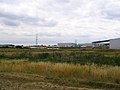 Industrial Estate near Wakefield - geograph.org.uk - 31071.jpg 640 × 480; 68 KB


_(2).jpg)


