Category:Amu Darya
Jump to navigation
Jump to search
major river in Central Asia   | |||||
| Upload media | |||||
| Instance of | |||||
|---|---|---|---|---|---|
| Location | Ghōr, Afghanistan | ||||
| Length |
| ||||
| Elevation above sea level |
| ||||
| Origin of the watercourse |
| ||||
| Mouth of the watercourse | |||||
| Basin country | |||||
| Tributary |
| ||||
 | |||||
Subcategories
This category has the following 3 subcategories, out of 3 total.
A
B
T
Media in category "Amu Darya"
The following 61 files are in this category, out of 61 total.
-
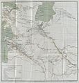
 Map of the Country of the Upper Oxus.jpg 3,789 × 2,543; 4.93 MB
-
 20230607 khiva144.jpg 6,000 × 4,000; 4.77 MB
-
 20230607 khiva145.jpg 6,000 × 4,000; 5.35 MB
-
 20230607 khiva146.jpg 6,000 × 4,000; 5.16 MB
-
 20230607 khiva147.jpg 6,000 × 4,000; 5.1 MB
-
 20230607 khiva148.jpg 6,000 × 4,000; 5.33 MB
-
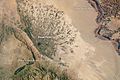
 Aerial view of Amu Darya River on the border of Afghanistan and Uzbekistan.jpg 3,648 × 2,736; 1.12 MB
-
 Amu Darya (MODIS).jpg 3,074 × 2,248; 2.13 MB
-
 Amu darya delta.jpg 5,248 × 4,096; 15.12 MB
-
 Amu Darya map.png 279 × 281; 38 KB
-
 Amu Darya Panorama.jpg 9,528 × 2,373; 7.21 MB
-
 Amudaria Beruniy District Bank.jpg 3,648 × 2,736; 4.36 MB
-
 AMUDARIA2015-1.jpg 4,000 × 3,000; 2.2 MB
-
 AMUDARIA2015-2.jpg 2,903 × 2,678; 1.14 MB
-
 Amudarya department, Әмиўдәря бөлими 1873-1920.png 1,920 × 1,237; 380 KB
-
 Amudarya river in Karakalpakstan.jpg 6,000 × 4,000; 6.32 MB
-
 Amudaryamap Alexandria on the Oxus.jpg 936 × 856; 146 KB
-
 Amudaryamap.jpg 936 × 856; 405 KB
-
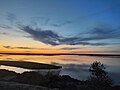
 Amudaryasunset.jpg 1,280 × 960; 104 KB
-
 Amur Darya River in Uzbekistan and Turkmenistan (MODIS).jpg 1,213 × 909; 655 KB
-
 AncientRoad between Indus and AmuDarya.png 414 × 425; 409 KB
-
 Aral map-ar.png 279 × 281; 53 KB
-
 Aral map-es.svg 930 × 682; 1.11 MB
-
 Aral map-fr.svg 991 × 680; 1.04 MB
-
 Aral map.png 279 × 281; 19 KB
-
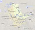 Aral Sea watershed hu.png 1,417 × 1,214; 2.11 MB
-
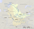 Aral Sea watershed.png 2,167 × 1,856; 3.69 MB
-
 Badakhshan, Afghanistan - panoramio - Zack Knowles.jpg 3,056 × 2,292; 1.24 MB
-
 Battle on the River Oxus (right).jpg 1,296 × 2,064; 449 KB
-
 Beruniy District, Uzbekistan - panoramio (5).jpg 6,000 × 3,376; 6.84 MB
-
 Bronze Age IVC Trade Route.png 1,568 × 1,564; 1.15 MB
-
 Corasmia 3.jpg 4,288 × 2,848; 9.31 MB
-
 Corasmia 4.jpg 4,288 × 2,848; 9.83 MB
-
 Corasmia 5.jpg 3,532 × 1,580; 4.36 MB
-
 Corasmia 6.jpg 4,288 × 2,848; 10.8 MB
-
 Corasmia 7.jpg 4,180 × 2,652; 7.35 MB
-
 Delta of Amu Daria, c1885 antique map.jpg 1,299 × 972; 141 KB
-

-
 KarazinNN PereprTurkOtrARTM.jpg 2,377 × 1,300; 612 KB
-
 Khwārezm tmo 2017232 lrg.jpg 6,000 × 6,000; 10.08 MB
-
 Khwārezm tmo 2017232.jpg 720 × 480; 169 KB
-
 LAmou Darya (Khorezm, Ouzbékistan) (5609625559).jpg 2,877 × 1,918; 3.36 MB
-
 LAmou Darya (Khorezm, Ouzbékistan) (5609636905).jpg 3,456 × 2,304; 3.47 MB
-
 Le Tour du monde-12-p088.jpg 1,998 × 1,185; 1.09 MB
-
 MAAmuDarja3.jpg 1,752 × 1,127; 425 KB
-
 Map of Panj river.png 632 × 404; 592 KB
-
 Mazar-i-Sharif & Band-e-Amir Fan.jpg 720 × 480; 209 KB
-
 Memorial for a martyr, Amude.jpg 2,448 × 3,264; 1.01 MB
-
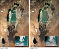 Modis aral.jpg 540 × 442; 80 KB
-
 NizinaTuranska2001grudzien.jpg 4,800 × 3,600; 2.19 MB
-
 Pumping water from Amu Darya (3892660090).jpg 1,200 × 640; 224 KB
-
 River end - Fluss aus - 43624362105.jpg 5,568 × 3,712; 3.84 MB
-
 Russians crossing the oxus 1873.jpg 1,755 × 1,200; 361 KB
-
 SourceFile of AncientRoad between Indus and AmuDarya.xcf 415 × 426; 2.57 MB
-

-
 The bottom of Amudarya.jpg 6,000 × 4,000; 7.06 MB
-
 Tugai forest at sunset on both sides of the AmuDarya river.jpg 4,096 × 3,072; 2.93 MB
-
 Turkmen-Rail-employees-new-Turkmenabat-Amu-Darya-railroad-bridge.jpg 3,264 × 2,448; 1.48 MB
-
 Wikiwyprawa 2015 IGP2305.jpg 4,288 × 2,848; 4.65 MB
-
 Древнейшие русла Аму-Дарьи, 1887.jpg 1,966 × 2,077; 772 KB
-
 अराल मानचित्र.png 279 × 281; 17 KB


.jpg)


.jpg)


.jpg)
.jpg)


.jpg)


_(5609625559).jpg)
_(5609636905).jpg)


.jpg)


.jpg)


