Category:Aoraki / Mount Cook National Park
Vai alla navigazione
Vai alla ricerca
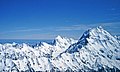
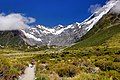
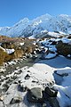
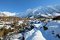
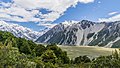
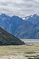
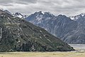
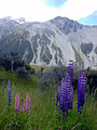
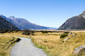
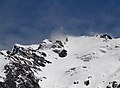
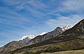
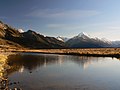
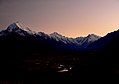
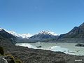
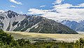
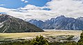
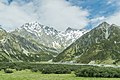
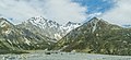
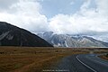
English: Aoraki/Mount Cook National Park is situated in the Canterbury region of New Zealand's South Island near the town of Twizel. Aoraki/Mount Cook village lies within the park. The area was formally gazetted as a national park in October 1953 and consists of reserves that were established as early as 1887 to protect the area's significant vegetation and landscape.
national park in New Zealand   | |||||
| Carica un file multimediale | |||||
| Istanza di | |||||
|---|---|---|---|---|---|
| Parte di |
| ||||
| Prende il nome da | |||||
| Luogo |
| ||||
| Operatore | |||||
| Categoria IUCN aree protette | |||||
| Data di fondazione o creazione |
| ||||
| Superficie |
| ||||
| sito web ufficiale | |||||
 | |||||
Sottocategorie
Questa categoria contiene le 57 sottocategorie indicate di seguito, su un totale di 57.
A
- The Acolyte (4 F)
- The Armchair (1 F)
B
- De la Beche (3 F)
- Blue Lakes, New Zealand (16 F)
C
- Copland Pass (6 F)
D
- Mount Dampier (6 F)
E
- Mount Elie de Beaumont (3 F)
F
- The Footstool (24 F)
G
- Godley River (9 F)
- Governor's Bush Walk (149 F)
H
- Mount Haidinger (6 F)
- The Hermitage Hotel (20 F)
- Mount Hicks (6 F)
- Hochstetter Glacier (2 F)
- Hooker Lake (26 F)
- Hooker River (27 F)
- Hoophorn Stream (4 F)
- Huddleston Glacier (8 F)
K
L
- Mount Lendenfeld (11 F)
M
- Malte Brun (3 F)
- Mount Biretta (2 F)
- Mount D'Archiac (1 F)
- Mount Sefton (56 F)
- Murchison Glacier (1 F)
N
- Nazomi (1 F)
- The Nuns Veil (2 F)
O
- Mount Ollivier (5 F)
- Onslow Glacier (2 F)
R
- Red Tarns (5 F)
S
- Sebastopol (mountain) (5 F)
- Silberhorn (New Zealand) (4 F)
- Stocking Stream (1 F)
T
- Mount Tasman (33 F)
- Tasman Lake (55 F)
- Tasman River (25 F)
- Mount Teichelmann (2 F)
V
- Mount Vancouver, New Zealand (6 F)
W
- Mount Wakefield (4 F)
File nella categoria "Aoraki / Mount Cook National Park"
Questa categoria contiene 92 file, indicati di seguito, su un totale di 92.
-
 00 1287 Mount Cook - New Zealand Alps.jpg 2 993 × 1 800; 5,66 MB
-
 00 1697 Mount Cook - Mount Cook Nationalpark (Neuseeländischen Alpen).jpg 4 200 × 2 800; 13,14 MB
-
 00 1819. Mount Cook Nationalpark - Mount Cook.jpg 1 867 × 2 800; 5,02 MB
-
 00 3391 Airplane for landings on glaciers (New Zealand).jpg 3 177 × 1 800; 7,04 MB
-
 PIA21509 - New Zealand Glaciers, Figure 1.jpg 3 168 × 2 592; 1,5 MB
-
 2014-02-06 11-54-38 NZ Hooker Valley track JH (52203011666).jpg 4 288 × 2 848; 8,56 MB
-
 2014-02-06 12-39-42 NZ Hooker Valley track JH (52203296931).jpg 4 288 × 2 848; 9,58 MB
-
 2015-01-05-09068-Mt Cook - Freda1.jpg 2 887 × 1 401; 1,01 MB
-
 2015-01-05-09068-Mt Cook - Freda2.jpg 3 933 × 2 563; 5,91 MB
-
 2015-01-05-09072-Mt Cook Memorial 2.jpg 4 272 × 2 848; 6,62 MB
-
 2015-01-05-09072-Mt Cook Memorial 3.jpg 4 272 × 2 848; 5,96 MB
-
 2015-01-05-09072-Mt Cook Memorial.jpg 2 848 × 4 272; 4,53 MB
-
 2015-01-05-09077-Mt Cook Hillary.jpg 3 064 × 1 555; 230 KB
-
 PIA21509 - New Zealand Glaciers.jpg 3 168 × 2 592; 1,27 MB
-
-
 A DOC sign at entrance to Aoraki - Mt Cook National Park.jpg 2 620 × 1 021; 1,1 MB
-
 Aoraki Mount Cook National Park and the Southern Alps (MODIS 2019-05-19).jpg 1 852 × 1 571; 1,14 MB
-
 Aoraki Mount Cook National Park WV Banner.jpg 4 000 × 570; 3,32 MB
-
 Aoraki Mt Cook National Park (38964922300).jpg 3 941 × 2 558; 3,54 MB
-
 Aoraki, Aoraki - Mount Cook National Park, New Zealand 02.jpg 5 472 × 3 648; 8,81 MB
-
 Aoraki-Mount Cook National Park, New Zealand (1).JPG 4 000 × 3 000; 5,52 MB
-
 Ausrüstung Überflug Mount Cook.PNG 632 × 423; 456 KB
-
 Blackburn Range Mt Cook. (11681937863).jpg 2 400 × 1 388; 2,85 MB
-
 Blackburn Range. (11681770505).jpg 2 400 × 1 281; 2,13 MB
-
 Bridge over Black Birch Stream in winter with snow.jpg 4 896 × 3 264; 5,32 MB
-
 Bridge over Stocking Stream with snow.jpg 4 896 × 3 264; 6,61 MB
-
 Cloudy Skies. - panoramio.jpg 3 264 × 2 448; 2,58 MB
-
 Glacial River - 2013.04 - panoramio.jpg 4 482 × 3 361; 4,14 MB
-
 Golden speargrass in flower in Tasman Valley.jpg 4 896 × 3 264; 6,34 MB
-
 Icy Stocking Stream in front of Mt Sefton.jpg 3 264 × 4 896; 6,19 MB
-
 Icy Stocking Stream with Mt Sefton in the background.jpg 4 896 × 3 264; 6,66 MB
-
 Landscape in Mount Cook National Park 01.jpg 3 879 × 2 684; 9,54 MB
-
 Landscape in Mount Cook National Park 03.jpg 2 879 × 1 813; 5,48 MB
-
 Landscape in Mount Cook National Park 04.jpg 3 374 × 2 348; 7,8 MB
-
 Landscape in Mount Cook National Park 07.jpg 3 742 × 2 113; 6,46 MB
-
 Landscape in Mount Cook National Park 08.jpg 3 780 × 2 520; 7,41 MB
-
 Landscape in Mount Cook National Park 09.jpg 2 440 × 3 660; 5,85 MB
-
 Landscape in Mount Cook National Park 10.jpg 3 000 × 1 109; 2,6 MB
-
 Landscape in Mount Cook National Park 11.jpg 3 000 × 2 000; 4,38 MB
-
 Landscape in Mount Cook National Park 14.jpg 3 834 × 2 420; 7,3 MB
-
 Landscape in Mount Cook National Park 17.jpg 3 697 × 2 563; 9,03 MB
-
 Landscape in Mount Cook National Park 22.jpg 3 657 × 2 438; 8,42 MB
-
 Landscape in Mount Cook National Park 24.jpg 3 938 × 2 685; 8,9 MB
-
 Landscape in Mount Cook National Park 25.jpg 3 975 × 2 141; 6,49 MB
-
 Landscape in Mount Cook National Park 29.jpg 3 851 × 2 567; 8,11 MB
-
 Landscape in Mount Cook National Park 30.jpg 3 882 × 2 270; 7,47 MB
-
 Lenticular clouds over Mt Cook. - panoramio.jpg 3 264 × 2 448; 2,7 MB
-
 Little-blue-lake-tasmania-cameron.jpg 922 × 519; 620 KB
-
 Mount Cook lenticular cloud - panoramio.jpg 3 264 × 2 448; 3,12 MB
-
 Mount Cook National Park (261408759).jpg 1 280 × 960; 160 KB
-
 Mount Cook National Park. (8114775802).jpg 2 400 × 1 774; 1,27 MB
-
 Mount Cook Village, Aoraki - Mount Cook National Park, New Zealand.jpg 5 359 × 3 114; 14,56 MB
-
 Mount Sefton LC0291.jpg 4 990 × 1 661; 6,65 MB
-
 Mt Cook Area Valley - panoramio.jpg 5 184 × 3 456; 2,12 MB
-
 Mt Cook Lichens - panoramio.jpg 5 184 × 3 456; 6,56 MB
-
 Mt cook.JPG 480 × 640; 168 KB
-
 Mt Sefton massif, Aoraki - Mount Cook National Park, New Zealand.jpg 8 699 × 3 034; 17,34 MB
-
 Mt. Cook National Park Panorama.jpg 10 025 × 1 680; 12,18 MB
-
 Near Mt Cook.jpg 3 724 × 2 483; 4,52 MB
-
 NZ090315 Mount Cook 02.jpg 2 000 × 1 333; 2,57 MB
-
 NZL-mtcook-gletscher-2.jpg 1 215 × 807; 434 KB
-
 Oblique aerial view of Murchison River.jpg 2 304 × 3 072; 1,43 MB
-
 Road to Mount Cook.NZ (13046770814).jpg 2 400 × 1 476; 3,65 MB
-
 Rudolf Glacier.jpg 4 896 × 3 264; 5,43 MB
-
 Snow and Mountains (32215337312).jpg 4 681 × 3 437; 6,85 MB
-
 Snow and Mountains 2 (32365490815).jpg 4 891 × 3 200; 7,54 MB
-
 Snow-covered Tasman Valley in front of Mount Cook and Burnett Mountains at sunset.jpg 4 896 × 2 880; 5,44 MB
-
 South Island new banner 4.jpg 3 941 × 563; 844 KB
-
 Stream disappearing in scree slope.jpg 3 200 × 3 600; 4,65 MB
-
 Stream in Mount Cook National Park NZ 01.jpg 3 000 × 2 000; 5,41 MB
-
 Stream in Mount Cook National Park NZ 02.jpg 3 000 × 2 000; 6,02 MB
-
 Stream in Mount Cook National Park NZ 03.jpg 3 000 × 2 000; 6,29 MB
-
 Sunrise Mount Cook (12) (8114770887).jpg 2 400 × 1 800; 972 KB
-
 Sunrise Mount Cook (14) (8114771623).jpg 2 400 × 1 688; 792 KB
-
 Sunrise Mount Cook (9) (8114777328).jpg 2 400 × 1 798; 882 KB
-
 Sunset Mount Cook (25) (8114785956).jpg 2 400 × 1 814; 933 KB
-
 Tasman Saddle Hut - Aoraki Mount Cook.jpg 1 024 × 1 536; 1,17 MB
-
 Terminal moraine of Tasman Glacier.jpg 4 058 × 2 705; 10,39 MB
-
 The Road to Giants (Unsplash).jpg 3 872 × 2 592; 10,22 MB
-
 Top of Mount Sefton, Aoraki - Mount Cook National Park, New Zealand.jpg 10 396 × 5 256; 34,64 MB
-
 Towards Mount Cook. - panoramio.jpg 3 264 × 2 448; 3,2 MB
-
 Tramping or hiking in Aoraki Mount Cook National Park..jpg 2 576 × 1 932; 1,24 MB
-
 Unwin Hut Inside 2023.jpg 4 608 × 3 456; 6,37 MB
-
 Valley of Hooker River 01.jpg 2 818 × 1 586; 3,26 MB
-
 Valley of Hooker River 02.jpg 3 796 × 2 085; 5,54 MB
-
 Valley of Hoophorn Stream 01.jpg 3 465 × 2 310; 5,26 MB
-
 Valley of Hoophorn Stream 02.jpg 3 457 × 1 456; 3,39 MB
-
 Valley of Hoophorn Stream 03.jpg 3 492 × 2 328; 5,75 MB
-
 Valley of Hoophorn Stream 04.jpg 3 561 × 1 628; 3,81 MB
-
 White Horse Hill Campsite, Aoraki - Mount Cook National Park, New Zealand.jpg 5 133 × 2 645; 9,95 MB
-
【4K HDR】 Solo Hiking on the New Zealand - Walk Tour HOOKER VALLEY TRACK -.webm 53 min 22 s, 2 560 × 1 440; 2,86 GB
-
 通往隐士酒店的路 Hwy 80 - panoramio.jpg 2 200 × 1 467; 1,72 MB

.jpg)

.jpg)

.jpg)
.jpg)


.jpg)
.jpg)
.jpg)

.JPG)

.jpg)
.jpg)


.jpg)
.jpg)


.jpg)

.jpg)
.jpg)


_(8114770887).jpg)
_(8114771623).jpg)
_(8114777328).jpg)
_(8114785956).jpg)


.jpg)


