Category:Arameans
Jump to navigation
Jump to search
Christian middle eastern people  | |||||
| Upload media | |||||
| Instance of |
| ||||
|---|---|---|---|---|---|
| Religion or worldview | |||||
| Different from | |||||
| |||||
English: This category is for ancient Arameans. For modern people that identify as Aramean, see
:Category:Aramean people.
Subcategories
This category has the following 10 subcategories, out of 10 total.
Media in category "Arameans"
The following 90 files are in this category, out of 90 total.
-
 25 Jahre Jubiläum.jpg 320 × 200; 83 KB
-

-
 Adadnirari2-abans 900.png 892 × 1,000; 271 KB
-
 Adadnirari2-després900.PNG 890 × 1,000; 295 KB
-
 Alter Orient 0900BC.svg 2,102 × 1,510; 4.93 MB
-
 Alter Orient 1000BC.svg 2,102 × 1,510; 4.69 MB
-
 Alter Orient 1100BC.svg 2,102 × 1,510; 4.79 MB
-
 Alter Orient 1200BC-es.svg 2,102 × 1,510; 3.57 MB
-
 Alter Orient 1200BC.svg 2,102 × 1,510; 4.71 MB
-
 AlterOrient.jpg 1,400 × 940; 454 KB
-
 Amarnamap.png 782 × 607; 743 KB
-
 Ancient Near East 0800BC.svg 2,102 × 1,510; 4.81 MB
-
 Ancient Near East 0900BC.svg 2,102 × 1,510; 4.92 MB
-
 Ancient Near East 1000BC.svg 2,102 × 1,510; 4.69 MB
-
 Ancient Near East 1100BC.svg 2,102 × 1,510; 4.78 MB
-
 Ancient Near East 1200BC.svg 2,102 × 1,510; 4.7 MB
-
 Ancient Orient History Map basis.de.svg 2,102 × 1,510; 8.63 MB
-
 Aramaic kingdoms and chiefdoms around 10-9th century BC (es).svg 3,126 × 1,978; 386 KB
-
 Aramaic kingdoms and chiefdoms around 10-9th century BC.svg 814 × 515; 163 KB
-
 Aramaic language written in Estrangelo script.jpg 800 × 400; 27 KB
-
 Aramaic language written in Estrangelo.jpg 800 × 600; 42 KB
-
 Aramaic language written in the Estrangelo script.jpg 800 × 400; 27 KB
-
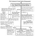 Aramean Christians. Schisms of Syriac Christianity.jpg 1,170 × 1,225; 88 KB
-
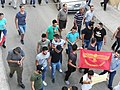
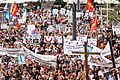
 Aramean demonstration in Berlin, Germany.jpg 750 × 484; 74 KB
-
 Aramean demonstration in The Hague, Netherlands (1990).jpg 750 × 488; 71 KB
-
 Aramean fighter Shamoun Hanna Haydo.jpg 536 × 826; 112 KB
-
 Aramean genocide (Sayfo) commemoration in Paris, France 2.jpg 1,087 × 950; 292 KB
-
 Aramean genocide monument.jpg 259 × 194; 11 KB
-
 Aramean protest in Qamishli, Syria 2.jpg 512 × 384; 63 KB
-
 Aramean states.png 1,146 × 1,200; 548 KB
-
 Arameans (Syriacs) in the diaspora.jpg 1,920 × 1,270; 514 KB
-
 Arameans in Germany (1995).jpg 1,920 × 1,302; 636 KB
-
 Aramese (Suryoyo) Genocide herdenking in Enschede, Nederland (2021).jpg 1,040 × 1,517; 339 KB
-
 Aramäischer Meister.jpg 320 × 200; 94 KB
-
 Armenians and Arameans (Syriacs) demonstrating in Brussels.jpg 900 × 499; 109 KB
-
 Assurnasirpal2.png 1,143 × 1,200; 450 KB
-
 Assyrer.JPG 610 × 370; 71 KB
-
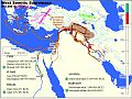
 Assyria in reign of Adad-nirari II.jpg 960 × 720; 229 KB
-
 AssyriaEastLands ru.svg 1,800 × 1,756; 2.03 MB
-
 Assyrian Expansion under Ashurnasirpal II.jpg 960 × 720; 220 KB
-
 Benefizturnier.jpg 320 × 200; 88 KB
-
 Bezirksliga-Kader.jpg 900 × 600; 769 KB
-
 Bit-bahiani.he.svg 814 × 515; 164 KB
-
 Demonstration in Sweden against the Christian genocide in Iraq.jpg 960 × 640; 281 KB
-
 Edom-Moab-830BCE.svg 720 × 859; 69 KB
-
 Erste Turnierteilnahme.jpg 320 × 200; 124 KB
-
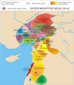 Estats neohitites i arameus a Síria al segle VIII aC.png 1,053 × 1,200; 394 KB
-
 Kingdoms around Israel 830 map sh.svg 720 × 859; 62 KB
-
 Kingdoms around Israel 830 map sr.svg 720 × 859; 62 KB
-
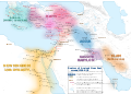
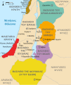
 Kingdoms around Israel 830 map-de.png 1,004 × 1,198; 318 KB
-
 Kingdoms around Israel 830 map-el.svg 720 × 859; 509 KB
-
 Kingdoms around Israel 830 map-nl.svg 720 × 859; 479 KB
-
 Kingdoms around Israel 830 map-pt.svg 720 × 859; 54 KB
-
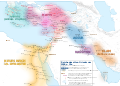
 Kingdoms around Israel 830 map.svg 720 × 859; 122 KB
-
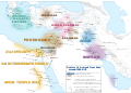
 Kingdoms of the Levant Map 830.png 1,955 × 2,332; 438 KB
-
 Kingdoms of the Levant Map 830.xcf 1,955 × 2,332; 941 KB
-
 Levant 830 ar.svg 1,185 × 1,280; 777 KB
-
 Levant 830 map-pt.svg 720 × 859; 44 KB
-
 Levant 830 nl 3-ar.png 720 × 855; 105 KB
-
 Levant 830-HE-2.svg 545 × 591; 196 KB
-
 Levant 830-HE.svg 545 × 591; 248 KB
-
 Levant 830-nl.PNG 544 × 593; 26 KB
-
 Levant 830-rus.svg 545 × 591; 68 KB
-
 Levant 830.svg 545 × 591; 105 KB
-
 Levant hu.svg 545 × 591; 67 KB
-
 Map Amarna.png 583 × 599; 99 KB
-
 Map of old damascus.jpg 1,772 × 1,181; 632 KB
-
 Mor Julius Yeshu Çiçek (portrait).jpg 1,069 × 1,916; 385 KB
-
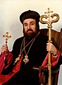 Mor Julius Yeshu Çiçek 1.jpg 2,572 × 3,516; 1.39 MB
-
 Neo-hittites et arameens.svg 841 × 643; 810 KB
-
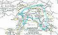
 NeoHittiteStates.gif 380 × 380; 16 KB
-
 Robert de Vaugondy. Map of the Early Ages of the World. 1762.jpg 807 × 800; 231 KB
-
 Royaumes Araméens.jpg 1,125 × 1,043; 250 KB
-
 Royaumes autour d'Israel en 830.svg 720 × 859; 99 KB
-
 Salmanassar3.png 1,145 × 1,200; 494 KB
-
 Stadtmeisterschaft 2003.jpg 320 × 200; 113 KB
-
 Syriac Aramean Tell-Hallaf Flag.svg 512 × 320; 13 KB
-
 Syriac Aramean village of Iwardo.jpg 1,920 × 1,280; 677 KB
-

-
 Syriac-Aramean anti-ISIS demonstration in Berlin, Germany 2015.jpg 594 × 396; 84 KB
-

-
 Syriac-Aramean demonstration in Stockholm, Sweden.jpg 641 × 344; 103 KB
-
 Syriac-Aramean genocide (Sayfo) commemoration in Stockholm, Sweden.jpg 960 × 720; 191 KB
-
 Syriac-Aramean New Year feast in Syria.jpg 960 × 540; 173 KB
-
 Syriac-Aramean scouts in Bethlehem.jpg 1,680 × 1,120; 301 KB
-
 Syriac-Aramean soldier in Bakhdida, Iraq.jpg 1,125 × 933; 1.24 MB
-
 Syriac-Aramean soldiers of Sootoro in Qamishli, Syria.jpg 960 × 720; 204 KB
-
 Syrian-Aramean towns in Western Neo-Aramaic (Maalouli).jpg 3,464 × 3,464; 372 KB
-
 Towns of aram.jpg 709 × 758; 186 KB
-
 Tukultininurta2.png 887 × 1,000; 287 KB

_(14596041107).jpg)


.svg)


.jpg)

_commemoration_in_Paris,_France_2.jpg)


_in_the_diaspora.jpg)
.jpg)
_Genocide_herdenking_in_Enschede,_Nederland_(2021).jpg)

_demonstrating_in_Brussels.jpg)


.jpg)


_commemoration_in_Stockholm,_Sweden.jpg)


.jpg)

